Aljažev dom v Vratih - Šmarjetna glava (via Koča na Doliču)
Starting point: Aljažev dom v Vratih (1015 m)
Starting point Lat/Lon: 46.4128°N 13.8466°E 
Path name: via Koča na Doliču
Time of walking: 6 h 55 min
Difficulty: difficult pathless terrain
Difficulty of skiing: no data
Altitude difference: 1343 m
Altitude difference (by path): 1700 m
Map: TNP 1:50.000
Access to starting point:
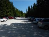
We drive into Mojstrana, and then we follow the signs for valley Vrata. At first still asphalt, further mostly macadam road, after approximately 12 km from a center of Mojstrana brings us to a large parking lot in the valley Vrata. During the summer season parking fee has to be paid.
Path description:
From the parking lot, we continue on for public traffic closed macadam road, on which past the mountain hut Šlajmerjev dom we quickly get to the mountain hut Aljažev dom v Vratih.
Mountain hut Aljažev dom we bypass on the right side and we continue straight in the direction of Triglav, Sovatna, Luknja (right Škrlatica, bivouac Bivak na Rušju...). We continue on a rough macadam road which past winter room brings us to a marked crossing by the famous wedge (monument to fallen partisans mountaineers).
We again continue straight (left Tominšek route) and gently sloping path leads with nice views on Triglav and Triglav northern wall. When after few minutes of additional walking, we get to beech forest, the path over Sovatna branches off to the right, and we continue straight in the direction of Luknja and Triglav - Čez Prag route. Next follows a short ascent on a cart track, and then blazes point us to the left, on a path, which gets close to a riverbed of Triglavska Bistrica. Here the path leads past a memorial to those who died in the mountains, and a little ahead we get to the next marked crossing.
Left, through the stream continues route Čez Prag, and we continue straight, on the path which gradually starts considerably ascending. The path towards Luknja further is for some time moderately ascending, higher becomes steeper and more panoramic. A bit higher path leads through a lane of bushes and a thin forest, where the footpath towards the nearby bivouac branches off to the right, and we continue on a wider path, which a little ahead brings us out of the lane of a forest. Further, the path becomes even a little steeper, and gradually brings us on the scree below Luknja. The path through the scree is quite slippery, when we get to the foot of the walls, we get also help from steel cables (in dry undemanding, they come in handy mainly on the descent). For a short time, we are steeply ascending just by the wall, and then the path turns a little to the right and a bit higher brings us to a crossing on the saddle Luknja, from where a nice view opens up on mountains above Zadnjica.
From Luknja we continue straight downwards (left Triglav over Plemenice (Bamberg route), right Bovški Gamsovec and pathless approach on Pihavec) and start descending on an old mule track. At first the path leads us through a smaller rockfall, where some caution is needed because of possibility of falling stones. Next follows a descent above steep Korita, we descend on a wide path, because the old mule track in spite of the steepness is still relatively well preserved. After approximately 40 minutes of descent, where we lose more than 300 altitude meters, we get to a marked crossing.
From the crossing, we continue slightly left in the direction of Dolič (slightly right Zadnjica) and again start ascending. Further, we are mostly moderately ascending on a mule track, which leads us over a steep and occasionally also exposed precipitous slopes. Since the path is wide and nicely routed technically isn't demanding, but it is exposed to falling stones and because of occasional deep views mostly isn't appropriate for those who are vertiginous. The path occasionally makes few hairpin turns, otherwise it is for most of the time ascending diagonally towards the right, so that we are getting closer to the mighty wall of Kanjavec.
Higher from the right joins also the climbing path from Zadnjica over Komar, and a little further, the path Pot Mire Marko Debelakove branches off to the right (path over Kanjavčeve police). The path with increasingly beautiful view higher makes few hairpin turns, and from there also the path towards Triglav branches off to the left.
We continue straight and then we quickly get to the mountain hut Koča na Doliču.
From the mountain hut, we continue in the direction of Vodnikov dom, and we follow the marked path only a short time, or to the spot where on the left side a nice passage opens (we leave the marked path still before the saddle Dolič). We continue left upwards on pathless terrain. We are ascending on a rocky slope to the ridge, from which a view opens up on Šmarjetna glava. We go on a saddle on the left side of Šmarjetna glava.
On the saddle, we then continue right on a steep ridge, which is marked with some cairns. Ridge becomes even a little steeper and on short part some easy climbing is needed (1st grade). A little below the summit, where the ridge is the most steep, cairns point us on the right side and a short ascent follows on a slightly exposed and crumbly slope to the top.
Vrata - Luknja 2:30, Luknja - Koča na Doliču 3:10, Koča na Doliču - Šmarjetna glava 1:15.
Pictures:
 1
1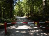 2
2 3
3 4
4 5
5 6
6 7
7 8
8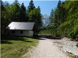 9
9 10
10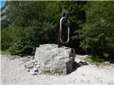 11
11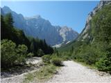 12
12 13
13 14
14 15
15 16
16 17
17 18
18 19
19 20
20 21
21 22
22 23
23 24
24 25
25 26
26 27
27 28
28 29
29 30
30 31
31 32
32 33
33 34
34 35
35 36
36 37
37 38
38 39
39 40
40 41
41 42
42 43
43 44
44 45
45 46
46 47
47 48
48 49
49 50
50 51
51 52
52 53
53 54
54 55
55 56
56 57
57 58
58 59
59 60
60 61
61 62
62 63
63 64
64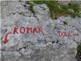 65
65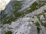 66
66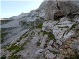 67
67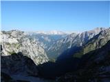 68
68 69
69 70
70 71
71 72
72 73
73 74
74 75
75 76
76 77
77 78
78 79
79 80
80 81
81 82
82 83
83 84
84 85
85 86
86 87
87 88
88 89
89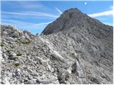 90
90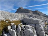 91
91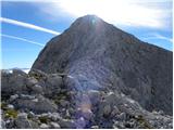 92
92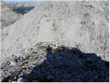 93
93 94
94 95
95 96
96 97
97 98
98 99
99 100
100 101
101 102
102 103
103 104
104 105
105