Dom v Kamniški Bistrici - Dom v Kamniški Bistrici (pot ob izviru)
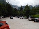
Starting point: Dom v Kamniški Bistrici (600 m)
Starting point Lat/Lon: 46.32712°N 14.58927°E 
Path name: pot ob izviru
Time of walking: 10 min
Difficulty: easy marked way
Difficulty of skiing: no data
Altitude difference: 0 m
Altitude difference (by path): 15 m
Map: Kamniške in Savinjske Alpe 1:50.000
Access to starting point:
A) We drive to Kamnik, and then we follow the signs for Kamniška Bistrica. The road through the valley of Kamniška Bistrica we follow to the parking lot below the mountain hut Dom v Kamniški Bistrici.
B) We leave Štajerska highway at exit Vransko, and then we follow the road towards Kamnik. In Kamnik at the first traffic light we turn right, and then we follow the signs for Kamniška Bistrica. The road through the valley of Kamniška Bistrica we follow to the parking lot below the mountain hut Dom v Kamniški Bistrici.
C) We drive to Gornji Grad, and then over mountain pass Črnivec we drive towards Kamnik. Still before Kamnik, in the settlement Stahovica we turn right in the direction of Kamniška Bistrica. The road through the valley of Kamniška Bistrica we follow to the parking lot below the mountain hut Dom v Kamniški Bistrici.
D) From Luče over the mountain pass Volovljek (Kranjski Rak) we drive to Stahovica, where at the traffic light we turn right towards Kamniška Bistrica. The road through the valley of Kamniška Bistrica we follow to the parking lot below the mountain hut Dom v Kamniški Bistrici.
Path description:
From the parking lot, we return to the asphalt road, and then we continue right towards Stahovica. Already after few steps we step on the bridge over Kamniška Bistrica, from which a nice view opens up on the lake at the source of Kamniška Bistrica. Immediately after the bridge signs for path around the source point us to the left downwards, where after few steps we get to the lake, by which then the circular path continues. We few minutes continue on a footpath which for few steps ascends and then again descends, and while walking we go also past some wooden bridges, where when crossing them we have to be careful not to slip. On the other side of the lake, we return to the asphalt road which we cross, and on the other side, we are already at the mountain hut Dom v Kamniški Bistrici, which is situated only a little above the parking lot.
Description and pictures refer to a condition in August 2021.
On the way: Izvir Kamniške Bistrice (597m)
Pictures:
 1
1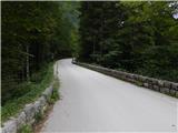 2
2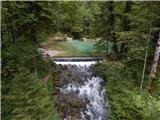 3
3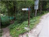 4
4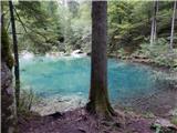 5
5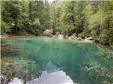 6
6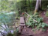 7
7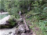 8
8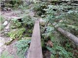 9
9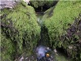 10
10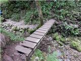 11
11 12
12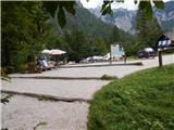 13
13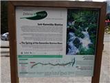 14
14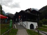 15
15