Koča pri Savici - Velika Baba (via Bogatinsko sedlo and Lanževica)
Starting point: Koča pri Savici (653 m)
Starting point Lat/Lon: 46.2896°N 13.8022°E 
Path name: via Bogatinsko sedlo and Lanževica
Time of walking: 6 h
Difficulty: easy pathless terrain
Difficulty of skiing: no data
Altitude difference: 1363 m
Altitude difference (by path): 1515 m
Map: TNP 1:50.000
Access to starting point:
We drive to Bohinjska Bistrica, and then we continue driving in the direction of the lake Bohinj. From Lake Bohinj we follow the signs for waterfall Savica, and we park on a payable parking lot at the mountain hut Koča pri Savici.
Price for parking for a car to 3 hours is 3 eur, and more than 3 hours 6 eur (September 2018).
Path description:
From the parking lot, we go on a wide path in the direction of waterfall Savica, Dom na Komni and Koča pod Bogatinom. We at first walk on a gently sloping macadam road, and we quickly go from the road slightly left on a marked path towards Komna (right waterfall Savica). Further, we are ascending on an old mule track, which leads us through 48 marked hairpin turns. At the last marked zig zag we reach valley Pekel, which we soon leave, and the path is still ascending through the forest. Higher forest gradually starts to get thinner, and from the right joins the path which leads over Komarča and past the lake Črno jezero.
Only few 10 strides ahead path once again splits, and we choose the left path in the direction of Dom na Komni (right mountain hut Koča pri Triglavskih jezerih and also Koča pod Bogatinom, the latter is about a minute shorter as the one which leads past Dom na Komni), to which we get into 5 minutes of additional walking.
From Dom na Komni we continue right in the direction of Koča pod Bogatinom (straight ski slope Vogel and mountain pasture Govnjač), where we soon join the before mentioned path. Follows approximately 10 minutes of easy walking and we get to the mountain pasture Planina na Kraju, where Koča pod Bogatinom is situated.
On the mountain pasture, about a minute ahead from the mountain hut, there is a marked crossing, and we continue in the direction of saddle Bogatinsko sedlo or Vratca (right Lanževica over Lepa Komna). On the other side of the mountain pasture, where to the left almost unnoticeable another path towards the mountain pasture Govnjač branches off, the path gradually starts ascending. We are ascending diagonally on an area named Gracija, and during the crossing on the south side we bypass also less known Srednji vrh. After the crossing of Srednji vrh path becomes a little steeper and splits. We can continue on a moderately steep mule track, which makes longer zig zag, or slightly right, on a steeper mountain path. Both paths join on a saddle Bogatinsko sedlo, where there is the next marked crossing.
From the saddle, from where a nice view opens up also in the direction of Krn, we continue right towards Lanževica (left Mahavšček and Bogatin, straight Krn, Dom pri Krnskih jezerih, Prehodci, Lepena...). Further, we are with nice views mostly moderately ascending, and on the part where the path flattens, on the left side we bypass Vrh nad Gracijo. A little further from the right joins also the path through Lepa Komna, to the top Lanževica follows good 20 more minutes, mostly of a moderate ascent.
From Lanževica we start descending on an indistinct ridge, which continues towards the southwest. We are descending on easier pathless terrain, where we can occasionally follow a worse footpath. When we reach a smaller saddle, relatively easy to follow footpath appears, and there we continue in approximately same direction. A little further, we reach a small valley, from which we diagonally ascend over short rugged crumbly terrain. With nice views we continue with some shorter ascents and descents, and footpath point us slightly to the left, so that on the left south side we bypass peak with name Predolina. When we reach the indistinct ridge, which connects Velika Montura and Predolina, at the crossing of unmarked footpaths, we continue right.
For a short time, we still cross slopes of Predolina, and then we get closer to the ridge, which connects Predolina with Velika Baba. We continue slightly left and we walk below the ridge, so that we cross occasionally with dwarf pines vegetated slopes. The footpath through dwarf pines is relatively easy to follow, but on some spots is quite overgrown. The path then it brings us on a ridge and a little further we reach a marked path which leads from Lepena towards Velika Baba.
We continue on a marked path, and there in approximately 10 minutes of ascent, we ascend on a panoramic peak.
Koča pri Savici - Dom na Komni 2:30, Dom na Komni - Koča pod Bogatinom 0:15, Koča pod Bogatinom - Bogatinsko sedlo 1:15, Bogatinsko sedlo - Lanževica 1:00, Lanževica - Velika Baba 1:00.
Description refers to condition in September 2018, and pictures are from various periods.
Pictures:
 1
1 2
2 3
3 4
4 5
5 6
6 7
7 8
8 9
9 10
10 11
11 12
12 13
13 14
14 15
15 16
16 17
17 18
18 19
19 20
20 21
21 22
22 23
23 24
24 25
25 26
26 27
27 28
28 29
29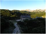 30
30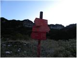 31
31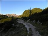 32
32 33
33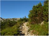 34
34 35
35 36
36 37
37 38
38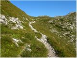 39
39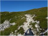 40
40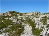 41
41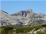 42
42 43
43 44
44 45
45 46
46 47
47 48
48 49
49 50
50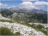 51
51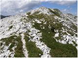 52
52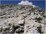 53
53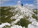 54
54 55
55 56
56 57
57 58
58 59
59 60
60 61
61 62
62 63
63 64
64 65
65 66
66 67
67 68
68 69
69 70
70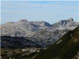 71
71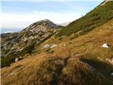 72
72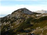 73
73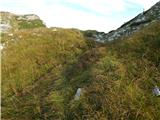 74
74 75
75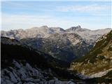 76
76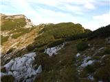 77
77 78
78 79
79 80
80 81
81 82
82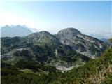 83
83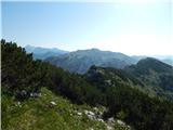 84
84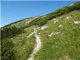 85
85 86
86 87
87 88
88 89
89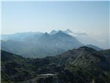 90
90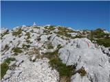 91
91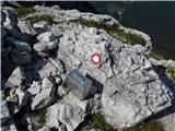 92
92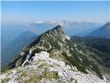 93
93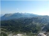 94
94