Lake Gradišče - Sveti Mohor on Mohorjev hrib (via Vinje pri Moravčah)
Starting point: Lake Gradišče (355 m)
Starting point Lat/Lon: 46.1621°N 14.708°E 
Path name: via Vinje pri Moravčah
Time of walking: 1 h 35 min
Difficulty: easy marked way
Difficulty of skiing: no data
Altitude difference: 156 m
Altitude difference (by path): 215 m
Map:
Access to starting point:
From highway Ljubljana - Maribor, we go to the exit Lukovica, and then we continue driving towards Moravče. After the crossing of Radomlje, we get to the beginning of the settlement Spodnje Prapreče, where at the crossroad we continue left in the direction of Lake Gradišče. After a short ascent, we get to a crossroad with the priority road, where we continue right towards Lake Gradišče (left Gradišče), after that only a little further, from a priority road left towards Lake Gradišče (right Preserje pri Lukovici), in front of which we then park on a large parking lot.
Path description:
From the starting point, we continue on a marked path in the direction of Limbarska gora, which continues by the northern shore of Lake Gradišče. The path which continues on a macadam road and which is closed for public traffic, soon turns right and passes on the eastern side of the lake, where the marked path towards Limbarska gora turns left in the forest.
We continue towards Limbarska gora, where we at first ascend steeper, and then the path which continues on a cart track, quickly flattens. Higher, we come out of the forest and on the right side a nice view opens up towards the church of St. Mohor on Mohorjev hrib, and the path in additional few minutes descends to the settlement Vinje pri Moravčah, where there is a marked crossing.
We continue right downwards in the direction of Sveti Mohor (left - Limbarska gora), where we at first go past few more houses, and then we get to a stream Drtijščica. We few minutes continue by the stream and then before a smaller dam and where on the other side of the stream there are few houses, we go over the footbridge on the other side of the stream and we bypass the houses on the right side.
When at the houses we reach the macadam road, we go right and through meadows and past a cross we ascend to the homestead Rožek, where there is a marked crossing.
To the right a path branches off to the castle Rožek, straight we get to Lake Gradišče, and we continue left in the direction of Sveti Mohor. Above the homestead, the path passes into the forest, and blazes again become more frequent. Higher, the path flattens and soon from the right joins another unmarked path from Lake Gradišče.
We continue left, where we follow the blazes, and the church of St. Mohor we already see quite close. Few minutes ahead we reach the macadam road, where we go left (right - Imenje and Tuštanj), and the path further leads past few Stations of the Cross. When we get to the nearby house we go slightly left and then on the stairs, we ascend to the church of St. Mohor.
The starting point - Vinje pri Moravčah 0:45, Vinje pri Moravčah - Sveti Mohor 0:50.
Description and pictures refer to a condition in the year 2018 (November).
On the way: Vinje pri Moravčah (394m)
Pictures:
 1
1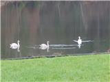 2
2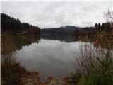 3
3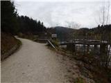 4
4 5
5 6
6 7
7 8
8 9
9 10
10 11
11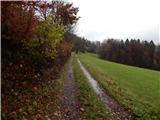 12
12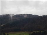 13
13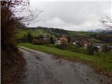 14
14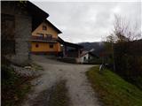 15
15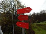 16
16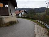 17
17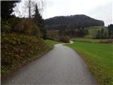 18
18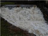 19
19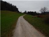 20
20 21
21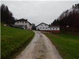 22
22 23
23 24
24 25
25 26
26 27
27 28
28 29
29 30
30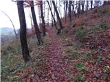 31
31 32
32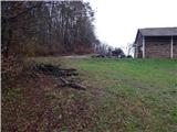 33
33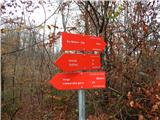 34
34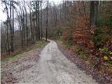 35
35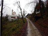 36
36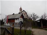 37
37 38
38