Passo Sella - Rifugio Sandro Pertini
Starting point: Passo Sella (2183 m)
Starting point Lat/Lon: 46.50822°N 11.75825°E 
Time of walking: 1 h 20 min
Difficulty: easy marked way
Difficulty of skiing: no data
Altitude difference: 117 m
Altitude difference (by path): 200 m
Map: Tabacco 05 1:25.000
Access to starting point:
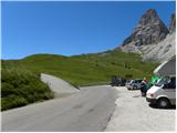
From Kranjska Gora over mountain pass Korensko sedlo to Austria, where at the first larger crossroad, we continue left towards Podklošter / Arnoldstein and Trbiž / Tarvisio. By the end of the settlement Podklošter signs for Šmohor / Hermagor point us to the right on a regional road, on which past the mentioned settlement we drive to the end of the valley Gailtal, or more precisely to the settlement Kötschach-Mauthen, where we turn right towards the settlement Oberdrauburg. The path ahead leads us over an Alpine mountain pass Gailbergsattel (982 meters), after which we descend into the mentioned settlement. After we cross the bridge through river Drau, we continue left towards the settlement Lienz. In the main roundabout in Lienz we continue "left" in the direction of the settlement Sillian and Italy. Further, we cross the border between Austria and Italy, and we follow the main road past settlements Dobbiaco / Toblach, Villabassa / Niederdorf, Monguelfo - Tesido / Welsberg - Taisten, Brunico / Brunec. Only a little after the last-mentioned settlement, past which leads a bypass road, we turn left into a valley Val Badia. Further, we drive through the mentioned valley and in the settlement La Villa we turn right towards the mountain pass Passo Gardena. Further, we follow an ascending road following the signs Passo Gardena. From the mountain pass Passo Gardena we descend on the other side and then we continue left towards the mountain pass Passo Sella. On the mountain pass Sella we park at the mountain hut Rifugio Passo Sella or on one of smaller parking lots by the road. Parking lot at the mountain hut is payable (July 2012 – 4€).
Path description:
From the mountain hut Rifugio Passo Sella we continue on the main road to a crossroad where a narrower road towards the mountain hut Rifugio Carlo Valentini branches off to the right upward. At the crossroad, there is also a smaller parking lot. We go on the mentioned road and we start ascending on at first still asphalt road. The road leads us past the already mentioned mountain hut Carlo Valentini, and then the asphalt ends and we continue slightly right on a macadam road following the signs »Sasso Piatto Plattkofel«.
From the road which runs by grassy slopes we have a nice view mainly towards group Sella and Marmolada, and occasionally opens up also a view towards the summit Sassolungo. The road further is still ascending towards the south and leads us past the mountain hut Rifugio Salei and then also past the mountain hut Chalet Margherita to the notch Forcela Rodela, which is situated below the slopes of the peak Col Rodela. On the notch where there is a crossroad we continue right and on a gentle road we come to the hut Rifugio Friedrich August.
From the mountain hut, we continue few ten meters on the road, and then the road ends and we continue on a footpath following the signs »Rif. Sasso Piato«. The path at first slightly descends and then crosses grassy slopes towards the west. Further, the path crosses a stream and brings us below the slopes of the peak Sasso Levante. Here also increasingly beautiful views start opening up towards the mountain group Catinaccio. The path then still crosses slopes towards the west and then it brings us to the hut Rifugio Sandro Pertini.
Pictures:
 1
1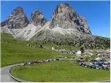 2
2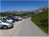 3
3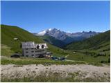 4
4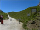 5
5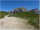 6
6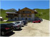 7
7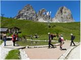 8
8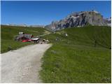 9
9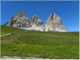 10
10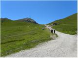 11
11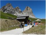 12
12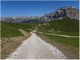 13
13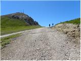 14
14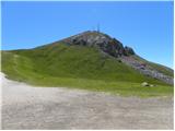 15
15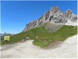 16
16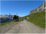 17
17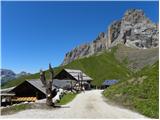 18
18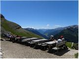 19
19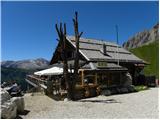 20
20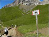 21
21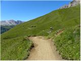 22
22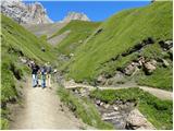 23
23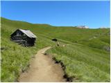 24
24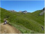 25
25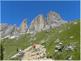 26
26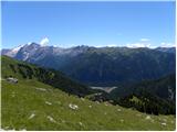 27
27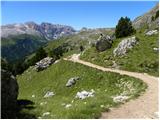 28
28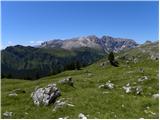 29
29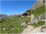 30
30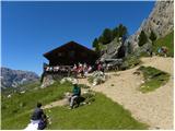 31
31