Planina Polog - Rdeči rob (via Javorca and Planina Sleme)
Starting point: Planina Polog (457 m)
Starting point Lat/Lon: 46.238°N 13.7232°E 
Path name: via Javorca and Planina Sleme
Time of walking: 4 h 30 min
Difficulty: easy marked way, partly demanding unmarked way
Difficulty of skiing: no data
Altitude difference: 1456 m
Altitude difference (by path): 1456 m
Map: Julijske Alpe - zahodni del 1:50.000
Access to starting point:
First, we drive to Tolmin, from there we follow the road in the direction of Zatolmin (main road we leave at the traffic light). In Zatolmin we notice signposts for Javorca, which point us on an ascending road towards Javorca. Occasionally quite narrow and in parts precipitous road after approximately 8 km of driving brings us to a smaller crossroad, where the road towards Javorca branches off to the left upwards. We continue straight, and we follow the road only for approximately 100 meters and then on an appropriate place by the gate we also park.
Path description:
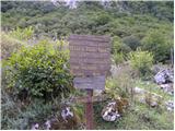
From the starting point, we go on a footpath which leads to the parking lot before the ascent to the church Javorca, where we go on this concrete path. After approximately 15 minutes we reach the church from the first world war Javorca, and we continue on the road left past the church. At the fence we go left on a cart track which goes past the farm above Javorca, and the path over a concrete bridge brings us on a slope below Visoči vrh. At the first crossing, we go right through a grazing fence and we follow the signs of Walk of peace (Pot miru), which brings us to the mountain pasture Črča. There we can continue on a gentle and well-preserved mule track to the mountain pasture Laška seč or we can already before the mountain pasture go left on a shortcut (Walk of Peace), which brings us to the next mountain pasture - this is the mountain pasture Laška seč. Past this mountain pasture, we continue on a mule track to the mountain pasture Medrja, and from there we can turn right on a direct mule track to the mountain pasture Sleme, or we can go on the road towards the mountain pasture Pretovč, and from there right on a concrete road to the mountain pasture Sleme.
On the mountain pasture Sleme at the partisan monument we go upwards towards the signpost, which is pointing left in the direction of Krn and mountain pasture Kuhinja on the bottom footpath which on two spots crosses gravel scree (in case if the path is swept away, the passage can be dangerous). The upper (old) path isn't recommended because of rockfalls. We follow marked footpath to a marked path, which is from the mountain pasture Kuhinja ascending towards the lake Jezero v Lužnici, and on this path we soon notice in front of us rocks with a characteristic red color, and we are ascending there all the way to a crossing for Rdeči rob (right uphill).
At the crossing, we start ascending on unmarked and poorly visible path to below the foot of the ridge between Rdeči rob and Škofič. We soon come to the next unmarked crossing, where we go left uphill on the ridge (right straight - Veliki Stador), which is surrounded by characteristic red rocks. The path is covered with gravel and quite rough, therefore some caution is needed, mainly at the descent. We can't miss the path if we ascend entirely to the foot of the ridge (to the wall).
When we reach the ridge between Škofič and Rdeči rob we continue right on at first a gently sloping path, which then steeply ascends by the edge of a precipitous ridge and in 3 minutes of additional walking brings us on Rdeči rob.
The second path, the path from the direction of Veliki Studor on Rdeči rob is quite exposed, because it is carved into gravel, without fixed safety gear and therefore also quite dangerous.
Planina Polog - Javorca 00:20, Javorca - Planina Sleme 02:00, Planina Sleme - Rdeči rob 02:10.
Pictures:
 1
1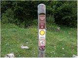 2
2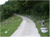 3
3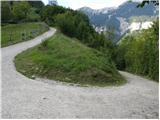 4
4 5
5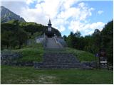 6
6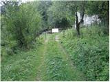 7
7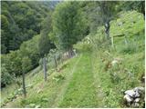 8
8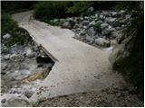 9
9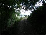 10
10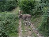 11
11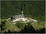 12
12 13
13 14
14 15
15 16
16 17
17 18
18 19
19 20
20 21
21 22
22 23
23 24
24 25
25 26
26 27
27 28
28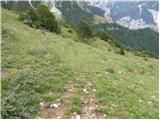 29
29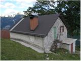 30
30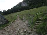 31
31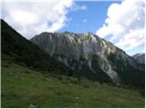 32
32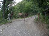 33
33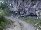 34
34 35
35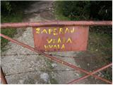 36
36 37
37 38
38 39
39 40
40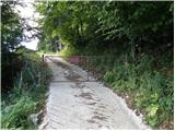 41
41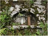 42
42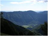 43
43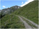 44
44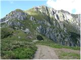 45
45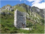 46
46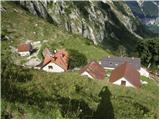 47
47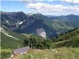 48
48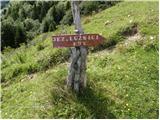 49
49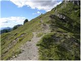 50
50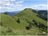 51
51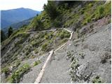 52
52 53
53 54
54 55
55 56
56 57
57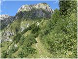 58
58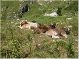 59
59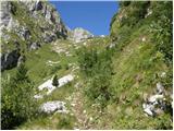 60
60 61
61 62
62 63
63 64
64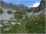 65
65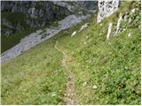 66
66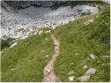 67
67 68
68 69
69 70
70