Starting point: Strmec (1520 m)
Starting point Lat/Lon: 46.3902°N 13.9675°E 
Time of walking: 2 h 30 min
Difficulty: easy marked way
Difficulty of skiing: no data
Altitude difference: 494 m
Altitude difference (by path): 630 m
Map: TNP 1:50.000
Access to starting point:
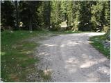
From highway Ljubljana - Jesenice we go to the exit Lesce and we follow the road in the direction of Bled, there in traffic lights crossroad signs for Pokljuka point us to the right. This road which in the lower part runs through some villages and later starts ascending steeper we follow to Mrzli Studenec (mountain pasture, which is located a good 50 meters behind the crossroad, where left downwards road to Bohinj branches off). In the middle of the mentioned mountain pasture from the main road the road which runs to Medvedova konta, Pri Rupah and mountain pasture Javornik branches off to the right. Here we turn right and follow the road to the next crossroad, where we continue right in the direction of Medvedova konta (straight mountain pasture Javornik). The road ahead after a shorter ascent descends and it brings us to the next crossroad, where we continue left. After that at the first right turn off we turn right. Soon another road branches off sharply to the right, here we go straight and only about 100m and then at the crossroad sharply right. Now we drive approximately 3km to the first turn-off to the left. Here we turn left and drive to the parking lot, where signs point us on the mountain pasture Klek. We park on a smaller parking lot by the road.
Path description:
From the parking lot, we return few meters back, and then we go on a footpath in the direction of Lipanca, Klek and Debela peč. The path ahead runs on a cart track which past a watering-place for animals brings us to first shepherd huts on the mountain pasture Klek. From the mentioned huts, a beautiful view opens up on the entire mountain pasture, and we continue slightly right and diagonally descend to the second part of the mountain pasture, where there stands some more shepherd huts.
We continue on a poorly visible path, which already after few 10 strides of additional walking passes into larch forest. Here, the footpath again becomes more distinct, and we follow it in the direction of Lipanca. Next follows few shorter ascents and descents, on occasionally again poorly visible footpath. After approximately 30 minutes of walking from the mountain pasture Klek, we will come at the marked crossing, where we continue right in the direction of Debela peč (slightly left Lipanca and Debela peč past Spodnja Brda). At the crossing, the footpath for a short time entirely vanishes, but if we continue in the direction as shows signpost, we quickly find it. Further, the path starts moderately ascending through thinner (mostly) larch forest. Only a little further, we pass into a smaller valley, through which we are ascending to the spot, where signs for Debela peč point us sharp to the left. The path ahead passes into a lane of dwarf pines, through which we ascend below the ridge of Klečica (the peak Klečica is situated more to the right). Only few 10 meters before the mentioned ridge, marked path turns left and starts diagonally descending towards the southwest. During the descent, few times a breathtaking view opens up on Debela peč. The path ahead for some time crosses with dwarf pines vegetated slopes, and then turns to the right and starts very steeply ascending. After a short ascent, we again reach the ridge, from which a nice view opens up towards Radovna.
On the ridge, the path turns to the left and it avoids the ridge into a dwarf pine, through which the path is still very steeply ascending. The path higher flattens and brings us on panoramic and on some spots also precipitous ridge (path runs a little below the ridge, so that there is no significant danger for slipping). The path ahead slightly descends, and then it brings us by the upper edge of gully in the shape of letter V. We continue on a marked path, which then leads us by ridge of Debela peč, and after less than 5 minutes of additional walking brings us on a panoramic peak.
Pictures:
 1
1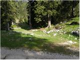 2
2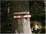 3
3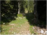 4
4 5
5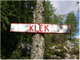 6
6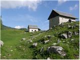 7
7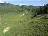 8
8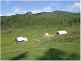 9
9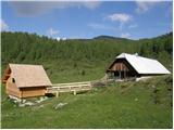 10
10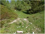 11
11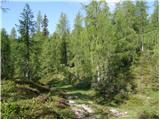 12
12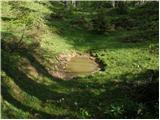 13
13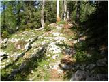 14
14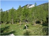 15
15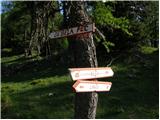 16
16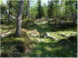 17
17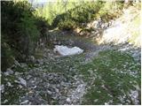 18
18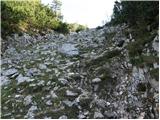 19
19 20
20 21
21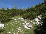 22
22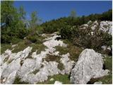 23
23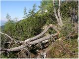 24
24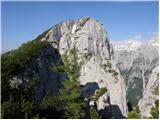 25
25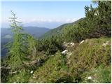 26
26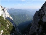 27
27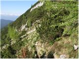 28
28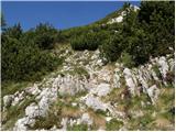 29
29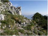 30
30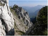 31
31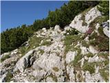 32
32 33
33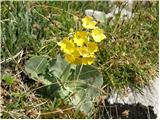 34
34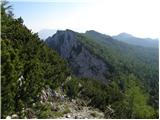 35
35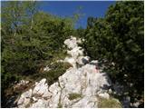 36
36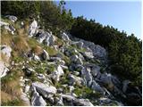 37
37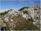 38
38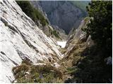 39
39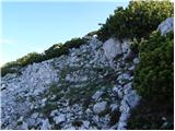 40
40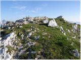 41
41 42
42