The Krma Valley - Triglav (via Planika and Triglavska škrbina)
Starting point: The Krma Valley (930 m)
Starting point Lat/Lon: 46.3851°N 13.9071°E 
Path name: via Planika and Triglavska škrbina
Time of walking: 5 h 45 min
Difficulty: very difficult marked way
Difficulty of skiing: very demanding
Altitude difference: 1934 m
Altitude difference (by path): 1934 m
Map: Triglav 1:25.000
Access to starting point:
We leave Gorenjska highway at exit Hrušica and follow the road ahead in the direction of Kranjska Gora. Just a little before the village Dovje the road which goes to Mojstrana (Vrata, Kot and Krma) branches off to the left. We follow the road ahead in the direction of village Radovna and the valleys Krma and Kot. The relatively steep road then runs past the sign TNP, behind which the road soon flattens and it brings us to a crossroad, where a macadam road into a valley Kot branches off to the right. We continue straight on the road which starts descending. In the middle of the descent, a road into a valley Krma branches off to the right (straight Radovna). A little further, we come to the next crossing, where we continue right in the direction of Krma. Macadam road then brings us to the mountain hut Kovinarska koča, and we follow it further. Occasionally a little rough road then brings us to a parking lot in front of the gate.
Path description:
From the parking lot, we continue past a gate and we continue on gentle and for public traffic closed forest road. The worse road for some time continues on an extensive gravel terrain, and then turns slightly to the right, where passes into the forest and changes into a rocky cart track. Further, we are for some time gently ascending through the forest, after we stride across a little bigger torrent, the path starts ascending steeper through a dense forest. Higher, we pass out of the forest into a lane of dwarf pines, mixed with bushes, and the path is over the mentioned slope ascending on gravel. At the altitude approximately 1400 meters, the path flattens and after few 10 strides of additional walking brings us on a nice grassy plain named Vrtača.
On the other side of the plain, wide path again starts ascending and after approximately 20 minutes of additional walking brings us on Malo polje, where it turns to the right and brings us on a less noticeable crossing. We continue on easy to follow path (left Vodnikov dom over Bohinjska vratca), which is for some time gently ascending, and then it brings us to a trough with water. Further, the path splits into two parts, and we continue straight on a marked path, which over at first grassy slopes brings us to shepherd cottages on the mountain pasture Zgornja Krma.
From the shepherd hut, we continue slightly right, on a marked mountain path, which in few minutes of a light ascent brings us to a marked crossing. We continue left in the direction of Planika over Kurica (right Kredarica and Staničev dom) on the path which starts ascending steeper and steeper. After few minutes of walking from a crossing, the path brings us to short rocky jump, where it ascends even steeper. After few minutes, the steepness decreases and the path passes on gentle slopes north from less noticeable Cesar (peak near Kurica). The path ahead is slowly turning slightly towards the left, where gradually passes on little steeper slopes, on which in a gentle diagonal ascent we ascend to a saddle Konjsko sedlo.
From the saddle, we continue in the direction of Planika (left Vodnikov dom, right Kredarica and Staničev dom) on a relatively steep path, which is ascending diagonally towards the west. Higher, an increasingly scenic path brings us on an indistinct ridge, where it turns to the right and for some time flattens a little. Ahead marked path on the right side bypasses a larger sinkhole, and then it starts turning towards the left. Next follows approximately 10 minutes of ascent and the path brings us to the mountain hut Dom Planika below Triglav.
At the mountain hut, we go on the path in the direction of Triglav over Triglavska škrbina. The path at first almost horizontally crosses high mountain cirque Triglavski kot in which snow stays for most of the year. On the other side of the cirque, the path ascends on the scree to the beginning of the climbing part of the path. The path steeply ascends with the help of iron spikes and steel cables. A well-secured path is exposed to falling stones, so the helmet is mandatory! The last meters below the notch Triglavska škrbina are less steep but equally dangerous. The ascent on slippery sand demands a lot of caution, that we don't slip. At the notch, where joins the path from Dolič and Plemenice we continue right upwards on a steep but well-secured path. After few minutes, the steepness decreases and to the top there is only few minutes of ascent on the upper slope of Triglav.
Krma - Zgornja Krma 2:30, Zgornja Krma - Konjsko sedlo 1:00, Konjsko sedlo - Planika 1:00, Planika - Triglav 1:15.
On the way: Vrtača (1430m), Malo polje (1585m),
Planina Zgornja Krma (1720m), Konjsko sedlo (2020m), Dom Planika (2401m), Triglavska škrbina (2659m)
Pictures:
 1
1 2
2 3
3 4
4 5
5 6
6 7
7 8
8 9
9 10
10 11
11 12
12 13
13 14
14 15
15 16
16 17
17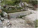 18
18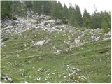 19
19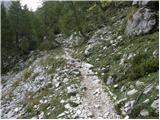 20
20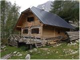 21
21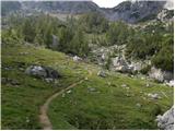 22
22 23
23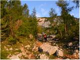 24
24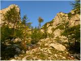 25
25 26
26 27
27 28
28 29
29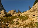 30
30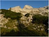 31
31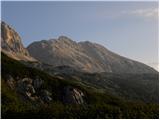 32
32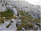 33
33 34
34 35
35 36
36 37
37 38
38 39
39 40
40 41
41 42
42 43
43 44
44 45
45 46
46 47
47 48
48 49
49 50
50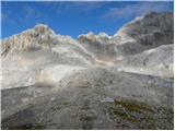 51
51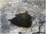 52
52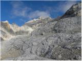 53
53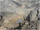 54
54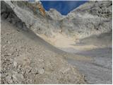 55
55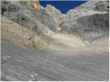 56
56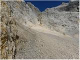 57
57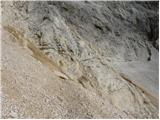 58
58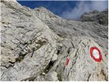 59
59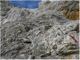 60
60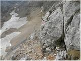 61
61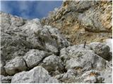 62
62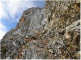 63
63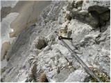 64
64 65
65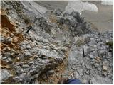 66
66 67
67 68
68 69
69 70
70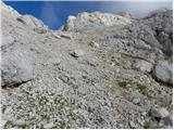 71
71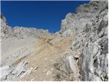 72
72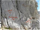 73
73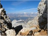 74
74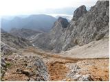 75
75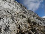 76
76 77
77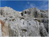 78
78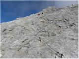 79
79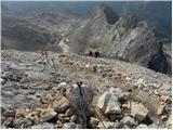 80
80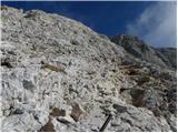 81
81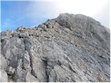 82
82 83
83 84
84 85
85 86
86