Zgornji Pobič / Povici di Sopra - Lopič / Monte Plauris (CAI 702)
Starting point: Zgornji Pobič / Povici di Sopra (346 m)
Starting point Lat/Lon: 46.3824°N 13.2198°E 
Path name: CAI 702
Time of walking: 5 h 30 min
Difficulty: very difficult marked way
Difficulty of skiing: no data
Altitude difference: 1612 m
Altitude difference (by path): 1660 m
Map: Tabacco 027
Access to starting point:
From central Slovenia on Gorenjska highway to exit Hrušica. From there on the main road through the valley Zgornja Savska dolina past Rateče to Trbiž / Tarvisio. West from Trbiž we continue on the main road SS13 towards Videm / Udine. In the settlement Na Bili / Resiutta we turn into a valley Rezija / Val Resia. Through it we drive to a little less than a kilometer distant exit for Spodnji Pobič / Povici di Sotto (371 meters), through a bridge over the stream Rezija and through Spodnji Pobič over the next bridge above gravel riverbed of the stream Resàrtico in the upper part of Pobič with dozen newer houses.
Path description:
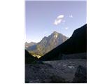
On the south part of Zgornji Pobič through the valley of the stream Resàrtico runs 2 km long forest road which leads us by the riverbed of strong stream Resàrtico with numerous artificial dams. After a good kilometer we leave it and we continue gently on a small footpath through the forest and over a numerous riverbeds with boulders. When we step in beech forest, increases also the steepness of the slope, so that we move forward in zig-zags to the next torrent (left, few meters away, behind the boulders is hidden a nice waterfall with some pools), beyond which in few steps we reach the cottage Resartico and ruins of former mining buildings.
We continue left past the ruins. After a little less than 50 altitude meters right from our path to the nearby entrance in former mine branches off footpath. From the crossroad, we continue left in zig-zags on a steeper slope. We soon come to the edge of broken, slightly exposed gully, where signposts pointing left, while well visible footpath winding right behind the edge.
This footpath is newer, by the edge of the gully goes to dwarf pine ridge and on it steeply, partly exposed uphill. Left turns old path, which goes at first over a jump (I grade), above which is winding in short zig-zags over a very steep and exposed grass slopes to a few meters high hanging ladder, which is on steepness like this especially in wet very useful. Above it steepness of the slope does not decrease, so that the trees, which partly cover the ridge, are very helpful. We soon step to traverse footpath, where from the right joins already described newer version of the path. Both versions are interesting, possibly more recommended is newer, but undoubtedly is the older more entertaining.
After the juncture of versions we turn left and go on in some parts eroded and narrow footpath a little gentler diagonally uphill. In between we cross more exposed gullies, where we get help from in grass hidden old steel cable. Soon slope widens and for short we continue through a thin forest. Higher it is changed by bushes and high grass with nettles, which show, that we are on the spot of former mountain pasture Lanis. The footpath is here on some spots poorly visible and it is winding in many gentle, almost horizontal zig-zags. Unpleasant searching for the traces of the path is after few minutes end, because in short we step on open grassy slope and on it again a little steeper to the nearby saddle Slips (1631 meters).
On the saddle, the path continues left diagonally below southwest slope of Vogršček downwards towards the mountain pastures Ungarina and Confin, and right we go a little downwards on a small footpath, that we avoid rocky slope of unnamed southeast secondary peak Lopič (on map it is marked only with point 1858 m; it is easily accessible over nortwestern ridge, which connects it with Lopič). When we bypass it, we go on steep grass uphill to the edge on the north precipitous ridge and on it quite steep, in the upper part also over a smaller rocky bands, to the top.
Pictures:
 1
1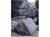 2
2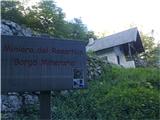 3
3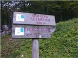 4
4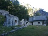 5
5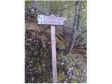 6
6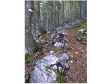 7
7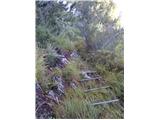 8
8 9
9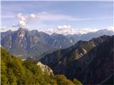 10
10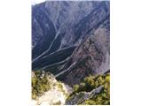 11
11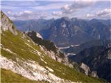 12
12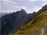 13
13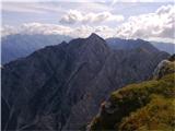 14
14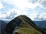 15
15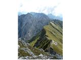 16
16