Bašelj - Mali Grintovec (via hospital Košuta and over Bašeljski vrh)
Starting point: Bašelj (590 m)
Starting point Lat/Lon: 46.321°N 14.4002°E 
Path name: via hospital Košuta and over Bašeljski vrh
Time of walking: 4 h 10 min
Difficulty: easy marked way
Difficulty of skiing: no data
Altitude difference: 1223 m
Altitude difference (by path): 1345 m
Map: Karavanke - osrednji del 1:50.000
Access to starting point:
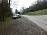
A) From highway Ljubljana - Jesenice we go to the exit Kranj - east, and then we continue driving in the direction of Jezersko. When we get to Preddvor we leave the main road and we continue driving left towards the center of the mentioned settlement, from there we follow the signs for settlement Bašelj. When we get to Bašelj, at the spot, where the main road makes long left turn, we leave it and we continue driving straight in the direction of the path Gamsova pot. We continue driving on a narrow asphalt road which leads us between the houses and stream Belica. We park on a parking lot by Tourism Association Bašelj.
B) From highway Jesenice - Ljubljana we go to the exit Kranj - zahod and at the first crossroad, we continue left. Further, we drive through the underpass below the highway, and then we get to a roundabout, from where we continue driving in the direction of Golnik. The path ahead leads us through the settlement Mlaka pri Kranju, and at the end of the settlement, we continue right in the direction of the settlement Srakovlje. Next follows driving through Srakovlje, Spodnja Bela, Srednja Bela, Zgornja Bela (in Zgornja Bela we join the road from Preddvor) to Bašelj, where the main road makes long left turn, we leave it and we continue driving straight in the direction of the path Gamsova pot. We continue driving on a narrow asphalt road which leads us between the houses and stream Belica. We park on a parking lot by Tourism Association Bašelj.
Path description:
From the starting point at log cabin of tourism association Bašelj we continue on for public traffic closed forest road which leads us by the stream Belica. We at first walk by a football and basketball field, and then we already get to the first a crossing of the path Gamsova pot, where the path branches off to the left towards the church of St. Lovrenc, mountain hut Dom pod sv. Lovrencem, it is also possible to continue towards Storžič, Krničarjeva koča na planini Javornik, Mala and Veliki Poljana...
From the mentioned crossing, we still continue on a macadam road which is moderately ascending through the forest or partly through bushes. After few minutes, we get to the turning point of the forest road, where the footpath towards Kališče continues right over a stream and slightly to the left continues the path gamsova pot, which leads on Gradišče and forward to St. Lovrenc and the path on Kališče on the forest road, Kališče past hospital Košuta and Kališče on the ridge of Kisovec. We continue on a wide cart track which is ascending towards the nearby water catchment. Before the water catchment we leave a wide cart track and we again continue slightly left, on the path, where continues the path Gamsova pot. Further, we are few minutes ascending on more steep cart track, when it ends we continue right on less distinct, but relatively well-beaten path, which is ascending through the forest. Higher on some spots footpath partly vanishes, and we follow otherwise rare yellow-white blazes, which mark path Gamsova pot. Few minutes we are ascending through the forest, after that on one turn we reach the other forest road which we follow to the right (left Laško). On the macadam road, we walk few 10 meters and we already get to the next crossing, where the path towards St. Lovrenc branches off to the left, and few steps ahead also to the summit Gradišče to the right. We continue on the road for about 10 minutes, and then we get to a smaller parking lot and few steps ahead to the turning point at the end of the road.
From the end of the road, we continue left on a cart track in the direction of Kališče and Storžič. Cart track is then moderately ascending by the riverbed of the stream Belica and after approximately 10 minutes splits into two parts. We continue on the left cart track which already after few meters ends. On this part we leave vicinity of the riverbed and we continue a little left on the path which ascends steeply through the forest. The steepness soon decreases and the path brings us to partisan hospital Košuta.
Behind the hospital we cross two successive torrents, and then the path again becomes steeper. The path ahead still continues through the forest, and in doing so it crosses one steeper slope, where in wet a little more caution is needed. Above the steep part we reach a side ridge of Kališče, where from the right side joins an unmarked path from Bašelj.
Here we continue left and we continue the ascent on still steep path which continues through gradually more and more thin forest. After the bench and after some views on the nearby Storžič path turns right and returns into a dense forest. Next follows less steep path, which quickly takes us to first cottage on Spodnje Kališče. Behind the cottage forest ends, after that on a pleasant grassy grounding in few minutes we reach the main part of the mountain pasture, where we also join the normal path from Mače.
From Spodnje Kališče we continue slightly left in the direction of Dom na Kališču, from where follows few minutes of walking through the forest and then we get to a nice viewpoint, from which a nice view opens up towards the nearby mountain hut Dom na Kališču, Mali Grintovec, ridge of Lanež, Krvavec... From the viewpoint only a short ascent follows and we are already at the mountain hut Dom na Kališču.
Behind the mountain hut Dom na Kališču we notice a mountain signpost with numerous options to continue. We continue on a gently sloping and panoramic ridge path in the direction of Storžič, Bašeljski vrh..., which continues towards the north. After few minutes of easy walking with nice views, which reaches all the way to Julian Alps, we get to a crossing, where we continue right (straight Storžič) towards Bašeljski vrh. The path ahead ascends steeper through a lane of dwarf pines and with a nice view towards the neighbouring Mali Grintovec brings us on with dwarf pines covered ridge Bašeljski vrh, where in next few minutes we get to the next well-marked crossing. At the crossing, the path to Mali Grintovec and Srednji vrh branches off to the right, and we continue straight and with a view on Storžič we continue the ascent. The path which runs on and by with dwarf pines covered ridge, little below the summit joins also the path from Jekarica and Bašeljski preval. Here we continue right and on a little narrower ridge in a minute of additional walking, we reach Bašeljski vrh, from which a nice view opens up towards the mountains above Jezersko, and the view reaches all the way to Košuta, Obir and Lavanttal Alps in Austria.
From Bašeljski vrh we start relatively steeply descending towards the east to northeast, on the path that runs on and by the ridge, which is mostly vegetated with dwarf pines, and on the part where it isn't a little more caution is needed. After approximately 15 minutes the descent ends and the path brings us on a saddle Mačensko sedlo, where the marked path from Kališče and unmarked path through the valley of Suha join.
We continue straight in the direction of Mali Grintovec, on the path which starts relatively steeply ascending on the western slope of the mentioned mountain. After approximately half an hour of walking from the saddle Mačensko sedlo we come at the marked crossing, where from the right side, the path from Dolga njiva joins. We continue left and after few 10 strides of additional walking, we get to the top of Mali Grintovec.
Bašelj - Kališče 2:40, Kališče - Bašeljski vrh 45 minutes, Bašeljski vrh - Mali Grintovec 45 minutes.
Pictures:
 1
1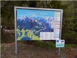 2
2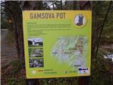 3
3 4
4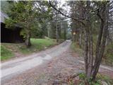 5
5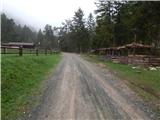 6
6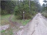 7
7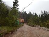 8
8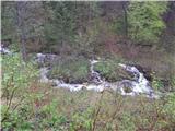 9
9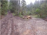 10
10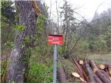 11
11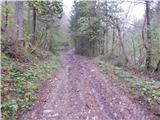 12
12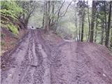 13
13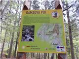 14
14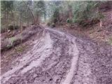 15
15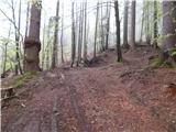 16
16 17
17 18
18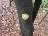 19
19 20
20 21
21 22
22 23
23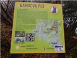 24
24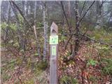 25
25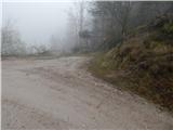 26
26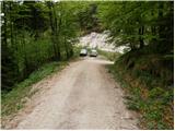 27
27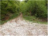 28
28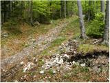 29
29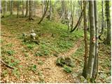 30
30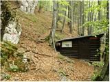 31
31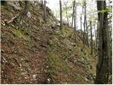 32
32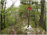 33
33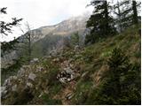 34
34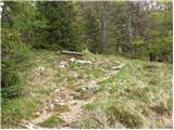 35
35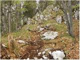 36
36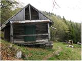 37
37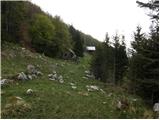 38
38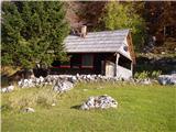 39
39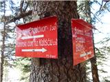 40
40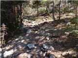 41
41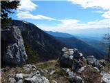 42
42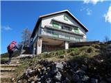 43
43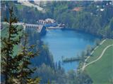 44
44 45
45 46
46 47
47 48
48 49
49 50
50 51
51 52
52 53
53 54
54 55
55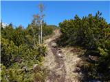 56
56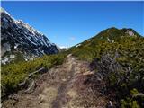 57
57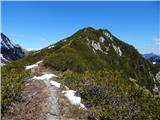 58
58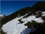 59
59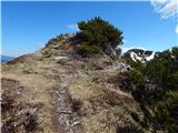 60
60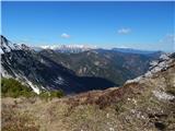 61
61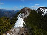 62
62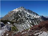 63
63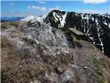 64
64 65
65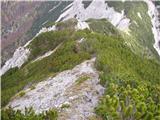 66
66 67
67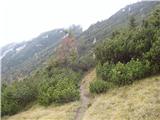 68
68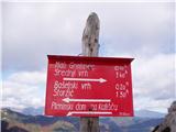 69
69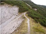 70
70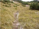 71
71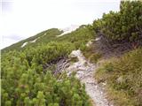 72
72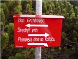 73
73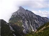 74
74 75
75