Bašelj - Storžič (past sv. Lovrenc and on SW ridge)
Starting point: Bašelj (590 m)
Starting point Lat/Lon: 46.321°N 14.4002°E 
Path name: past sv. Lovrenc and on SW ridge
Time of walking: 4 h 5 min
Difficulty: difficult unmarked way
Difficulty of skiing: no data
Altitude difference: 1542 m
Altitude difference (by path): 1550 m
Map: Karavanke - osrednji del 1:50.000
Access to starting point:
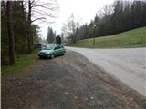
A) From highway Ljubljana - Jesenice we go to the exit Kranj - east, and then we continue driving in the direction of Jezersko. When we get to Preddvor we leave the main road and we continue driving left towards the center of the mentioned settlement, from there we follow the signs for settlement Bašelj. When we get to Bašelj, at the spot, where the main road makes long left turn, we leave it and we continue driving straight in the direction of the path Gamsova pot. We continue driving on a narrow asphalt road which leads us between the houses and stream Belica. We park on a parking lot by Tourism Association Bašelj.
B) From highway Jesenice - Ljubljana we go to the exit Kranj - zahod and at the first crossroad, we continue left. Further, we drive through the underpass below the highway, and then we get to a roundabout, from where we continue driving in the direction of Golnik. The path ahead leads us through the settlement Mlaka pri Kranju, and at the end of the settlement, we continue right in the direction of the settlement Srakovlje. Next follows driving through Srakovlje, Spodnja Bela, Srednja Bela, Zgornja Bela (in Zgornja Bela we join the road from Preddvor) to Bašelj, where the main road makes long left turn, we leave it and we continue driving straight in the direction of the path Gamsova pot. We continue driving on a narrow asphalt road which leads us between the houses and stream Belica. We park on a parking lot by Tourism Association Bašelj.
Path description:
From the starting point at log cabin of tourism association Bašelj we continue on for public traffic closed forest road which leads us by the stream Belica. At first, we walk by football and basketball field, and then we already get to the first crossing of the path Gamsova pot, where we continue left (straight on the road Kališče, Gradišče, Storžič...) in the forest, where at first we walk parallel with the road, and then the path turns more to the left and starts ascending diagonally over gradually steeper slope. Higher, we step out of the forest, from where a nice view opens up towards Gamsov raj, Gorenjska and nearby village Laško. From here past the bench and NOB monument in few steps we descend to the near road, and there we walk only few meters, because signs of the path Gamsova pot point us to the right into the forest. A few minutes of ascent through the forest follows, and then we reach the forest road which we follow to the right to the nearby crossroad and parking lot.
From the crossroad, we continue on rough and steeper left road in the direction of St. Lovrenc and hut Dom pod Lovrencem (straight Kališče, Storžič - to Kališče and Storžič it is possible to get to even if we continue left). From the crossroad ahead we are ascending relatively steeply, during the ascent marked footpath which leads directly towards the church of St. Lovrenc branches off to the right and bypasses hut below Lovrenc. We all the time continue on the road, and from there higher for some time a view opens up a little. When the road after some time turns sharply right, in few steps it brings us to the already mentioned hut Dom pod Lovrencem.
From the hut, we continue in the direction of Javornik, Velika and Mala Poljana, Kališče and Storžič, on the path which moderately ascends through the forest. A well-beaten path quickly leads out of the forest on an ample meadow, through which in nice views we walk to the church of St. Lovrenc.
Behind the church, the path returns into the forest and starts descending towards few minutes distant marked crossing, where we continue straight in the direction of Storžič and Kališče.
Further, we continue in the direction of Storžič still on a wide path, which is slightly ascending. The path soon becomes narrower and is then for quite some time steeply ascending through the forest. Higher, the path finally brings us out of the forest and nice views open up on the southern slopes of Storžič. The steepness is still not decreasing all the way to a bench on crossing.
Left leads a marked path towards Javornik and Poljana, and right towards Kališče. At the crossing, we don't continue left or right, but on an unmarked footpath which leads straight. A little worse beaten path we will notice left from the tree on which there are signposts. From the crossing, the path is ascending on a grassy slope, which becomes steeper and soon brings us near the indistinct gully. Here we continue a little to the left and then we are ascending left from the mentioned gully towards the southwest ridge of Storžič. The slope is on this side also a little more vegetated with trees. The path is otherwise poorly beaten, but we can follow it without any bigger problems. When we get closer to the ridge, the path turns to the right and crosses grassy slopes. Next follows a shorter steep ascent to the ridge. Grassy slopes are on a larger part of the path pretty steep and are in wet very dangerous for slipping. And also in dry some caution is needed.
When we reach the ridge, we continue right and we are then ascending on mostly grassy and relatively steep ridge. On steeper parts path few times avoids the ridge on left or right side. We follow the ridge all the way until we join the marked path from the mountain pasture Planina Javornik. The marked path then turns slightly to the right and soon join also paths from Dom pod Storžičem and Kališče. To the top, which we already see in front of us then only a short ascent follows.
We can descend over mountain pasture Planina Javornik or towards Kališče.
Pictures:
 1
1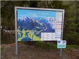 2
2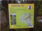 3
3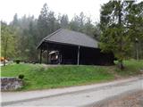 4
4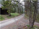 5
5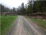 6
6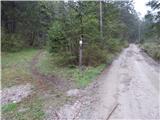 7
7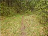 8
8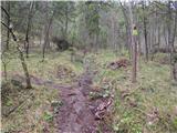 9
9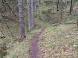 10
10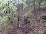 11
11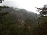 12
12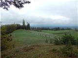 13
13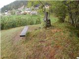 14
14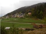 15
15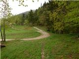 16
16 17
17 18
18 19
19 20
20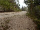 21
21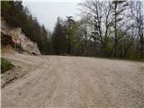 22
22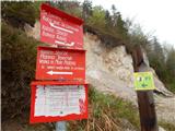 23
23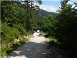 24
24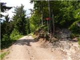 25
25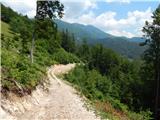 26
26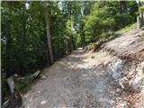 27
27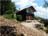 28
28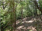 29
29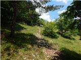 30
30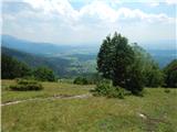 31
31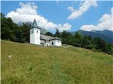 32
32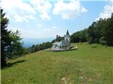 33
33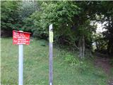 34
34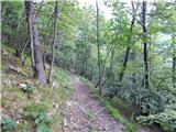 35
35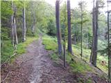 36
36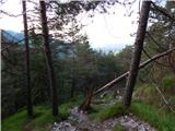 37
37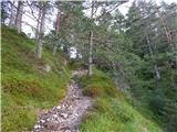 38
38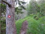 39
39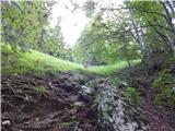 40
40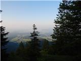 41
41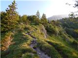 42
42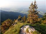 43
43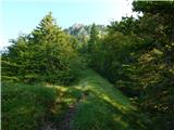 44
44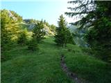 45
45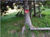 46
46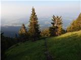 47
47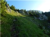 48
48 49
49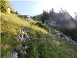 50
50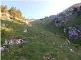 51
51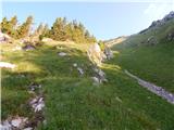 52
52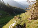 53
53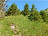 54
54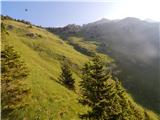 55
55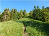 56
56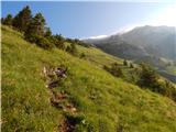 57
57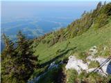 58
58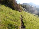 59
59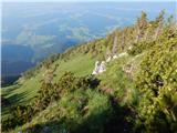 60
60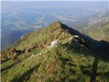 61
61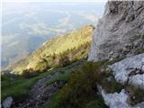 62
62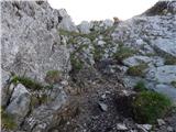 63
63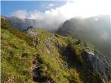 64
64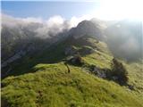 65
65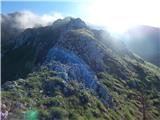 66
66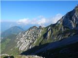 67
67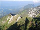 68
68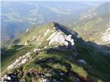 69
69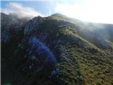 70
70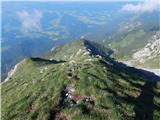 71
71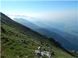 72
72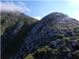 73
73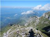 74
74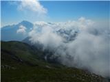 75
75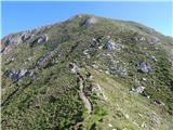 76
76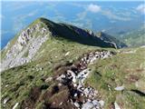 77
77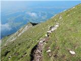 78
78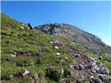 79
79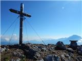 80
80 81
81 82
82 83
83