Begunje (Krpin) - Smokuški vrh (on cart track and past sv. Peter)
Starting point: Begunje (Krpin) (585 m)
Starting point Lat/Lon: 46.3821°N 14.203°E 
Path name: on cart track and past sv. Peter
Time of walking: 1 h 50 min
Difficulty: easy unmarked way
Difficulty of skiing: partly demanding
Altitude difference: 537 m
Altitude difference (by path): 560 m
Map: Karavanke - osrednji del 1:50.000
Access to starting point:
From highway Ljubljana - Jesenice we go to the exit Radovljica (from Gorenjska side exit Lesce) and follow the road ahead in the direction of Begunje. In Begunje (only a little after the crossroad, where a road branches off to the left towards Žirovnica) we continue left in the direction of recreation center Krpin (straight Draga and Tržič). We park on a large parking lot by recreation center Krpin.
Path description:
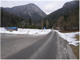
From the parking lot, we continue on the asphalt road which higher over a small bridge crosses the stream Blatnica and then it changes into a macadam road. We still follow the road, and it soon brings us to a marked crossroad, where we continue on the left road in the direction of St. Peter (right St. Peter longer path and saddle Kališča). The road which is getting worse then quickly brings us to the next crossroad, where we continue right on a cart track (marked). Cart track then starts ascending steeper and higher it brings us out of the forest on grassy slopes on which in few minutes we ascend to the church from which a beautiful view opens up.
From the church, we continue past eponymous airfield on the path which soon goes into the forest and then in a gentle ascent continues all the way to Sankaška koča.
From Sankaška koča we continue in the direction of the mountain pasture Poljška planina and Završnik on the path which goes into the forest and for a short time it steeply ascends. The steepness then decreases and the path after a short descent brings us to two smaller cottages between which stands a wooden cross.
We continue on a marked path, which returns into the forest and starts gradually ascending steeper and steeper. At the hunting cottage steepness decreases and we continue on a path which runs by the edge of a wide ridge. Only a little further, the path turns to the right, crosses a cart track (option to continue on a cart track) and smaller clearing and then starts ascending on a quite ruined cart track. Higher the cart track widens (because we join the cart track which we recently crossed) and it brings us to a forest road.
Only few meters before we step on the mentioned forest road we will notice on the left side unmarked footpath which after approximately 10 minutes of additional walking brings us on panoramic Smokuški vrh.
The starting point - Sveti Peter 0:50, Sveti Peter - Sankaška koča 0:10, Sankaška koča - Smokuški vrh 0:50.
Pictures:
 1
1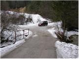 2
2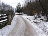 3
3 4
4 5
5 6
6 7
7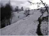 8
8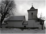 9
9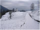 10
10 11
11 12
12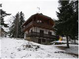 13
13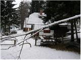 14
14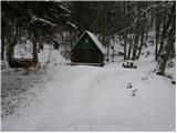 15
15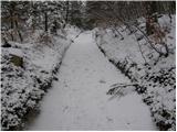 16
16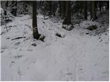 17
17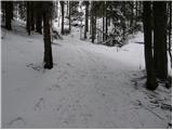 18
18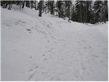 19
19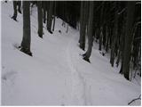 20
20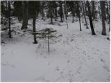 21
21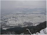 22
22 23
23