Brezje pri Tržiču - Dobrča (on path Po robu and via Lešanska planina)
Starting point: Brezje pri Tržiču (677 m)
Starting point Lat/Lon: 46.3589°N 14.2787°E 
Path name: on path Po robu and via Lešanska planina
Time of walking: 2 h 35 min
Difficulty: easy marked way
Difficulty of skiing: partly demanding
Altitude difference: 957 m
Altitude difference (by path): 957 m
Map: Karavanke - osrednji del 1:50.000
Access to starting point:
From highway Ljubljana - Jesenice we go to the exit Ljubelj and follow the road ahead in the direction of Tržič. Just before the gas station at Tržič we turn right (direction Tržič) and then immediately left (direction Begunje) and drive ahead to the village Brezje pri Tržiču, where we park on a parking lot near the church.
Path description:
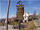
From the parking lot, we continue on the road towards Begunje, but only to a spot, where it starts descending. Here the road which leads on the mountain pasture Bistriška planina branches off to the right (by the crossroad there are also signposts for Dobrča), we walk there only for few minutes, and then at the crossroad we go left in the direction of Dobrča (right road leads on the mountain pasture Bistriška planina).
From the crossroad ahead we continue on a little rough road, on which we walk approximately 1 minute, and then blazes lead us to the right on a footpath which continues along the fence. For some time we are moderately ascending by the fence, and then after approximately 20 minutes of walking from the starting point, we get to on a wide, but steep cart track. On cart track we are ascending to a bit thinner forest, where blazes point us sharply right upward. Further are ascending steeply through the forest and after 15 minutes of additional walking, we get to abandoned watering place for animals. Here the path turns to the left and ascending gently below an indistinct peak Vaško. A little further, we get to on a smaller saddle between the already mentioned peak on the right and slopes of Dobrča on the left.
Next follows a short ascent and the path brings us to the spot, where we cross nearby forest road (we cross the road right on the spot where it ends). Further, we are ascending for some time on a wide and the forest ridge, on which we walk all the way to a paragliding take off point, which is located on the southern slopes of Dobrča.
Here we continue right in the direction of the mountain pastures Lešanska and Bistriška planina (straight mountain hut Koča na Dobrči and Dobrča - direct path) and we continue on a rough road which only a little further brings us to the next crossing. This time we continue slightly left (slightly right mountain pasture Bistriška planina) and start ascending steeper on a wide cart track. Because cart track further has few crossings we carefully follow the blazes, not to go astray from the right path. After approximately half an hour ascent from paragliding take off point, we step out of the forest on an ample mounatin pasture Lešanska planina, in the middle of which we get to an unmarked crossing.
We continue right (left shepherd hut on Lešanska planina 50 meters and option to continue towards the mountain hut Koča na Dobrči and Dobrča) and we continue gently sloping ascent by the edge of the mountain pasture. After few minutes of additional walking, or more precisely few meters behind hunting observatory we continue left, where on a well visible path we are steeply ascending on the upper edge of the mountain pasture, where we again step on a cart track which we left at at the hunting observatory. We follow the cart track to the left and we are diagonally ascend to a marked path which leads from the mountain hut Koča na Dobrči towards the summit Dobrča. Here we continue sharply right and after 5 minutes of additional walking, we get to the top.
Pictures:
 1
1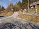 2
2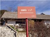 3
3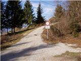 4
4 5
5 6
6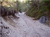 7
7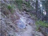 8
8 9
9 10
10 11
11 12
12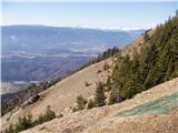 13
13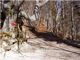 14
14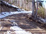 15
15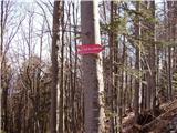 16
16 17
17 18
18 19
19 20
20 21
21 22
22 23
23 24
24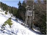 25
25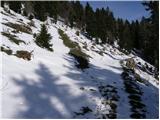 26
26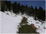 27
27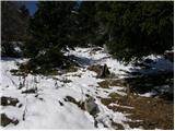 28
28 29
29 30
30 31
31 32
32 33
33 34
34 35
35 36
36 37
37 38
38