Dom pod Storžičem - Bela peč (via Javorniški preval)
Starting point: Dom pod Storžičem (1123 m)
Starting point Lat/Lon: 46.3586°N 14.3906°E 
Path name: via Javorniški preval
Time of walking: 2 h 5 min
Difficulty: easy marked way
Difficulty of skiing: no data
Altitude difference: 460 m
Altitude difference (by path): 565 m
Map: Karavanke - osrednji del 1:50.000
Access to starting point:
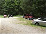
From highway Ljubljana - Jesenice we go to the exit Ljubelj (Tržič), and then we continue driving towards Ljubelj. Just before the gas station in Bistrica pri Tržiču we leave the main road and we continue driving right in the direction of Tržič. Further, we drive through Tržič in the direction of gorge Dolžanova soteska, and then at the end of the town we continue right in the direction of Lom pod Storžičem and Grahovše. At the end of the village Grahovše asphalt ends, and further we follow the macadam road in the direction of the mountain hut Dom pod Storžičem. This in the upper part steeper macadam road, we then follow to the parking lot near the mountain hut Dom pod Storžičem.
Path description:
From the parking lot near the mountain hut Dom pod Storžičem we continue on the left road in the direction of saddle Javorniško sedlo, mountain pasture Javornik, Jezersko, Pavšel, Tič, Tržič and NOB monument. Already after few meters of walking road splits into two parts, and we choose the upper right road (left Tič and monument NOB). We continue on the mentioned road, and after approximately 20 minutes of walking it changes into a cart track. At the spot, where the road changes into a cart track we have two options to continue. We can continue the ascent on a steep and quite overgrown footpath, or on a little less steep cart track which isn't marked, but orientationally even a little easier as marked footpath. Cart track and footpath higher join and bring us on a saddle Javorniški preval, where there is a marked crossing.
Here we continue left (right Kanonir, sharply right Storžič), where after few 10 strides we get to the next crossing. The right path leads towards the saddle Močnikovo sedlo, and we continue on the left path in the direction of the mountain pasture Javornik. The path ahead continues on a wide and gentle cart track which for some time crosses slopes towards the northwest. After few minutes forest gets thinner and an increasingly panoramic path brings us to the mountain pasture Javornik, from which a beautiful view opens up.
From the mountain pasture, we continue left downwards (straight Stegovnik, right Veliki Javornik or Ženiklovec) and on a cart track which crosses a lane of a forest, we descend to the nearby forest road. When we step on the road which we reach right at the smaller crossroad, by which there is situated memorial plaque, from the left joins another path from the mountain hut Dom pod Storžičem. Here we continue straight on a slightly ascending road, on which we quickly get to the nearby hut Pr Zdravc.
From the hut, we short time continue on the road, after that on a smaller saddle we continue right on a marked footpath in the direction of Bela peč. The path ahead starts moderately ascending by the edge of steep slopes, and then it for some time brings us on a cart track which we follow to the left. Cart track quickly ends, and the path passes on steeper slopes, which we cross towards the right. Next follows a short slightly exposed passage, after which slope flattens. Next follows crossing of a grazing fence, after that gently sloping path brings us to the next marked crossing.
At the crossing, we continue left (straight mountain pasture Zgornja and Spodnja Konjščica) in the direction of vantage point Bela peč. Here we continue through narrower passage between two trees, and then we quickly ascend on a panoramic peak.
Pictures:
 1
1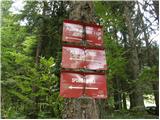 2
2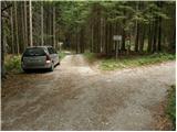 3
3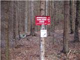 4
4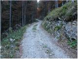 5
5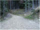 6
6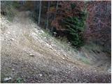 7
7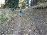 8
8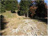 9
9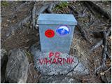 10
10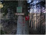 11
11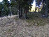 12
12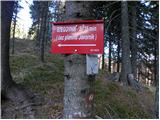 13
13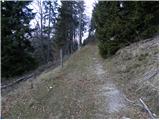 14
14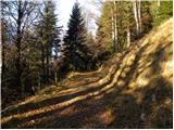 15
15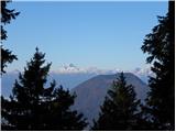 16
16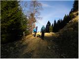 17
17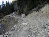 18
18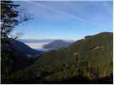 19
19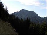 20
20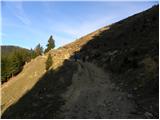 21
21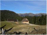 22
22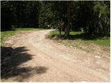 23
23 24
24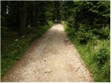 25
25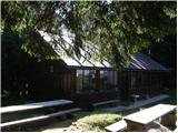 26
26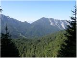 27
27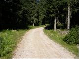 28
28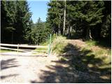 29
29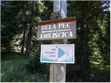 30
30 31
31 32
32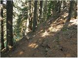 33
33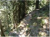 34
34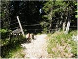 35
35 36
36 37
37 38
38 39
39 40
40 41
41 42
42