Kraljev hrib - Črnuški dom na Mali planini (via Škorenca, Kačjek and Gamsove streže)
Starting point: Kraljev hrib (540 m)
Starting point Lat/Lon: 46.3061°N 14.6088°E 
Path name: via Škorenca, Kačjek and Gamsove streže
Time of walking: 4 h
Difficulty: partly demanding unmarked way
Difficulty of skiing: no data
Altitude difference: 986 m
Altitude difference (by path): 1200 m
Map: Kamniške in Savinjske Alpe 1:50.000
Access to starting point:
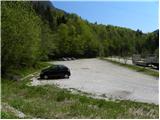
First, we drive to Kamnik, and then we continue driving in the direction of Kamniška Bistrica and cableway on Velika planina. In Stahovica we continue left (direction Kamniška Bistrica and cableway Velika planina) and we follow moderately ascending road to a large parking lot near the bottom cableway station on Velika planina (parking lot is located on the right side of the road).
Path description:
From the parking lot, we go on a macadam road in the direction of Kraljev hrib and Velika planina. At first right turn marked path towards the mountain pasture Dol, Velika planina and Konj branches off to the left, and we follow wide road to first bigger left turn. In the middle of the turn, immediately after power line pole, we leave the road which leads towards the inn Kraljev hrib and we continue right on the forest road which past the chapel brings us to the next left turn (to here possible also with a car). Same as at first turn, also now we continue right, only that now we continue on a cart track which from the road branches off at feeding site for animals.
We continue on a gentle cart track which gradually changes into easy to follow hunting footpath. The footpath for some time crosses slopes towards the right, crosses gulley Šimnov plaz, and then in numerous zig-zags starts ascending steeper. Higher, we come on a well visible and partly marked crossing. On one of the trees, which is situated directly by the crossing we notice a sign R and below it arrow left (R - marks hunting path on Rigelj), and we continue right on traverse path which leads towards the hunting cottage Sivnik. We continue on easy to follow, but with leaves covered path, which through gullies and occasionally steeper slopes, brings us to decaying hunting cottage Sivnik. To here we need approximately 1.5 hours of moderate walking.
At the hunting cottage another path which leads on Rigelj branches off to the left, and we continue straight on traverse path, which soon after hunting cottage passes on the other side of indistinct ridge. The path ahead crosses numerous gullies and steep slopes and over slopes of Škorenca and Kačjek brings us to entirely forested Gamsove streže. Long lasting crossing of the slopes here ends, and the path turns slightly towards the left and starts ascending steeply. Higher, the footpath again goes towards the right and then in a diagonal ascent brings us to the spot, where we step on a marked path Stahovica - Velika planina.
When we step on a marked path we continue left (straight mountain pasture Kisovec, right Stahovica) on the path which gradually starts ascending steeper and steeper. Higher, the path flattens and over a grazing fence brings us on the south edge of plateau Velika planina. Only few meters above the grazing fence we cross wider path, and we continue straight on a little poorly visible footpath which soon brings us to first cottages on the mountain pasture. Gentle footpath which leads us over pastures, we follow to the memorial who died in the crash of an allied aircraft in the year 1944. Only few meters before memorial we continue left (right Jarški dom) and then on a moderately steep path in 5 minutes of additional walking, we get to the mountain hut Črnuški dom na Mali planini.
On the way: Lovska koča Sivnik (975m)
Pictures:
 1
1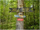 2
2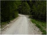 3
3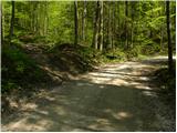 4
4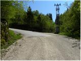 5
5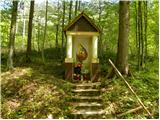 6
6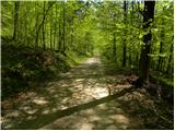 7
7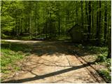 8
8 9
9 10
10 11
11 12
12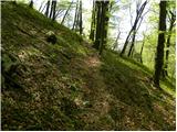 13
13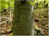 14
14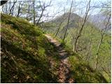 15
15 16
16 17
17 18
18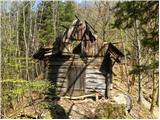 19
19 20
20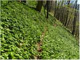 21
21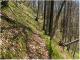 22
22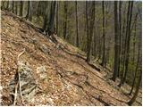 23
23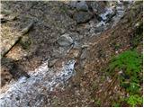 24
24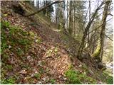 25
25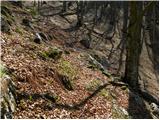 26
26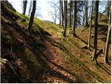 27
27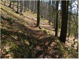 28
28 29
29 30
30 31
31 32
32 33
33 34
34 35
35 36
36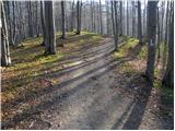 37
37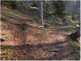 38
38 39
39 40
40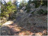 41
41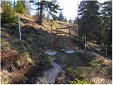 42
42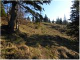 43
43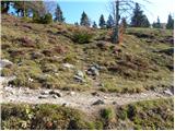 44
44 45
45 46
46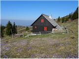 47
47 48
48 49
49 50
50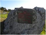 51
51 52
52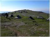 53
53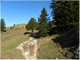 54
54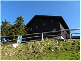 55
55