Laško - Storžič (via Sveti Lovrenc and over Bašeljski preval)
Starting point: Laško (740 m)
Starting point Lat/Lon: 46.3256°N 14.3969°E 
Path name: via Sveti Lovrenc and over Bašeljski preval
Time of walking: 4 h 30 min
Difficulty: difficult marked way
Difficulty of skiing: no data
Altitude difference: 1392 m
Altitude difference (by path): 1425 m
Map: Karavanke - osrednji del 1:50.000
Access to starting point:
A) From highway Ljubljana - Jesenice we go to the exit Kranj - east, and then we continue driving in the direction of Jezersko. When we get to Preddvor we leave the main road and we continue driving left towards the center of the mentioned settlement, from there we follow the signs for settlement Bašelj. When we get to Bašelj at first at the beginning of the left turn in the direction of straight continues narrower road which leads to the parking lot at log cabin TD Bašelj (in descriptions starting point Bašelj), and from the mentioned crossroad we continue on the main road a good 100 meters to the next crossroad, where we continue right on the road towards Gamsov raj and hamlet Laško. Only about 50 meters ahead we continue on the left road which gradually starts moderately ascending. At the hamlet Laško we again continue left and then the asphalt ends and we continue driving on a steep macadam road which we follow to the parking lot, at the smaller crossroad. At the crossroad, there are situated red hiking signposts.
B) From highway Jesenice - Ljubljana we go to the exit Kranj - zahod and at the first crossroad, we continue left. Further, we drive through the underpass below the highway, and then we get to a roundabout, from where we continue driving in the direction of Golnik. The path ahead leads us through the settlement Mlaka pri Kranju, and at the end of the settlement, we continue right in the direction of the settlement Srakovlje. Next follows driving through Srakovlje, Spodnja Bela, Srednja Bela, Zgornja Bela (in Zgornja Bela we join the road from Preddvor) to Bašelj, where the main road makes long left turn, where in the direction of straight continues narrower road which leads to the parking lot at log cabin TD Bašelj (in descriptions starting point Bašelj), and from the mentioned crossroad we continue on the main road a good 100 meters to the next crossroad, where we continue right on the road towards Gamsov raj and hamlet Laško. Only about 50 meters ahead we continue on the left road which gradually starts moderately ascending. At the hamlet Laško we again continue left and then the asphalt ends and we continue driving on a steep macadam road which we follow to the parking lot, at the smaller crossroad. At the crossroad, there are situated red hiking signposts.
Path description:
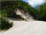
From the parking lot, we go on a steep cart track in the direction of Lovrenc. After a short steep ascent cart track brings us to a crossing, where the footpath to the church of St. Lovrenc branches off to the right. We continue on the bottom cart track which again starts ascending steeper and after 15 minutes of walking from the starting point brings us to hut Dom na Lovrencu.
At the hut we continue on the path towards Storžič and already after few steps the path brings us out of the forest on meadows below the church. Church of St. Lovrenc we reach in few minutes of walking on a meadow.
We continue on a meadow past the church and the path soon brings us into the forest. Further wide path slightly descends to small indistinct saddle, where joins the path from a little higher starting point. Further, we continue in the direction of Storžič still on a wide path, which is slightly ascending. The path soon becomes narrower and is then for quite some time steeply ascending through the forest. Higher, the path finally brings us out of the forest and nice views open up on the southern slopes of Storžič. The steepness is still not decreasing all the way to a bench on crossing.
Left leads a marked path towards Javornik and Poljane, and we go right towards Kališče. The path from the crossing becomes a little narrower and less beaten. Further, we for long time cross the slopes towards the east. On the path, there are taking turns forest and grassy slopes, which are on some spots also pretty steep. While crossing the path occasionally ascends a little steeper, and few times also slightly descends. In the second part of the crossing, the path brings us to the source below the saddle Bašeljsko sedlo. Here the path turns slightly to the right and is still crossing slopes until it brings us to a marked crossing.
To the right leads the path towards the mountain hut Dom na Kališču to which there is only few minutes of walking, and we go sharply left on the path towards Storžič. At the crossing otherwise also the path towards Bašeljski vrh and Mali Grintovec branches off. A gently sloping path then with nice views quickly brings us on a saddle Bašeljsko sedlo, where joins the path from Jezersko. On the saddle signpost for Storžič points us on the path which goes towards the west (straight). The path which starts ascending steeply through dwarf pines after 30 minutes of ascent brings us on the ridge of Storžič. The path soon avoids the ridge on a steep southern slopes of Storžič. This part of the path is dangerous for slipping, in wet we have to be very careful. The steepness then decreases a little, and the path continues on a ridge or a little below it. Few meters below the summit we join the path which comes from Žrelo (also from the mountain pasture Javornik and from Psica). We continue right and in few steps we reach the peak on which stands a cross.
Pictures:
 1
1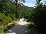 2
2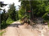 3
3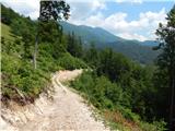 4
4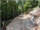 5
5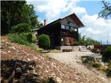 6
6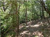 7
7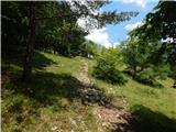 8
8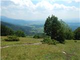 9
9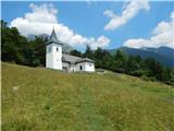 10
10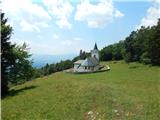 11
11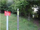 12
12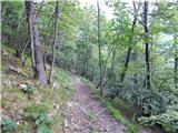 13
13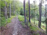 14
14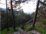 15
15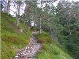 16
16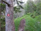 17
17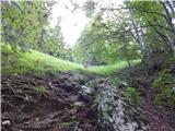 18
18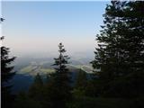 19
19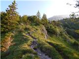 20
20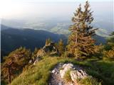 21
21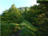 22
22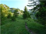 23
23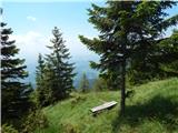 24
24 25
25 26
26 27
27 28
28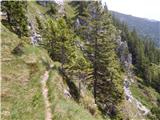 29
29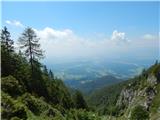 30
30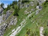 31
31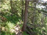 32
32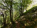 33
33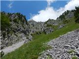 34
34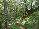 35
35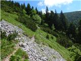 36
36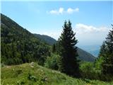 37
37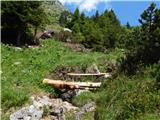 38
38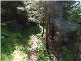 39
39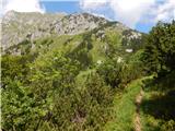 40
40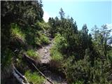 41
41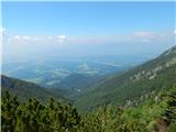 42
42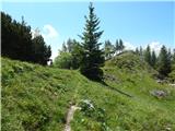 43
43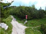 44
44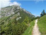 45
45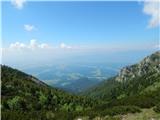 46
46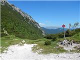 47
47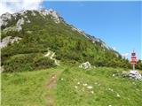 48
48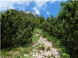 49
49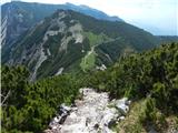 50
50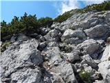 51
51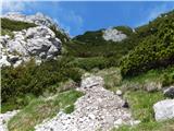 52
52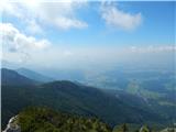 53
53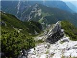 54
54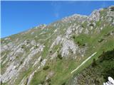 55
55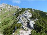 56
56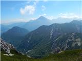 57
57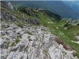 58
58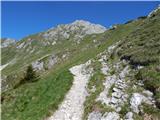 59
59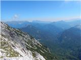 60
60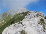 61
61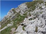 62
62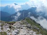 63
63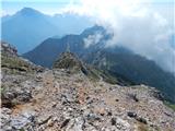 64
64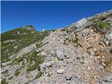 65
65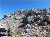 66
66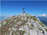 67
67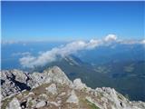 68
68 69
69