Lovrenc na Pohorju (cemetery) - Koglerjev vrh (via Hožičev vrh)
Starting point: Lovrenc na Pohorju (cemetery) (493 m)
Starting point Lat/Lon: 46.5348°N 15.37958°E 
Path name: via Hožičev vrh
Time of walking: 1 h
Difficulty: easy unmarked way
Difficulty of skiing: no data
Altitude difference: 205 m
Altitude difference (by path): 245 m
Map: Pohorje 1:50.000
Access to starting point:
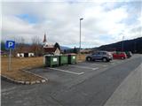
A) From the road Maribor - Dravograd, between HE Fala and HE Ožbalt we turn left towards Lovrenc na Pohorju (from the direction Dravograd we turn right). On the other side of Drava we start ascending along Radoljna, and at the marked crossroad, we go slightly right on the main road towards Lovrenc na Pohorju. When we get to the settlement Lovrenc na Pohorju we follow the main road, and we park a little further from the parish church of St. Lovrenc, on a marked parking lot at the cemetery.
B) We drive into Ruše, and then we follow the road towards Lovrenc na Pohorju. In the settlement Činžat we get to a saddle, where the road starts descending, and lower we go left towards Lovrenc na Pohorju. When we get to the settlement Lovrenc na Pohorju we follow the main road, and we park a little further from the parish church of St. Lovrenc, on a marked parking lot at the cemetery.
Path description:
From the parking lot, we continue on the main road through the upper part of the settlement, so that we bypass the cemetery on the right side. We at first walk on a sidewalk, and soon after the road sign, which marks the end of the settlement Lovrenc na Pohorju we quickly get to the chapel Hojnikova kapela, where the sidewalk ends, and we continue right on a side road, by which there are signs for Koglerjev vrh (straight - Lovrenška jezera).
After the crossroad, we start lightly descending, and after crossing Bednikov jarek we start ascending steeper. We quickly leave the forest and we get to a crossing before the homestead Kacajner.
Signs for a circular path point us left, but we go straight and we still continue on the asphalt road. Follows some more of the crossing, where we go past individual homesteads, and after the farm Hožič the asphalt ends and the road descends a little and brings us into the forest, where it makes a longer left turn. In the middle of the turn the blazes point us left on a cart track, on which we start ascending steeper, and when the path flattens, we quickly get to indistinct Hožičev vrh.
Next follows few minutes of entirely gentle path, and when we leave the forest, by the edge of the forest we ascend to the nearby transmitter. From the transmitter ahead follows some light ascent and with nice views, we get to organic farm Šlaus-Kogler.
Here we go slightly right and we continue on the road to the chapel, where the blazes end or continue left downwards.
Few steps before the chapel, a circular path branches off left downwards, which descends back towards Lovrenc na Pohorju, and we bypass the chapel on the right side and then we go immediately left on a cart track. We continue on a cart track which is diagonally ascending through the forest, and when we higher reach the ridge, we go from the cart track sharply to the right on a footpath, on which in few minutes we ascend on the indistinct Koglerjev vrh.
The starting point - Hožičev vrh 0:40, Hožičev vrh - Koglerjev vrh 0:20.
Description and pictures refer to a condition in February 2022.
Pictures:
 1
1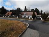 2
2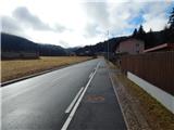 3
3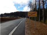 4
4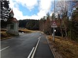 5
5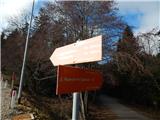 6
6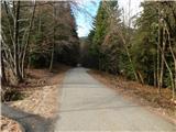 7
7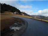 8
8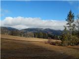 9
9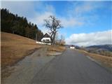 10
10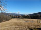 11
11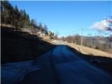 12
12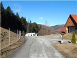 13
13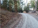 14
14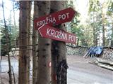 15
15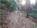 16
16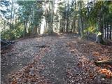 17
17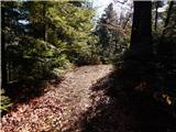 18
18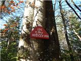 19
19 20
20 21
21 22
22 23
23 24
24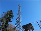 25
25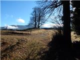 26
26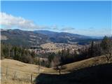 27
27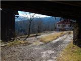 28
28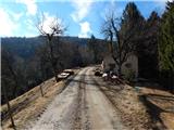 29
29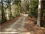 30
30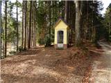 31
31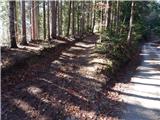 32
32 33
33 34
34 35
35 36
36 37
37