Passo di Costalunga / Karerpass - Roda di Vael / Rotwand (Via Ferrata Majare)
Starting point: Passo di Costalunga / Karerpass (1752 m)
Starting point Lat/Lon: 46.40461°N 11.61347°E 
Path name: Via Ferrata Majare
Time of walking: 5 h 30 min
Difficulty: very difficult marked way
Ferrata: C
Difficulty of skiing: no data
Altitude difference: 1054 m
Altitude difference (by path): 1250 m
Map: Tabacco 06 1:25.000
Access to starting point:
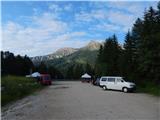
Access from Gorenjska: Through the Karawanks Tunnel, we drive to Austria, and then we continue driving towards Spittal and forward towards Lienz (a little after Spittal highway ends). Further, we drive on a relatively nice and wide road through Drau valley, which brings us in Italy. The road further leads past Dobbiaco / Toblach and Brunico / Bruneck. Only a little after the last-mentioned town, past which leads a bypass road, we turn left into a valley Val Badia. Further, we drive through the mentioned valley past settlements La Vila and Corvara. Next follows an ascent over the mountain pass Passo Campolongo and Passo Pordoi. From the mountain pass Passo Pordoi we then descend on the west side into a valley Val di Fassa. A little after the settlement Pozza di Fassa we turn right towards the mountain pass Passo di Costalunga / Karerpass. Few hundred meters before the mountain pass, we park on a large parking lot named »Valate«. The parking lot is situated on the right side of the road.
From Primorska side: From Nova Gorica, we drive to Italy and drive forward on the highway towards Venice / Venezia. At town Portogruaro we leave the highway towards Venice and continue right on the highway towards Pordenone. At the next highway junction near Conegliano, we continue right towards Belluno. We follow the highway to exit for Belluno. When we leave the highway we come to bigger roundabout, which we leave at exit for Belluno and settlement Feltre. In smaller roundabout in the settlement Belluno we then continue right towards the settlement Agordo. We follow this road all the way to the settlement Moena into a valley Val di Fassa. In the settlement Moena we then continue right towards the settlement Canazei, but only to the settlement Vigo di Fassa where we go left towards the mountain pass Passo di Costalunga / Karerpass. Few hundred meters before the mountain pass, we park on a large parking lot named »Valate«. The parking lot is situated on the right side of the road.
Path description:
From the parking lot, we go on narrow cart track following the signs »Rifugio Roda di Vael«. Cart track is at the beginning ascending through the forest and soon brings us to a marked crossing. The path branches off to the left towards the mountain hut Rifugio Paolina, and we continue right towards the mountain hut Rifugio Roda di Vael.
Further, we still walk on a cart track which is mostly ascending through the forest, and occasionally also a view opens up towards the mountain group Latemar. Higher, the path out of the forest brings us on pastures from which a view opens up also towards the south.
On the mountain pasture where there is also a shepherd hut cart track ends, and we continue on a footpath which still runs towards the east. After that, the path turns slightly to the left and starts ascending a little steeper on the more and more panoramic slopes. We will soon in front of us notice a mountain hut Rifugio Roda di Vael and Baita Marino Pederiva to which there is only a short ascent. A little before huts from the left joins also the path from the mountain hut Rifugio Paolina.
At the mountain hut, we continue left upwards following the signs »Via ferrata Majare«. The path ascends on a grassy slope and it quickly brings us to a crossing. Right leads shorter path, which runs direct towards the tower Torre Finestra, and we continue left on longer variant, which leads on the ridge over the peak Punta Masare.
From the crossing, the path at first crosses slopes towards the south and then turns to the right and starts ascending a little steeper below the slopes of the peak Punta Masare. Such a path brings us on the ridge on the western side of the mentioned summit where there is the beginning of a secured climbing path named Via Ferrata Majare.
The secured path in the beginning runs on the western side of the ridge and crosses steep slopes by the steel cable. Such a path brings us to a smaller notch from which follows a very steep ascent with the help of steel cables and few stemples. After steep ascent path then runs mostly by the ridge and it brings us to tower from which we then vertically descend. At the descent beside steel cables we also get help from numerous iron spikes. Next follows few more short steep ascents and descents, and then the path turns slightly to the right and runs on the eastern side of the ridge. On this part, the path is slightly less demanding and is ascending by the steel cable back towards the ridge. Later, the path turns right again and is then for quite some time quite steeply descending by the steel cable all the way to less steep slopes below the summit Torre Finestra where there is also a crossing.
At the crossing, we continue left upwards, and from the right joins the second path (shorter variant) from the mountain hut Roda di Vael. From the crossing, the path runs on an undemanding slope below the summit of Torre Finestra, which is easily recognizable by natural window. Relatively gentle slope is later crossed by deep gully. We descend into a gully on a vertical wall, which is well secured with a steel cable and iron spikes.
From the gully then follows a steep ascent by the steel cable, on a shorter part we also get help from a ladder. The path then brings us on again less steep slope where the secured path ends. Follows only ascent on undemanding and more and more panoramic slope to the top.
We can descend on the ascent route and then on shorter variant back to the hut Roda di Vael. The second option is that from the peak we descend on a secured path which runs on the northern side of the mountain to a saddle Passo di Vaiolon. The secured path which runs on the northern side of the mountain is a little less demanding from above described. From the saddle, we then return back to the hut Roda di Vael or we descend through the gully to the hut Paolina and from there back to the starting point on the mountain pass Passo di Costalunga / Karerpass.
Pictures:
 1
1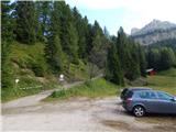 2
2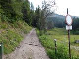 3
3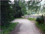 4
4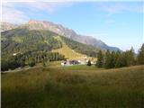 5
5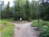 6
6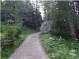 7
7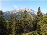 8
8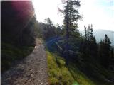 9
9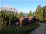 10
10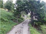 11
11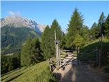 12
12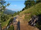 13
13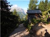 14
14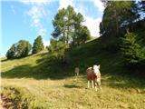 15
15 16
16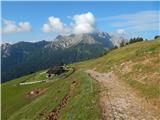 17
17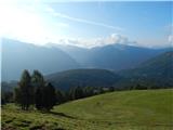 18
18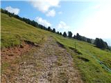 19
19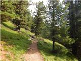 20
20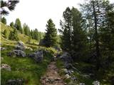 21
21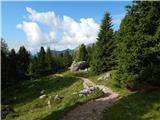 22
22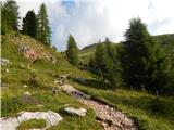 23
23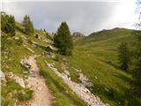 24
24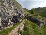 25
25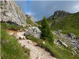 26
26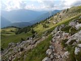 27
27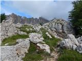 28
28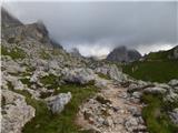 29
29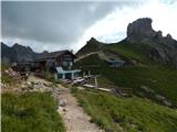 30
30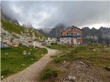 31
31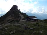 32
32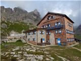 33
33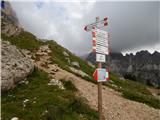 34
34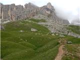 35
35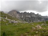 36
36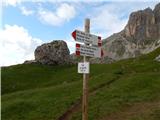 37
37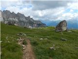 38
38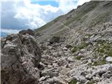 39
39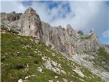 40
40 41
41 42
42 43
43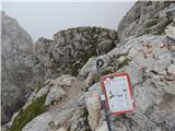 44
44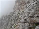 45
45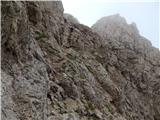 46
46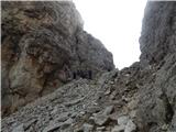 47
47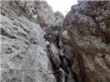 48
48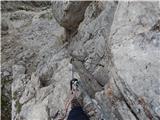 49
49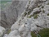 50
50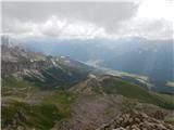 51
51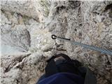 52
52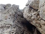 53
53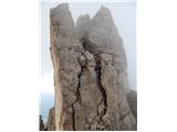 54
54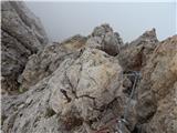 55
55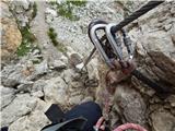 56
56 57
57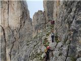 58
58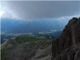 59
59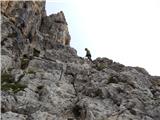 60
60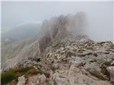 61
61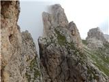 62
62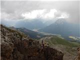 63
63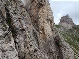 64
64 65
65 66
66 67
67 68
68 69
69 70
70 71
71 72
72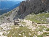 73
73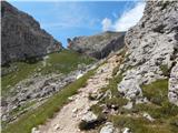 74
74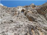 75
75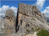 76
76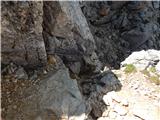 77
77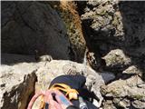 78
78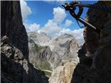 79
79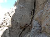 80
80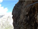 81
81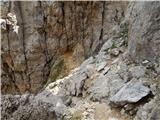 82
82 83
83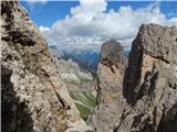 84
84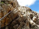 85
85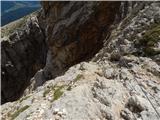 86
86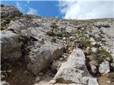 87
87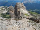 88
88 89
89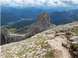 90
90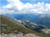 91
91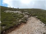 92
92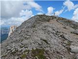 93
93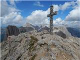 94
94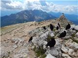 95
95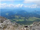 96
96 97
97 98
98