Planina Pecol - Strma peč / Monte Cimone (path 640 via notch Vandul)
Starting point: Planina Pecol (1500 m)
Starting point Lat/Lon: 46.4092°N 13.4376°E 
Path name: path 640 via notch Vandul
Time of walking: 4 h
Difficulty: difficult marked way
Difficulty of skiing: no data
Altitude difference: 880 m
Altitude difference (by path): 880 m
Map: Zahodni Julijci PZS 1:50000 ali Tabacco 018 1:25000
Access to starting point:
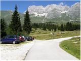
Mountain pasture Pecol is accessible on a steep asphalt road from the saddle V Žlebeh / Sella Nevea, to where from Slovenia we can come over Predel, or from Rateče through Trbiž or from Primorska side from the road Videm – Trbiž, where in the settlement Kluže / Chiusaforte we turn into a valley Reklanica / Raccolana and we follow it to a saddle.
Path description:
From the parking lot, we go past last dairy towards the west. We follow well-marked cart track which soon changes into almost horizontal footpath, marked with number 621. The path runs in the forest below the slopes of Zabuš, and meanwhile we can admire Žrd and Kanin on the other side of the valley. After a good hour we are at the crossing, where we go upwards on the path number 640. (In July 2010 was here a sign, that the path is impassable, but ruined fixed safety gear they already repaired and probably just forgot to remove the sign). Gentle footpath is in numerous zig-zags winding over grassy slopes, runs past interesting eroded rock shelters and in constant zig-zaging reaches notch Vandul. A look on vertical and overhang precipices on the northern side is really terrifying. Renovated steel cable points us left almost vertically over shorter wall. There is enough holds and footholds. The footpath continues to the lowest point of the ridge above slopes of Viene, which is perpendicularly attaching on the main ridge of Poliški špiki. On the ridge leads to the highest point (2124 meters) and slightly descends into saddle Viene. Nearby is new bivouac, which replaced once already moved, last time placed on the summit of Strma peč. From the right joins the path from the valley Dunja, which goes past the bivouac Cividale and on a secured path Norina over the northern wall. Upper slopes of Strma peč are in front of us, marked path on a grassy slope, crisscrossed with short rocky parts is regarding the name of the mountain easy, only on the edge of the wall above precipices we have to be careful. On the summit, there are left foundations of bivouac and two Mary's statues– one in plastic/glass bird house.
It doesn't have an Inscription book. A view on all four sides in appropriate weather is phenomenal. There stand out nearby Zabuš, Montaž, Malborghetto mountains over Dunja, Kanin group over Reklanica and the highest peaks of Carnic Alps, in the distance Dolomites and Austrian two and three-thousanders.
On the way: škrbina Vandul (1986m), greben Viene (2124m), bivak (2120m)
Pictures:
 1
1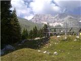 2
2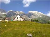 3
3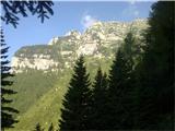 4
4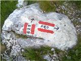 5
5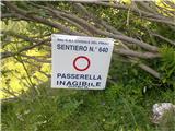 6
6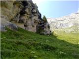 7
7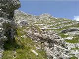 8
8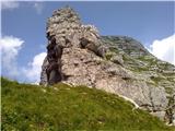 9
9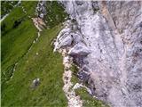 10
10 11
11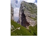 12
12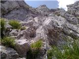 13
13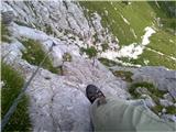 14
14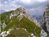 15
15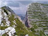 16
16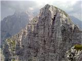 17
17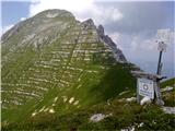 18
18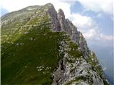 19
19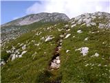 20
20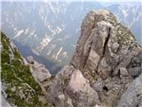 21
21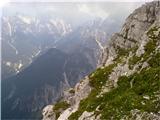 22
22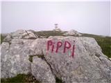 23
23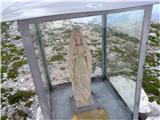 24
24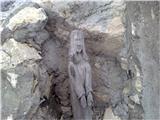 25
25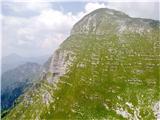 26
26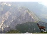 27
27