Planina Zajzera - Krniška glavica / Jof di Sompdogna (path 639 and 652)
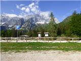
Starting point: Planina Zajzera (1004 m)
Starting point Lat/Lon: 46.4565°N 13.46924°E 
Path name: path 639 and 652
Time of walking: 3 h 10 min
Difficulty: easy marked way
Difficulty of skiing: no data
Altitude difference: 885 m
Altitude difference (by path): 910 m
Map: Julijske Alpe - zahodni del 1:50.000
Access to starting point:
From Kranjska Gora over the border crossing Rateče we drive to Trbiž / Tarvisio. Further, we drive on the old road towards Videm / Udine. Already after few kilometers from Trbiž / Tarvisio, the road into Ovčja vas / Valbruna branches off to the left. Here we turn left and we follow the road all the way to the mountain pasture Zajzera, where we park on a large parking lot.
Path description:
From the parking lot, we go on the road which is closed for traffic following the signs Bivacco Mazzeni, Bivacco Stuparich. The road at first slightly descends and then leads through the forest. We soon come out of the forest to a wide riverbed of the stream, where a lot of sand is deposited. Here the path is a little poorly visible and terrain with sand we cross slightly to the right. The path then brings us to a crossing, where we go right following the signs Bivacco Stuparich. With the help of some cairns we again cross a torrent to the right and then the path brings us into the forest. The path through the forest soon starts quite steeply ascending, then turns to the left and soon nice views open up to mountain walls of Montaž. The path further leads along the riverbed of the stream past some bushes and dwarf pines and it brings us to a crossing where from the right side joins the path from the hut Grego.
Straight leads slightly shorter path towards Krniška glavica, which is a little less beaten. And at the crossing, we continue left and we at first cross the riverbed of a torrent. The path then starts ascending and it turns to the left. A relatively steep path then mostly runs through a thin larch forest, and higher by the path there are also some dwarf pines and bushes. Such a path then brings us to a marked crossing.
To the left leads the path towards the bivouac Stuparich, and we go right on the path 652.
From the crossing follows crossing of the slopes below the northern walls of Montaž towards the west. Here the path runs mostly by dwarf pines and rare larches, and it also crosses quite a few screes. When the path starts turning to the right, from the right joins the mentioned slightly shorter path. The path further turns a little more to the right on the southern slopes of the peak Krniška glavica. Here we start ascending through dwarf pines and by larches and the path brings us to a marked crossing.
To the left leads the path towards the notch Foran de la Grave and further into the valley Dunja, and we continue right towards the summit of Krniška glavica (Jof di Sompdogna). The path soon brings us in a little more dense dwarf pines through which we are then ascending for some time with beautiful views on Montaž. Higher, the path brings us to a smaller saddle from where a view opens up on the ridge of Malborghetto mountains. After that, the path turns slightly to the right and dwarf pines becoming rarer. Panoramic path then runs on the western slopes of the peak Krniška glavica and leads us past numerous ruins from the time of the first world war. On such path we then soon reach the peak on which stands a cross. If we continue on the path few ten meters on the eastern side, we will by the path notice few more military ruins and trenches. One of the structures is also converted into a smaller bivouac.
Pictures:
 1
1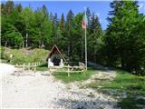 2
2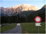 3
3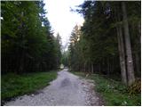 4
4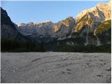 5
5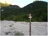 6
6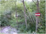 7
7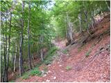 8
8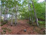 9
9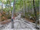 10
10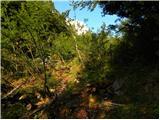 11
11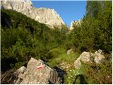 12
12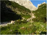 13
13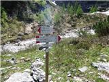 14
14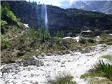 15
15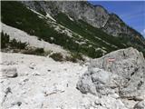 16
16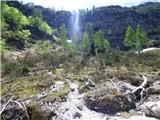 17
17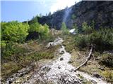 18
18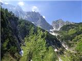 19
19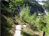 20
20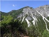 21
21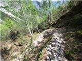 22
22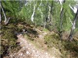 23
23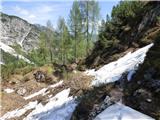 24
24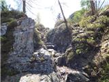 25
25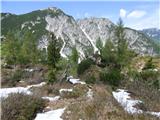 26
26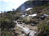 27
27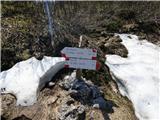 28
28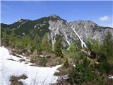 29
29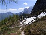 30
30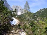 31
31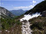 32
32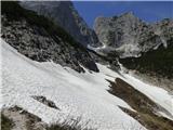 33
33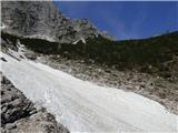 34
34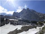 35
35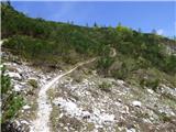 36
36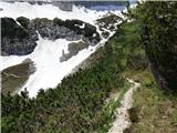 37
37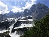 38
38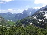 39
39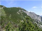 40
40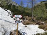 41
41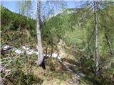 42
42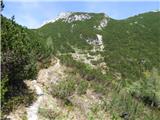 43
43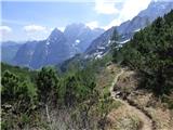 44
44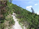 45
45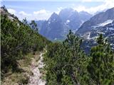 46
46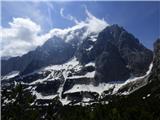 47
47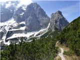 48
48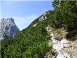 49
49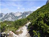 50
50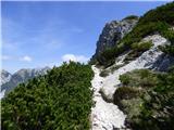 51
51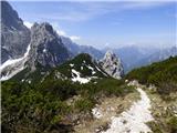 52
52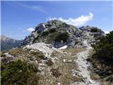 53
53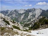 54
54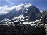 55
55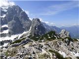 56
56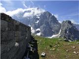 57
57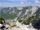 58
58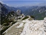 59
59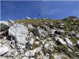 60
60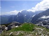 61
61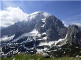 62
62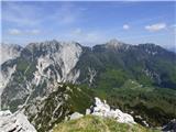 63
63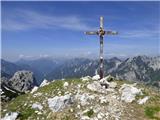 64
64