Pod Debelo glavo - Planina Suha (via hunting cottage)
Starting point: Pod Debelo glavo (1220 m)
Starting point Lat/Lon: 46.2489°N 13.892°E 
Path name: via hunting cottage
Time of walking: 3 h 10 min
Difficulty: easy unmarked way
Difficulty of skiing: no data
Altitude difference: 165 m
Altitude difference (by path): 490 m
Map: TNP 1:50.000
Access to starting point:
From highway Ljubljana - Jesenice we go to the exit Lesce and follow the road towards Bled and forward towards Bohinjska Bistrica and lake Bohinj. After the settlement Laški Rovt we will get to a smaller crossroad, where the road which leads towards the starting point of the path on Rodica, mountain pasture Suha, Šija, Vogel... and scout camp Laški Rovt branches off to the left. Macadam road immediately passes into the forest and at first ascend past the mentioned scout camp, and then it is few kilometers relatively steeply ascending. After a little less than 6.5 km of driving on a macadam, we will get to a little bigger crossroad, where a road towards the mountain pasture Planina Storeča raven (starting point of the path on Vogel) branches off to the right. Here we continue straight and after approximately 50 meters of additional driving, we get to the left turn, where there is a starting point of the path towards the mountain pasture Suha, Rodica and Šija. From here for approximately 1 km we continue on the road which leads towards the ski slope Kobla, and then at the crossroad we continue on the upper right road, on which we drive for approximately 2 km, or to its end where we park.
From the main road to the starting point, there is approximately 9.5 km of the macadam.
Path description:
About 20 meters before the end of the road (in the direction of ascent) at first a poorly visible footpath branches off to the right downwards. And after few steps of descent path becomes more visible and goes right, where without large changes in altitude crosses slopes towards the east. After approximately 15 minutes of walking, the path gradually starts ascending and a little higher joins the path from Vodel (option for the starting point). A moderately steep path then quickly brings us out of the forest, where by the path, we notice a hunting cottage.
The path ahead is for some time ascending gently on the bottom of the small valley, and then turns slightly to the right and in a diagonal ascent starts ascending steeply. Higher, the steepness decreases and in parts poorly visible footpath after series of smaller valleys brings us to the mountain pasture Poljana.
From the shepherd huts we continue on the right side of the mountain pasture, and by the edge of the mountain pasture we walk to the spot, where easy to follow footpath branches off to the right, which starts ascending through a lane of dwarf pines. After a short ascent, the path turns sharply to the right, and after good 10 minutes of additional walking brings us on a less noticeable crossing, where the path branches off to the left (later pathless terrain) towards Raskovec. We continue on wider right path, which a little further flattens, and then in a moderate ascent brings us to a saddle south from Gradovec (1692 meters).
Before the saddle a worse footpath branches off to the right, which leads towards Gradovec (path doesn't lead entirely to the top), and after the saddle, the path branches off to the left, which continues a little more south from the path, on which we continue). In both cases we continue on a little wider path, which after the saddle starts descending on an old mule track. Lower, we reach the edge of larger sinkhole, where in the early summer can still be snow. On the other side of the sinkhole, the path again starts slightly ascending and continues towards the west to northwest. Next follows few shorter ascents and descents, and then on the right side on a smaller hill we notice a hunting cottage Na Glinu.
Here we continue straight, and then a little further from the left joins another unmarked footpath. Here we continue straight as well, and then with nice views, we get to the spot, where the path turns to the left and descends over a steep section. The path over short steep part is relatively wide and because of this not very demanding. When the path flattens passes at first on a grassy terrain, after that also in smaller torrent valley, which ends on the mountain pasture Suha. In the lower part of torrent we join the marked path, and we follow it to the right to the nearby shepherd huts.
Pictures:
 1
1 2
2 3
3 4
4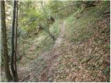 5
5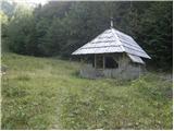 6
6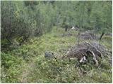 7
7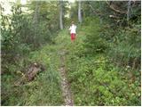 8
8 9
9 10
10 11
11 12
12 13
13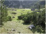 14
14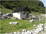 15
15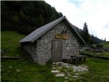 16
16 17
17 18
18 19
19 20
20 21
21 22
22 23
23 24
24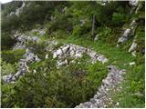 25
25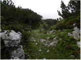 26
26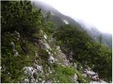 27
27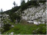 28
28 29
29 30
30 31
31 32
32 33
33 34
34 35
35 36
36 37
37 38
38 39
39 40
40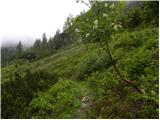 41
41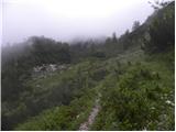 42
42 43
43 44
44 45
45 46
46 47
47 48
48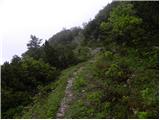 49
49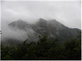 50
50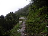 51
51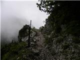 52
52 53
53 54
54 55
55 56
56 57
57 58
58 59
59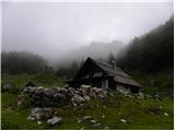 60
60