Poldov rovt (Vrata) - Dovški križ (via bivouac)
Starting point: Poldov rovt (Vrata) (941 m)
Starting point Lat/Lon: 46.4216°N 13.86289°E 
Path name: via bivouac
Time of walking: 5 h 30 min
Difficulty: very difficult unmarked way
Difficulty of skiing: very demanding
Altitude difference: 1601 m
Altitude difference (by path): 1601 m
Map: Triglav 1 : 25.000
Access to starting point:
We drive to Mojstrana, and then we follow the signs for valley Vrata. Further, we drive through the valley Vrata, about 100 meters before the road sign 10 km, we will notice a cart track which branches off right perpendicularly on the main road. Here is the beginning of the described path. Marked parking lot on which it is allowed to park is situated approximately 500 meters ahead on the main road.
Path description:
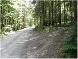
We go on a cart track which runs into the forest and then past a smaller house, where we continue slightly to the left on a footpath. Through the forest, we are ascending slightly to the left towards the stream Rdeči potok. A little before the stream, the path over Brinje branches off to the right (placed cairn, and on the tree is carved some kind of face and letter L). The path then brings us to a riverbed of the stream. Here the path goes on the right side (left bank) upwards and then it soon crosses the stream on the left side. The path is ascending through a small valley until we get to a smaller mountain wall, where we usually also run into a well. The path goes from here right and on a natural passage steeply ascends. Slightly exposed and not secured. We are above the small waterfall (if there is water). Here we come out of the forest and we ascend on some scree. The path on the scree isn't comfortable because storms and avalanches every year wreck the path. The path soon turns slightly to the right and for a short time ascends on a grassy slope. Next again follows the ascent by the scree and we soon come to bivouac Bivak na Jezerih, which we will notice on our left. Here we can sleep or only shelter in case of a storm. Here the terrain flattens. A view on Triglav is from here very nice.
The path from the bivouac ahead is slowly vanishing but we can still follow it. We continue slightly to the right towards the saddle between Dovški Križ and Šplevta. On the saddle, we go left on the scree from which after a short ascent, we go right and we cross a steep rocky slope. When we come on grassy slopes we go left upwards. On this part of the path, we will notice several poorly beaten footpaths, which are all marked with cairns. In dry it is best to choose the most right, which is ascending on a grassy slope. At the end, the footpath turns to the left towards the gully. We ascend through a short not too steep gully, and then at the end of the gully, we turn sharp to the right. If at the end of the gully, we continue straight we would come only on a secondary peak of Dovški Križ. When we turn sharply right, the footpath brings us on a steep east slopes of the secondary peak. We cross the slopes towards the north and then follows the most difficult spot. On a steep slope we descend into a narrow notch. The descent is otherwise very short, but caution is needed, because on the rocks there is usually quite a lot of sand. From the notch, we then ascend on the other side, after that the cairn points us left on the ridge. A better beaten footpath goes here straight, but if we want to avoid the gravel in the last part of the path, it is better, if we already here ascend on the ridge. A walk on the ridge then isn't difficult anymore and we soon reach a very panoramic peak.
The ascent on Dovški Križ is appropriate for mountaineers to who climbing 1st grade doesn't cause any problems.
Despite this, that to the top leads the footpath (often poorly visible) the orientation is still difficult.
Pictures:
 1
1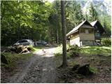 2
2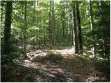 3
3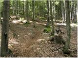 4
4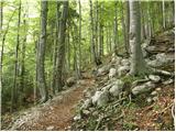 5
5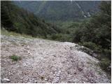 6
6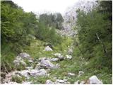 7
7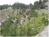 8
8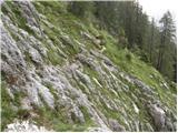 9
9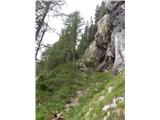 10
10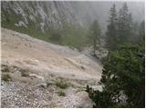 11
11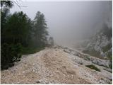 12
12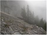 13
13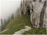 14
14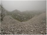 15
15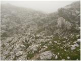 16
16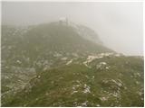 17
17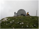 18
18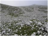 19
19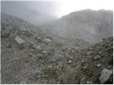 20
20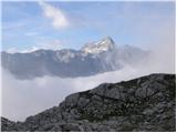 21
21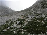 22
22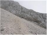 23
23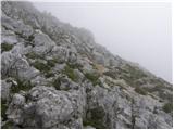 24
24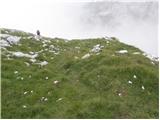 25
25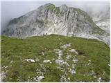 26
26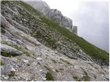 27
27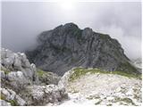 28
28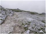 29
29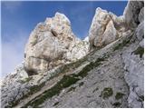 30
30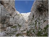 31
31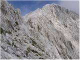 32
32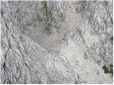 33
33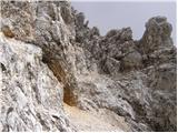 34
34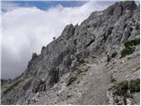 35
35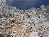 36
36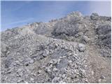 37
37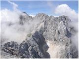 38
38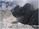 39
39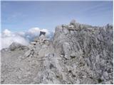 40
40