Ravenska Kočna - Kokrska Kočna (umik Žrela and on Kremžarjeva pot)
Starting point: Ravenska Kočna (1000 m)
Starting point Lat/Lon: 46.385°N 14.5364°E 
Path name: umik Žrela and on Kremžarjeva pot
Time of walking: 5 h 35 min
Difficulty: very difficult marked way
Difficulty of skiing: no data
Altitude difference: 1520 m
Altitude difference (by path): 1600 m
Map: Kamniške in Savinjske Alpe 1:50.000
Access to starting point:
From highway Ljubljana - Jesenice we go to the exit Kranj - vzhod and follow the road ahead in the direction of Jezersko. In Zgornje Jezersko only a little behind the gas station, we will notice a road which from the main road branches off to the right (direction lake Planšarsko jezero). The road then leads us past the mentioned lake and behind it for a short time steeply ascends. Higher, the road flattens and at the beginning of a large meadow loses an asphalt covering. We then follow the macadam road to a larger marked parking lot.
Path description:
From the parking lot, we continue on a macadam road following the signs »Češka koča, Ledine« and after approximately 15 minutes of walking, we come to a cargo cableway.
From the cargo cableway we continue by following the signs for mountain hut Kranjska koča na Ledinah (skozi žrelo, Slovenska pot) and mountain hut Češka koča (umik žrela). At first for a short time, we walk through the forest and then the path brings us on a grassy terrain, which is partly covered with dwarf pines. Here the path turns slightly to the left and then it is ascending diagonally by rare dwarf pines, and later on the scree. Such a path brings us to a crossing. We go right where the sign »Češka koča« on rock point us to. Left leads the path to the mountain hut Koča na Ledinah (Slovenska pot, Skozi žrelo).
The path starts ascending diagonally in the direction towards Češka koča (southwest). Later, the path turns a little to the left and on a slope, which is partly covered with dwarf pines brings us to a crossing below the steep walls. We continue right towards Češka koča, left leads the path skozi žrelo (through chasm) on Ledine. The path further gradually becomes a little more demanding and most of the time with the help of steel cables crosses slightly exposed slope towards the west. Next follows a short exposed crossing under a rock overhang, and then the path becomes easier and by the rare dwarf pines soon brings us to the mountain hut Češka koča.
From the mountain hut, we continue right on the path in the direction of Kočna, Grintovec and Vratca (left mounain hut Kranjska koča through Žrelo). After a short ascent, we come on flat ground with sign H (intended for landing a helicopter). The path ahead runs on at first gentle scree, which is partly covered with dwarf pines. In the lower part of the scree path on Vratca branches off to the right, and we continue straight in the direction of Kočna and Grintovec. After approximately half an hour of walking from the mountain hut, we come to the next crossing. We continue right in the direction of Kočna (left Grintovec over Mlinarsko sedlo) and we are still ascending on partly vegetated scree to Zgornje Ravni. On Zgornje Ravni path turns sharply right and it ascends over the scree. Higher, the path which continues to turning right brings us on a side ridge of central Grintovci. Here a nice view opens up towards the north, where we clearly see most of the peaks, which surround Jezersko. Here, where we turn sharply left starts the climbing part of the path. Well secured and in dry not very demanding climbing path with nice views and past a natural window, which we will notice on the right side, after almost three hours of walking from Češka koča brings us on the main ridge of Grintovci (notch Zdolška škrbina), where there is a crossing. We continue sharp right in the direction of Jezerska Kočna (left Grintovec, straight mountain hut Cojzova koča) on the path which quickly brings us to one of the most interesting passages in Slovenian mountains. Because path brings us to rounded passage through which we have to crawl. Because the ceiling above us is so low, that otherwise it is not possible (watch out the head). The path ahead passes on short scree after which we step on a steeper path, where we get help from some iron spikes and steel cables. Then we follow a panoramic path to the narrow peak.
From the top, we descend few meters and we continue on the ridge path towards Kokrska Kočna (marked). The path which at the beginning descends into the gully between the both peaks is well secured with iron spikes and steel cables. From the gully, the path again starts ascending and with the help of fixed safety gear brings us on an ample peak of Kokrska Kočna.
Ravenska Kočna - Češka koča 1:35, Češka koča - Zdolška škrbina 2:45, Zdolška škrbina - Jezerska Kočna 45 minutes, Jezerska Kočna - Kokrska Kočna 30 minutes.
Pictures:
 1
1 2
2 3
3 4
4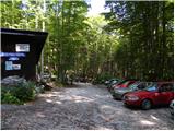 5
5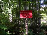 6
6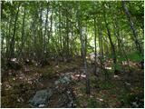 7
7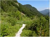 8
8 9
9 10
10 11
11 12
12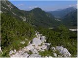 13
13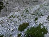 14
14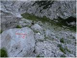 15
15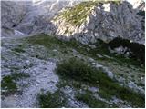 16
16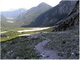 17
17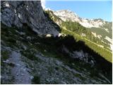 18
18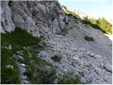 19
19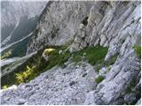 20
20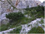 21
21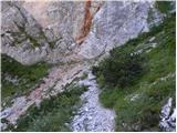 22
22 23
23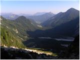 24
24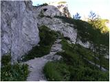 25
25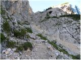 26
26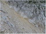 27
27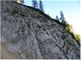 28
28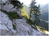 29
29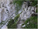 30
30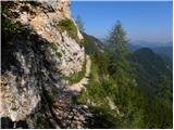 31
31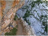 32
32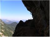 33
33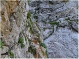 34
34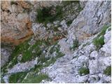 35
35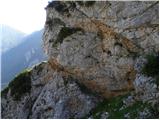 36
36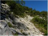 37
37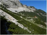 38
38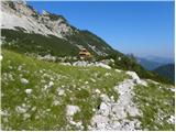 39
39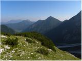 40
40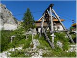 41
41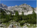 42
42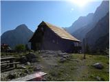 43
43 44
44 45
45 46
46 47
47 48
48 49
49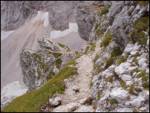 50
50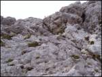 51
51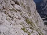 52
52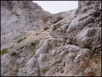 53
53 54
54 55
55 56
56 57
57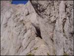 58
58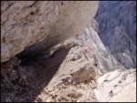 59
59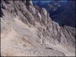 60
60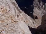 61
61 62
62 63
63 64
64 65
65 66
66