Reka (Laze) - Črvov vrh (through the gully of stream Sjaunk (Sejalnik))
Starting point: Reka (Laze) (230 m)
Starting point Lat/Lon: 46.1166°N 13.9089°E 
Path name: through the gully of stream Sjaunk (Sejalnik)
Time of walking: 2 h 30 min
Difficulty: easy unmarked way
Difficulty of skiing: no data
Altitude difference: 744 m
Altitude difference (by path): 760 m
Map:
Access to starting point:
A) From Idrija or Cerkno we drive towards Tolmin, where in the settlement Reka we need to pay attention to the approaching beginning of the path. At first, we cross the stream Kozarska grapa, and a little ahead after the right turn also an almost unnoticeable stream Poličanka, and we drive a little further to the hamlet Laze (hamlet is located between the road sign 9.0 km and 8.5 km), where at the turn-off of the road to the right to the nearby houses there is the beginning of the described path. At the starting point, there aren't any parking spots, so we have to park a little earlier or later on an appropriate place by the road.
B) We drive to Bača pri Modreju (to here from Most na Soči or Podbrdo), and then we continue driving towards Idrija. In the settlement Reka, between the road sign 8.5 km and 9.0 km we get to the hamlet Laze, where at the turn-off of the road to the left towards the nearby houses there is the beginning of the described path. At the starting point, there aren't any parking spots, so we have to park a little earlier or later on an appropriate place by the road.
Path description:
From the main road, we go on a side road which ascends to the nearby houses, and when the road ends on a cart track, we ascend to the highest house, which we bypass on the right side. Behind the house, there appears a relatively easy to follow footpath which at first ascends diagonally on the left side of the stream (right bank), and at the photogenic boulder passes on the right side of the stream (left bank).
The path ahead becomes quite steep and it is ascending above the steep gully of the stream Sjaunk (Sejalnik), but the path is from the steep slope mainly distant for about a meter, so that there is no significant danger of slipping. Next follows a longer diagonal ascent, where we cross also few steeper parts, where mainly in wet there is also the danger of slipping. Higher, the slope flattens, and on the right, the forest is replaced by pastures. Few minutes ahead, the path turns a little to the right and it brings us to the settlement Police, where among the houses we reach an asphalt road.
We follow the road to the left (right church of Mary's Birth in Police 5 minutes) and we continue among houses. At the smaller crossroad, we continue slightly left, and at the next slightly right in the direction of Šentviška Gora (slightly left Police house number 20-23).
Here, the asphalt ends, and already after few steps we get to the next crossing, where on the bottom path (cart track) continues a marked path towards Šentviška Gora, and we go on the upper path and we continue on the macadam road. Next follows mostly a diagonal ascent on slopes of Košarica (961 meters), from where occasionally a nice view opens up, and the path leads us also past two streams, at the second there is also a nicely settled trough, where we can fill the water. Further, from the slope we get to plateau and past few houses we get to the asphalt road Šentviška Gora - Bukovo Vrh.
We follow the road to the left (right Bukovski Vrh) and in few steps we get to the next crossroad from which we continue right in the direction of Gorski Vrh.
After the crossroad, the road slightly descends, and then it starts ascending steeper and leads us past the homestead Travnikar, and a little higher it brings us to the next crossroad.
To the left the road continues towards the settlement Ponikve, and to the right road towards the settlement Bukovski Vrh, and we continue straight on a beaten unmarked footpath which at first ascends through a meadow, after that for some time passes into the forest, where we cross the first grazing fence, when we step out of the forest we cross the fence two more times.
Here we join the path from the village Ponikve, and we continue straight towards Črvov vrh, where we already see antenna tower. Follows few minutes of a moderate ascent, after the crossing of a grazing fence to the top separates us only few steps of easy walking.
The starting point - Police 1:00, Police - Črvov vrh 1:30.
Description and pictures refer to a condition in December 2019 and February 2020.
On the way: Police (550m), Gorski Vrh (827m)
Pictures:
 1
1 2
2 3
3 4
4 5
5 6
6 7
7 8
8 9
9 10
10 11
11 12
12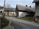 13
13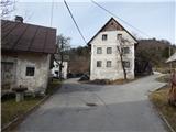 14
14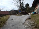 15
15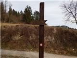 16
16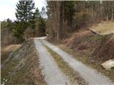 17
17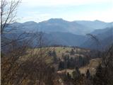 18
18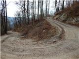 19
19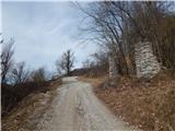 20
20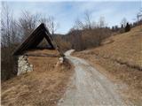 21
21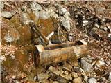 22
22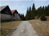 23
23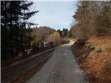 24
24 25
25 26
26 27
27 28
28 29
29 30
30 31
31 32
32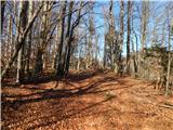 33
33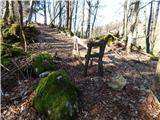 34
34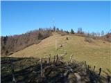 35
35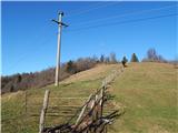 36
36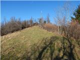 37
37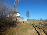 38
38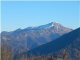 39
39 40
40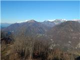 41
41 42
42