Renke - Climbing area and ferrata Renke (panoramic path on ferrata to Spital)
Starting point: Renke (231 m)
Path name: panoramic path on ferrata to Spital
Time of walking: 2 h
Difficulty: very difficult marked way
Difficulty of skiing: no data
Altitude difference: 469 m
Altitude difference (by path): 470 m
Map: Zagorje ob Savi, turistična karta 1:30.000
Access to starting point:
From the direction Ljubljana through Litija (45 km), or from Zagorje towards Ljubljana (6 km), on the main Zasavje road to small village Renke, we park by the river Sava on more or less unmarked parking lot, just before the hanging bridge over Sava (it is intended only for pedestrians and currently isn't in the best condition). Climbing area and ferrata are situated above the left bank of Sava, so we have from the parking lot go through the bridge over the river on the opposite bank.
Path description:
We begin with a little bit of adrenaline already on the hanging footbridge over the river Sava (officially there is a sign, that it is closed), otherwise it is used to cross the river by railwaymen, mountaineers, climbers, hunters, kayakers, rafters, etc. At the end of the bridge, we turn left (following green signs) and approx 50-80 meters we continue just by the railway upwards (in the direction towards Ljubljana), and then we have to cross a railway track and then we go upwards uphill. The same path or passage is used also by locals, who live in the house above the railway opposite the bridge. Then we follow a well-beaten and marked path towards Zasavska Sveta gora, which is at first slowly, and then steeper ascending upwards through the forest in the direction towards the west. After approx 15-20 minutes of walking, after the big fallen beech tree, when on the right above the path we notice the first rocky walls, we turn from the marked path to the right (marked with green sign and arrow) in the direction towards the climbing area. We continue almost horizontally towards the east and we bypass a smaller rock shelter, and then the footpath again starts ascending steeper towards the first rocky sector of climbing area, where there are a lot of climbing routes. We then follow wooden stairs or logs for easier walking and steep footpath upwards below the walls. At the end of the first sector we have to ascend also in some steep zig-zags through the forest (dangerous spots for slipping are secured with a rope) towards the second climbing sector, where for a short time the footpath again turns towards the west. Tight rope between the trees below the second sector, is also the orientation point when we are looking easiest passages at the ascent. Below the second sector, when we come on a plain and into a thin forest, we need to orient ourselves again - it is marked on the rock and the tree, we go right upwards, and from the left comes a descent footpath from the peak (who doesn't like climbing on ferrata, can here continue ahead to the top and bypasses the rocky part with the ferrata). We then follow the footpath below the wall and ahead past the climbing spots, we go entirely to the end of the wall, where the signs point us on ferrata. To here, if we don't stop too much, from the starting point, we walk approx 45 minutes. Ferrata then leads to the left, towards the west, it is moderately difficult, average B/C, one detail C/D, it consists of about four parts, because it is precipitous, the equipment and belaying is mandatory, to climb it we need approx 20 minutes. Above the ferrata we step out on a poorly visible traverse to the left upwards and past the last lonely rocky peaks we reach a better beaten footpath in the forest. If we go right upwards (yellow signs on the trees), in approx 15 minutes we come to a nice viewpoint below the hamlet Špital, and if we want to descend back to the starting point we follow green signs and the path left downwards. In parts, especially below the meadow and opposite the nearby house (holiday cottage) it is more overgrown, because it is less beaten. On this footpath, we turn to the left and we bypass the upper rocky part, and to the path of ascent we return at the crossroad below the upper sector of the climbing area. And from here to the starting point in Renke we have approx 1/2 hour. Most appropriate time for visiting this path and ferrata is in the early spring or in the late autumn, due to the sunny position, in the summer it could be very hot. In wet the path can be dangerous for slipping, therefore plan your visit and go there only in a dry weather. In the spring, by the path below the rocky walls of climbing area you can pick also edible black bryony, which is similar to wild asparagus and tasty (just a little more bitter). When in the forest the greenery and leaves starts growing, you can unintentionally get also ticks. For the end let's warn also about the possibility to meet snakes, 100 meters above ferrata, on the exit path, at the last rocky edge, 2 meters away from the path, in nice and warm days a viper or horned viper likes to sunbathe there. Do not disturb the snake's peace and the views, to the viewpoint you should rather go further on a nice forest and gentle footpath upwards, to the top of a rocky rib below the hamlet Špital, from where it is really a nice view downwards towards the river Sava and Renke and hills towards the south, from Žamboh and Kleviška špica, on Polšnik, Ostrež, Konjšica and a little further on Kum. Here up with the mentioned views we can also have snack from the backpack, there aren't any other choices of food or beverages, and there isn't any water either.
On the way: Plezališče I - več smeri (450m), Plezališče II - več smeri (550m)
Pictures:
 1
1 2
2 3
3 4
4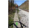 5
5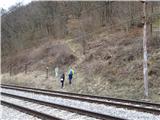 6
6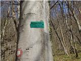 7
7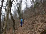 8
8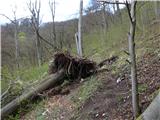 9
9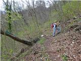 10
10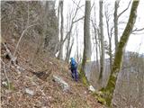 11
11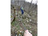 12
12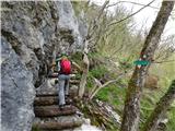 13
13 14
14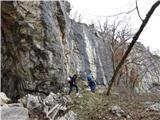 15
15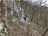 16
16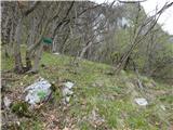 17
17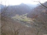 18
18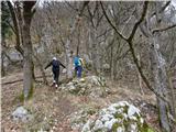 19
19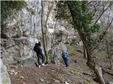 20
20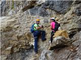 21
21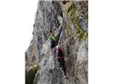 22
22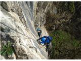 23
23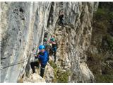 24
24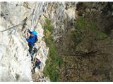 25
25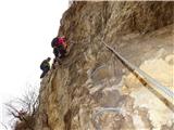 26
26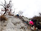 27
27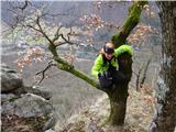 28
28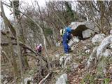 29
29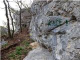 30
30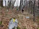 31
31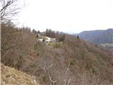 32
32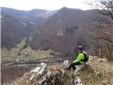 33
33 34
34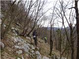 35
35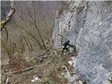 36
36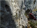 37
37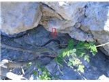 38
38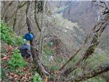 39
39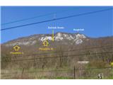 40
40