Rifugio Sorgenti del Piave - Monte Peralba (Ferrata Sartor)
Starting point: Rifugio Sorgenti del Piave (1815 m)
Starting point Lat/Lon: 46.6203°N 12.7157°E 
Path name: Ferrata Sartor
Time of walking: 2 h 20 min
Difficulty: very difficult marked way
Difficulty of skiing: no data
Altitude difference: 879 m
Altitude difference (by path): 879 m
Map:
Access to starting point:
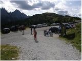
From highway Trbiž/Tarvisio - Videm/Udine we go to the exit Tolmezzo and follow the road ahead towards the mentioned town. Near Tolmezzo we leave the main road which leads towards the mountain pass Passo di Croce Carnico / Plöckenpass and go towards villages Villa Santina and Ampezzo. In the settlement Villa Santina at the roundabout, we go straight following the signs Raveo, Rigolato. We follow this road all the way to Cima Sapadda, where we continue right in the direction of the summit Monte Peralba. Considerably narrow and steep road we then follow to a large parking lot below the mighty Peralba. We park on the lower parking lot, where we notice signs for mountain hut Calvi (mountain hut at the source of Piava is a little further approx 500 meters).
Path description:
From the parking lot signs for mountain hut Calvi point us on a macadam road which starts moderately ascending towards the east. The road soon crosses a short lane of thin forest and then in few hairpin turns ascends a level higher. From the road with quite a nice view then marked footpath branches off to the right, on which we can continue the ascent.
If we continue on a footpath and if we start the ascent early enough we can notice some marmots by the path. In this case, we will get to the mountain hut Calvi in less than an hour.
And if we continue on the road, it starts ascending steeper (of course less steep as footpath) and after approximately one hour of walking from the starting point brings us to the mountain hut Calvi, which is located on a pleasant slope with a very beautiful view.
From the mountain hut, we continue slightly left on a wide path in the direction of saddle Passo Sesis and summit Monte Peralba. The path ahead ascends over smaller scree, and then passes on grassy slopes, where already after few minutes we come to a crossing, where a climbing path on Monte Peralba - ferrata Sartor branches off to the left (straight Monte Peralba "path of Pope John Paul II.".
From the crossing, we continue towards the west and start slightly ascending on a grassy slope. After that, the path turns a little to the right and soon brings us to the entry of a climbing part of the path.
At the beginning of the climbing part we ascend by the steel cable on rocky terrain, after that short unsecured ascent follows. From here ahead the path becomes even a little more demanding and at first, it is almost vertically ascending on stemples. Next follows a quite steep ascent by the steel cable, and then the path turns slightly to the left and crosses a steep rocky slope. Again we ascend steeply right upward by the steel cable, and then the path brings us on less steep upper gravel slope of the mountain. This part of the path otherwise isn't secured, but the slope isn't that steep, that ascent would cause bigger problems. On the path which is marked with red dots and arrows then we soon reach the panoramic peak.
Pictures:
 1
1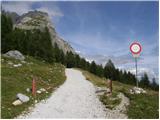 2
2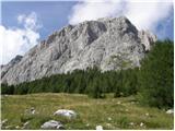 3
3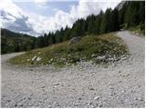 4
4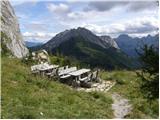 5
5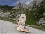 6
6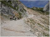 7
7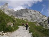 8
8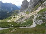 9
9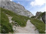 10
10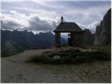 11
11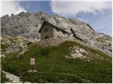 12
12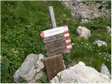 13
13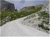 14
14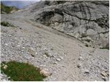 15
15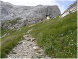 16
16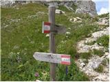 17
17 18
18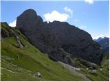 19
19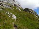 20
20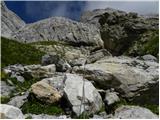 21
21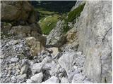 22
22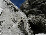 23
23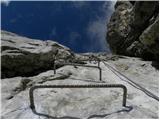 24
24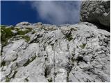 25
25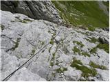 26
26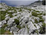 27
27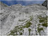 28
28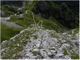 29
29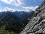 30
30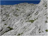 31
31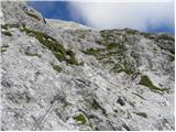 32
32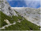 33
33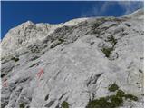 34
34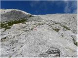 35
35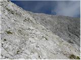 36
36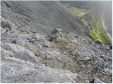 37
37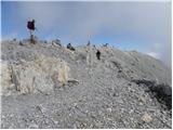 38
38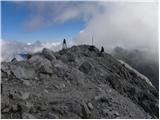 39
39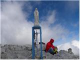 40
40