Spodnja Idrija - Cerkovni vrh (via Vranji greben - Prfarska gamsarica)
Starting point: Spodnja Idrija (305 m)
Starting point Lat/Lon: 46.032°N 14.0264°E 
Path name: via Vranji greben - Prfarska gamsarica
Time of walking: 1 h 30 min
Difficulty: easy marked way, partly demanding unmarked way
Difficulty of skiing: no data
Altitude difference: 499 m
Altitude difference (by path): 700 m
Map: Idrijsko in Cerkljansko 1: 50.000
Access to starting point:
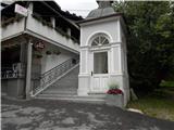
From Ljubljana, we drive towards Idrija. When we come to Idrija at the second traffic light crossroad we turn right towards Spodnja Idrija (4 km). Immediately, when we get to Spodnja Idrija, on the left side we notice a chapel and stairs, which lead towards the church. Here we park or about fifty meters ahead on the main road, at store we turn right on a parking lot at the culture house.
Path description:
From the chapel we go on the stairs to the church Marija na Skalci, which current form is from the year 1674, and the first mentions date in the 12th century. At the church, we turn left past the chapel of rest towards the end of the cemetery, where we come to a gully Šolska grapa. We go right, where we come on a meadow, where used to be a homestead Na Brd, burned during 2nd world war. We ascend by plantation of spruces towards the ridge. Here we notice the first signpost Cerkovni vrh / Lom. We follow the path by the ridge, we all the time walk left above the gully Šolska grapa.
Approximately after 15 minutes of walking, we come on a saddle, where the path splits. We continue right below Vranji Rob. The path is ascending diagonally, we see Spodnja Idrija, later already Spodnja Kanomlja with industrial zone. We cross two bigger gullies, when we get to a yew tree on a big clearing, the path ascends to the juncture with the forest road which otherwise runs gently to the farm Lom. Caution, we continue directly on the ridge and there steeply to the ridge plain, where we go right and again on a panoramic ridge towards the south, up and down past two midway peaks. On the right side we see farm Lom, and left below there is Spodnja Idrija. On the last summit we steeply descend to a saddle, where there is a crossing. Follows only 5 minutes of steep rocky ascent and the peak is here.
Pictures:
 1
1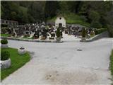 2
2 3
3 4
4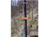 5
5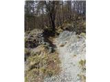 6
6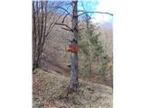 7
7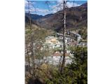 8
8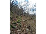 9
9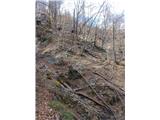 10
10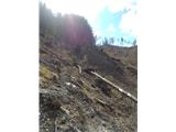 11
11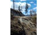 12
12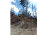 13
13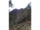 14
14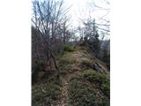 15
15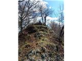 16
16 17
17 18
18 19
19