Štefanja Gora - Štefanja gora (via Zgornja Štefanja vas)
Starting point: Štefanja Gora (705 m)
Starting point Lat/Lon: 46.2856°N 14.4902°E 
Path name: via Zgornja Štefanja vas
Time of walking: 35 min
Difficulty: easy marked way
Difficulty of skiing: no data
Altitude difference: 43 m
Altitude difference (by path): 65 m
Map: Kamniške in Savinjske Alpe 1:50.000
Access to starting point:
A) From highway Ljubljana - Jesenice we go to the exit Vodice, and then we continue driving to a first traffic light crossroad in Vodice, where we continue left in the direction of Cerklje na Gorenjskem and Brnik. When we get to the main roundabout in Spodnji Brnik we continue driving in the direction of Cerklje and ski slope Krvavec. At the end of the settlement Cerklje na Gorenjskem we leave the main road which continues towards Velesovo and Visoko and we continue driving slightly right on a road in the direction of the ski slope Krvavec. Further, we drive past the bottom cableway station on Krvavec, and when higher the road flattens and it brings us to a smaller saddle, where there is the beginning of the settlement Štefanja Gora, we park on an appropriate place by the road.
B) From highway Jesenice - Ljubljana we go to the exit Kranj - east, and then we continue driving towards Brnik, Komenda and Mengeš. When we get to the main roundabout in Spodnji Brnik we continue driving in the direction of Cerklje and ski slope Krvavec. At the end of the settlement Cerklje na Gorenjskem we leave the main road which continues towards Velesovo and Visoko and we continue driving slightly right on a road in the direction of the ski slope Krvavec. Further, we drive past the bottom cableway station on Krvavec, and when higher the road flattens and it brings us to a smaller saddle, where there is the beginning of the settlement Štefanja Gora, we park on an appropriate place by the road.
Path description:
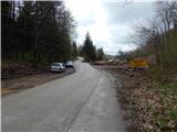
From the starting point, the path branches off to the right towards Kopa, Davovec and Krvavec, and we walk on an asphalt road to few 10 meters distant crossroad, where we continue on the bottom right road (left Štefanja gora over Spodnja Štefanja vas) in the direction of Mežnar and church. After the crossroad, we quickly get to the first houses in hamlet Zgornja Štefanja vas, and when the houses already end, we continue to the left road (slightly right Možjanca) in the direction of the church on Štefanja gora.
The path ahead leads us on a narrower asphalt road which is winding through the forest and higher through an ample meadow. At the end of the meadow, at the spot where from the left another path joins (path from the village Adergas, Dvorje, Grad, Štefanja Gora...), at the information boards a short path branches off to the right, which leads to an open door farm Pri Mežnarju, and we continue straight to the end of the road. From the end of the road, we go straight on a beaten footpath, on which we at first through a meadow, and then through the forest in few minutes reach the church of St. Štefan, which is situated on the summit of Štefanja gora, and from there a beautiful view opens up.
Description and pictures refer to a condition in the year 2016 (April).
Pictures:
 1
1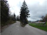 2
2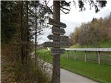 3
3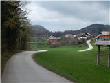 4
4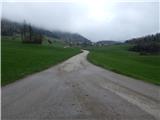 5
5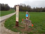 6
6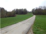 7
7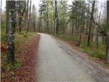 8
8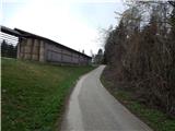 9
9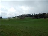 10
10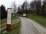 11
11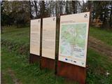 12
12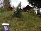 13
13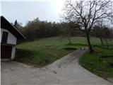 14
14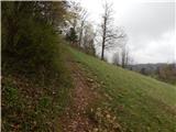 15
15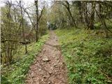 16
16 17
17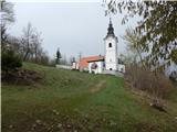 18
18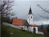 19
19