Sv. Lovrenc na Ivniku / St. Lorenzen ob Eibiswald - Bricnik
Starting point: Sv. Lovrenc na Ivniku / St. Lorenzen ob Eibiswald (947 m)
Starting point Lat/Lon: 46.6128°N 15.167°E 
Time of walking: 1 h 50 min
Difficulty: easy marked way
Difficulty of skiing: no data
Altitude difference: 70 m
Altitude difference (by path): 90 m
Map: Koroška 1:50.000
Access to starting point:
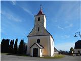
From Maribor or Dravograd we drive to Radlje ob Dravi, and there from the crossroad near the stores Hofer and Lidl, we drive on the road in the direction of small border crossing Radelj. Next follows an ascent to mountain pass Radeljski prelaz (674 meters), and when we get to Austria the road starts descending. We are descending to a crossroad, where the road branches off to the left towards the settlement Sveti Lovrenc / St. Lorenzen. From the crossroad, where we leave the main road, we again start ascending, and at the crossroads, we follow the signs for Sveti Lovrenc. When we get to the mentioned settlement, we drive to the church of St. Lovrenc, where we park on a parking lot by the cemetery.
Path description:
From the church of St. Lovrenc we return to the main road, and then we continue towards the west. We quickly get to a marked crossing, from which we continue on the left road in the direction of Sveti. Jernej / St. Bartholomä, Sveti Primož / St. Primon and Sveti trije Kralji / Hl. Drei König. The path ahead leads us past the chapel, few houses, and then it splits.
From the road slightly to the right leads Austrian path towards Sveti Jernej, and we walk on the road to the left turn, from which we continue straight, on a cart track, on which we quickly get from Austria to Slovenia and to the nearby crossing.
To the right Slovenian path branches off towards Sveti Jernej, and we continue straight towards the farm Odernik, Bricnik and Muta. The path ahead leads us on a cart track, and at Odernik it widens into a macadam road. We continue on the macadam road which leads us with increasingly beautiful views, which reach to Peca, Raduha and Uršlja gora, and after the nearby chapel, the road gradually returns into the forest, where at the crossroad we continue right towards Bricnik and Sveti Primož (left Sveti trije Kralji). From the crossroad, we few minutes continue on the road, and then we go straight on a cart track which at first steeply ascends through the forest, and when it flattens, it quickly brings us to the top of Bricnik.
Description and pictures refer to a condition in the year 2018 (October).
Pictures:
 1
1 2
2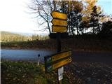 3
3 4
4 5
5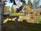 6
6 7
7 8
8 9
9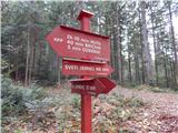 10
10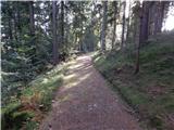 11
11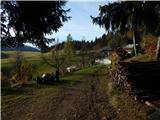 12
12 13
13 14
14 15
15 16
16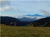 17
17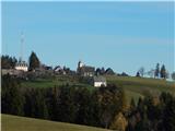 18
18 19
19 20
20 21
21 22
22 23
23 24
24 25
25 26
26 27
27 28
28