Tičnica - Sveti Jošt above Kranj (Pot prijateljev Sv. Jošta, on stairs)
Starting point: Tičnica (401 m)
Starting point Lat/Lon: 46.2348°N 14.3309°E 
Path name: Pot prijateljev Sv. Jošta, on stairs
Time of walking: 1 h 15 min
Difficulty: easy marked way
Difficulty of skiing: no data
Altitude difference: 444 m
Altitude difference (by path): 444 m
Map: Škofjeloško in Cerkljansko hribovje 1:50.000
Access to starting point:
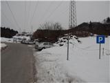
A) We drive to Medvode, and then on the old road we drive to Kranj, where at first traffic light we turn left in the direction of Stražišče and Šmarjetna gora. From the roundabout, where a road towards Šmarjetna gora branches off to the right, we continue "straight" (second exit). Further, we drive on the road Škofjeloška cesta, after that from a little bigger crossroad we turn right in the direction of Sveti Jošt above Kranj and Čepulje. When Kranj ends we park on a marked parking lot below the high voltage power line.
B) From highway Jesenice - Ljubljana we go to the exit Kranj west, and then on the old road towards Ljubljana. Towards the end of Kranj, at the last traffic light we turn right in the direction of Stražišče. From the roundabout, where a road towards Šmarjetna gora branches off to the right, we continue "straight" (second exit). Further, we drive on the road Škofjeloška cesta, after that from a little bigger crossroad we turn right in the direction of Sveti Jošt above Kranj and Čepulje. When Kranj ends we park on a marked parking lot below the high voltage power line.
C) From highway Ljubljana - Jesenice we go to the exit Kranj east, and then we follow the signs for Škofja Loka. We leave the road towards Škofja Loka at the spot, where signs for Stražišče and Šmarjetna gora point us to the right. Further, we drive on the road Škofjeloška cesta, which we leave on a little larger crossroad and we continue left in the direction of Sveti Jošt above Kranj and Čepulje (road signs are only from the opposite direction). When Kranj ends we park on a marked parking lot below the high voltage power line.
D) We drive to Škofja Loka, and then we continue driving towards Kranj. When the settlement Zgornje Bitnje ends, we continue left in the direction of Stražišče and Šmarjetna gora. Further, we drive on the road Škofjeloška cesta, which we leave on a little larger crossroad and we continue left in the direction of Sveti Jošt above Kranj and Čepulje (road signs are only from the opposite direction). When Kranj ends we park on a marked parking lot below the high voltage power line.
Path description:
Fom the end of the parking lot, we continue slightly right on a marked path in the direction of Sveti Jošt. A gently sloping path at first leads below the high voltage power line, and when we reach the edge of the forest it splits.
We continue straight on a marked path (slightly right Šmarjetna gora on an unmarked path), by which only few steps further we notice signs, that we walk on the path Pot prijateljev Sv. Jošta. Next follows a moderate ascent through the forest, on the path that runs a little right from an asphalt road, so that during the ascent from the left few more paths from higher starting points join. At the wooden religious symbol path turns slightly to the left and leads us by the upper part of a panoramic pasture, from where a nice view opens up on part of Gorenjska. The path then returns into the forest, and before we leave it from the left joins also the path Sodarjeva pot, and above the meadow path returns into the forest. In the forest, the path splits, and we choose the left, steeper path (straight path past the chapel, the path through the valley and Rakovica), which after few minutes of ascent again splits. We again choose the left path, by which there are signs "po stopnicah" (on stairs), and we start ascending diagonally, on a shorter part also on some stairs.
Higher, we reach a wide cart track, where most of the before mentioned paths join, and we follow a wide path from which a little below the summit nice views open up all the way to the top, where there are situated a mountain hut Dom na Joštu and church of St. Jošt.
Description and pictures refer to a condition in the year 2018 (February).
Pictures:
 1
1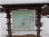 2
2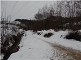 3
3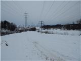 4
4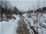 5
5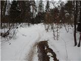 6
6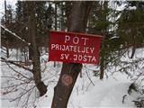 7
7 8
8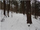 9
9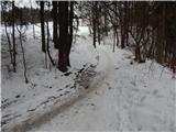 10
10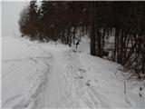 11
11 12
12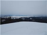 13
13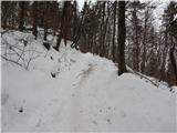 14
14 15
15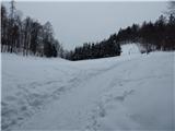 16
16 17
17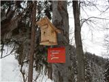 18
18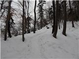 19
19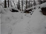 20
20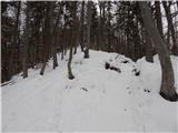 21
21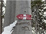 22
22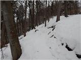 23
23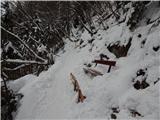 24
24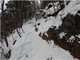 25
25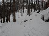 26
26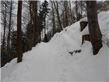 27
27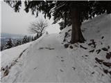 28
28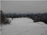 29
29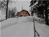 30
30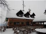 31
31 32
32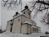 33
33 34
34