Vas na Skali - Veliko Špičje (on ridge of Špičje and on route Tumova smer)
Starting point: Vas na Skali (980 m)
Starting point Lat/Lon: 46.3404°N 13.7097°E 
Path name: on ridge of Špičje and on route Tumova smer
Time of walking: 5 h
Difficulty: very difficult pathless terrain
Difficulty of skiing: no data
Altitude difference: 1418 m
Altitude difference (by path): 1420 m
Map: Julijske alpe, Trenta, Triglav
Access to starting point:
From the village Soča we drive towards Log and after good kilometer we turn right over a bridge into a valley Vrsnik. Immediately behind the bridge we turn once again right and then after a half of kilometer again right. We stick to an asphalt road, we go past the end of the valley Pod Zjabci and also past hamlet Vas na Skali, until we get to zig-zags at an altitude 980 meters, where the main road turns left, and straight asphalted road is closed with a gate. Here we park.
Path description:
From the gate we follow the right road approx. 800 meters (we go also over a stream on a slope below Travniški rob), when on the left in grass we notice a cairn made of stones and through grass into the forest on a small footpath. Further in the forest footpath is well visible. At first leads through a dense spruce forest, where the passage is more or less possible only on the path. Ahead forest gets thinner, and we cross the forest road (1230 meters), which we left before, and we continue above the road in similar direction, so in the direction of the ridge of Špičje towards the northeast. Soon out of the forest we get to dwarf pines into narrow small valley, at the end of which we cross a torrent mildly left in the forest, in which is one zig zag. The path brings us on a small shoulder, from which we turn left on the forest road. If we get lost in that forest, we stick to direction of valley (settlement is called Dol pod Plazmi), through which we get to a meadow, from which we easily reach before the mentioned forest road. We stick to latter approx 300 more meters, when we come to a crossroad at which there is a pillar with a sign of local walking path. For us it is best, if we stick to a forest road straight to Dol. After approx 200 meters the road on a forest clearing ends. At the end of the clearing (we stick to the left edge) we cross a torrent and immediately on the other side we catch a footpath which through the low forest brings us to Dol - i.e. huge plain below the walls of Vrh Labrje (on the right) and Plazijanski Vršaci (on the left). At the end of the plain we follow the torrent, where there is most of the year water, until we come on higher scree, where we stick to the left edge to the boulder at an altitude 1750 meters. Here we can on grass on the left join variant from Dol pod Plazmi over mountain pass Čez Drt and ridge path over Plazijanski Vršaci. Or we can continue by the scree to altitude 1940 meters (almost to the wall), when we cross on steep grass to the grassy ridge on the left (20 meters). If we earlier turn left, to here we have to go at first through dwarf pines (on the ridge), then from the first small saddle to the right almost to the scree, and then steeply upwards and left back on a small ridge, on the northern side, and on a steep thin gravel upwards through poorly visible groove above us and finally on the mentioned ridge. Here on the left a passage opens to a grassy shoulder on the left. On the shoulder we turn back towards a wall and we stick to the ridge to the wall (or we walk on a slope on the southwest side) until we reach broken gully. There we ascend to 2 meters black plate, which we bypass on the right slope. Higher, we follow the gully only few meters, then we turn to the right slope, which we recognize by steep grass and white crumbly thin gravel. Higher rock becomes more compact. After 20 meters we cross to the left on the ledge to the upper gully and by its left side we reach the main ridge of Špičje (marked path). Peak of Veliko Špičje is 15 meters away on our right.
Pictures:
 1
1 2
2 3
3 4
4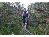 5
5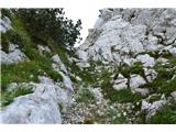 6
6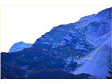 7
7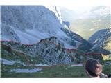 8
8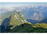 9
9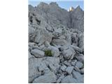 10
10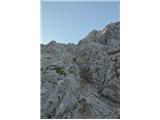 11
11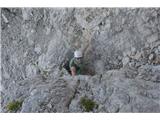 12
12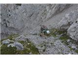 13
13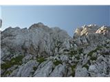 14
14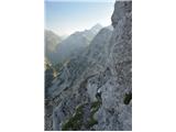 15
15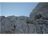 16
16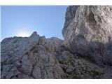 17
17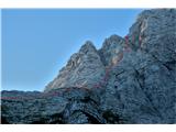 18
18