Veliko Tinje - Veliki vrh (on Pohorje) (via Sveti Urh)
Starting point: Veliko Tinje (655 m)
Starting point Lat/Lon: 46.41504°N 15.50028°E 
Path name: via Sveti Urh
Time of walking: 2 h 55 min
Difficulty: easy unmarked way
Difficulty of skiing: no data
Altitude difference: 689 m
Altitude difference (by path): 760 m
Map: Pohorje 1:50.000
Access to starting point:
We drive into the center of Slovenska Bistrica, where at the traffic light crossroad we turn in the direction of health center and further we drive on the road Partizanska cesta. Next follows driving through the town, where we continue straight, at the periphery of the town, at the industrial zone we go on the road towards Tinje, Sveti Trije kralji and lake Črno jezero. Next follows an ascent on a little narrower asphalt road which starts ascending and at first leads past the hunting cottage, pizzeria Gams, higher we go also through the settlement Visole, and few kilometers higher we get to Zgornje Tinje, where we continue left and then on the periphery of the settlement, we park at Dom krajanov and the fire station Tinje.
Path description:
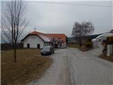
From the starting point, we walk to the church, where first blazes show up, and we ascend on stairs to the church, which we bypass on the left side. Behind the church, we cross the access road and we continue by the hedge and then through a meadow we return on an asphalt road, on which we ascend to an unmarked crossroad. From the crossroad, we continue on the right upper road, by which on the right we notice a blaze. Little further we get to few more houses, where we go right on a cart track which ascends diagonally above the road. Through the forest at the crossings we follow the blazes, and few minutes higher we leave the forest and we continue an ascent on the path which continues by the edge of the forest. Higher, the path turns right and returns into the forest, through which we ascend to an asphalt road which we reach at a smaller crossroad, where we leave the marked path.
We continue across the main road, on a side road in the direction of Urh (to the left continues a marked path towards Sveti Trije kralji, and to the right leads the road on Zgornje Tinje), on which we diagonally ascend through the forest, and we quickly leave the forest and we walk past individual homesteads of the settlement Urh. Higher, the path returns into a dense forest, and from the right joins also unmarked path from the settlement Turiška vas na Pohorju.
We continue on the asphalt road which a little ahead makes a left hairpin turn and after the hairpint turn it brings us to a smaller crossroad, where we continue slightly right (slightly left - homestead Korant).
Next follows a shorter ascent through the forest and we get to more flat part, where on the right side we notice the church of St. Urh, which is from the road distant approximately a minute of walking.
We bypass the church on the left side, and the road quickly brings us to a crossroad, from which we continue left in the direction of homestead Cehej (on maps Cahej) (straight - homestead Močnik and the road which leads further towards the settlement Šmartno na Pohorju).
Few 10 meters ahead, the road passes out of the forest, and we go right on an unmarked cart track which continues through the forest. The path ahead leads us on a mostly gentle cart track which has few crossings, at which we follow the wider path, which mainly leads on an indistinct eastern to southeastern ridge of Repnikov vrh. Higher, the path entirely flattens and it brings us to an indistinct highest point of Repnikov vrh.
From Repnikov vrh we start descending towards the west to northwest, and at the smaller crossing, we go slightly right. Next follows few minutes of descent and when we step out of the forest we join a marked path, which we follow to the right. After few steps, we cross also part of a meadow, and then we start ascending by the edge of the forest. We then cross a lane of a forest, and at the hunting observatory we for some time leave the forest. The path ahead leads us on a gentle cart track which through the forest brings us to Planina pod Šumikom, where we cross the asphalt road which leads towards Sveti Trije kralji.
We cross the main road and we continue on a side road which past the chapel brings us to the homestead Škrinjar, which we bypass on the bottom side, and before the next homestead Mlakar the blazes point us right into the forest. Next follows a little steeper ascent through the forest, where we follow the blazes, and when the path flattens from the right joins also the marked path past Močnik.
We continue straight, where follows few minutes of a light to moderate ascent, and then we already get to Hotel Jakec, above which there is the Church of Holy Three Kings.
From Church of Holy Three Kings we continue in the direction of the lake Črno jezero and the path Urškina pot, where we quickly get by the edge of the nearby ski track of the ski slope RTC Jakec - Trije kralji. The path ahead at first leads by the edge of the forest, only few meters away from the ski slope, and higher we cross the ski slope towards the right (while the ski slope operates, we cross the ski slope above the ski lift). On the other side of the ski track, the path goes a little to the right and leads us below the artificial lake.
A little after the lake we get to the connecting ski track, on which we continue the ascent (while the ski slope operates, we walk by the far left edge of the ski slope), and when few minutes higher we reach another ski track, where the marked path towards the lake Črno jezero crosses a ski slope, we still continue by the left edge, where there are also signs for path Urškina pot. Next follows few minutes of a steeper ascent and with increasingly beautiful views we get to benches on Veliki vrh, from where a nice view opens up on Pohorje and valley.
From here we can continue few more 10 meters into the forest, where there is the highest point of the peak.
Veliko Tinje - Sveti Urh 1:00, Sveti Urh - Repnikov vrh 0:25, Repnikov vrh - Sveti Trije kralji 1:00, Sveti Trije kralji - Veliki vrh 0:30.
Description and pictures refer to a condition in January 2022.
Pictures:
 1
1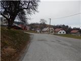 2
2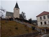 3
3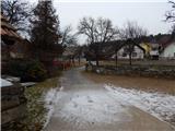 4
4 5
5 6
6 7
7 8
8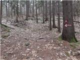 9
9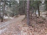 10
10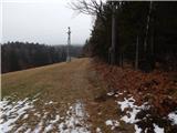 11
11 12
12 13
13 14
14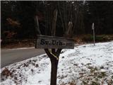 15
15 16
16 17
17 18
18 19
19 20
20 21
21 22
22 23
23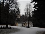 24
24 25
25 26
26 27
27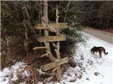 28
28 29
29 30
30 31
31 32
32 33
33 34
34 35
35 36
36 37
37 38
38 39
39 40
40 41
41 42
42 43
43 44
44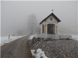 45
45 46
46 47
47 48
48 49
49 50
50 51
51 52
52 53
53 54
54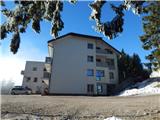 55
55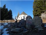 56
56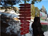 57
57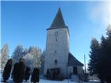 58
58 59
59 60
60 61
61 62
62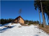 63
63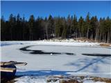 64
64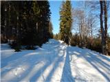 65
65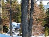 66
66 67
67 68
68 69
69 70
70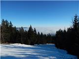 71
71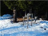 72
72 73
73 74
74 75
75