Zgornja Dobrava - Šobčev bajer (via Zjavka and Pusti grad)
Starting point: Zgornja Dobrava (509 m)
Starting point Lat/Lon: 46.3103°N 14.2123°E 
Path name: via Zjavka and Pusti grad
Time of walking: 2 h 20 min
Difficulty: easy unmarked way
Difficulty of skiing: no data
Altitude difference: -83 m
Altitude difference (by path): 215 m
Map: Karavanke - osrednji del 1:50.000
Access to starting point:
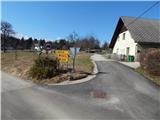
A) We drive to Podbrezje (to here from Gorenjska highway exit Naklo or Tržič), and then we follow the signs for Kropa. In the settlement Lipnica we don't drive in Kropa, but we continue driving right towards Kamna Gorica. A little further, we leave the main road and we continue driving right towards Zgornja Dobrava. After approximately 500 meters of ascent we get to Zgornja Dobrava, and we drive for few 100 meters ahead, to a crossroad on a smaller saddle, where a road towards Srednja Dobrava branches off to the right. At the mentioned crossroad is the beginning of described footpath, but there aren't any parking spots. We can park lower by the road, or higher on part of the described path.
B) We leave Gorenjska highway at exit Radovljica, and then we drive to Mošnje and forward towards the settlement Globoko, where we also cross river Sava. When we get to the settlement Mišače we continue straight towards Zgornja Dobrava, in Zgornja Dobrava we get to a crossroad, where a road branches off to the left towards Srednja Dobrava. At the mentioned crossroad is the beginning of described footpath, but there aren't any parking spots. We can park lower by the road, or higher on part of the described path.
Path description:
From the crossroad, we go on the road which continues towards the northwest (opposite road as the one which leads towards Srednja Dobrava), and at first, it leads past the hayrack and with nice views on Jamnik. When the asphalt ends we notice signs for Ojstra peč, which points us on the forest road, from which we soon go, at the unmarked crossroad right on a wide, at first still driving cart track. On the cart track soon from the right also the path from Mišače joins, and we go straight on a gradually narrower cart track which continues with some shorter ascents and descents. After a little less than 20 minutes of walking, we get to the next marked crossing, where we continue in the direction of Zjavka (slightly right Ojstra peč 1 minute).
From the cart track on which we continue only few steps further a wider path branches off to the right (path which leads further towards Pusti grad, Fux footbridge - path, which bypasses Zjavka), and we continue on a cart track which continues with some shorter ascents and descents. After few minutes, the cart track splits, and we once again continue on the left cart track. Cart track a little further for some time descends, and then it ascends on panoramic Zjavka.
Behind the "woodshed" on Zjavka we continue right and start descending diagonally. After few minutes of descent, we get to a smaller cross, where there is a marked crossing.
From the crossing, we continue straight in the direction of natural learning trail Pusti grad (right Fux footbridge and Radovljica, left Kamna Gorica).
Further gently sloping path leads steep above Galerije, and a little ahead also the path through Galerije joins. After the junction of the mentioned path we step out of the forest and the path through a meadow brings us to the settlement Zgornja Lipnica, where at the crossings we follow the signs for Pusti grad. Next follows a walk on a gently sloping macadam road which after few minutes joins another path from Fux footbridge. We still continue on the road which then brings us to the next houses, where at the crossings we again follow the signs for Pusti grad. Behind the last house a beautiful view opens up towards the Alps, after we again step in the forest, we get to a crossing, where a short path branches off to the left, which leads on Pusti grad. From the crossing, we reach Pusti grad after approximately a minute of additional walking, from the peak we then return to the last crossing and we continue left (straight, if we don't visit Pusti grad).
Next follows a short traverse, and then past a hayrack we descend to the nearby homestead, where we step on the road. We descend on the road to the main road Kamna Gorica - Lancovo, and we carefully cross it and continue the descent on a side road. A little lower road leads us past few more houses, and at the crossroads, we follow that road which continues in approximately the same direction and it is descending. Asphalt soon for some time ends, and then we return on the main road, on which we continue all the way to the settlement Lancovo. Through Lancovo we continue straight, and after the bridge over the river Sava we continue left on the path by Sava. A gentle path further leads on the left bank of river Sava, and it also leads us past fishes, and after a small bridge over the side stream it turns a little to the right and it avoids river Sava. Next follows some alternately walking through the forest and through meadows, and then we get to a larger meadow, where short, less than 5 minutes long path towards the stream Lehnjak and its source branches off to the right. If we decided, that we view the mentioned stream, we return on "main" path and then we continue in the direction of Šobec. A little further, at few bee houses we reach the macadam road, and then a little ahead also the other wider road which we follow left downwards. After a short descent, we reach a large parking lot by Šobčev bajer, where we continue left and through the entrance into camp we walk to Šobčev bajer.
During the swimming season the access to the lake is payable.
Pictures:
 1
1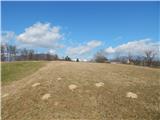 2
2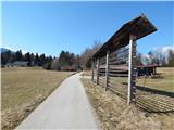 3
3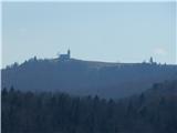 4
4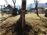 5
5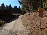 6
6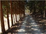 7
7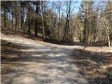 8
8 9
9 10
10 11
11 12
12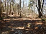 13
13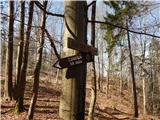 14
14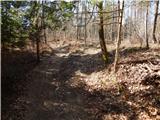 15
15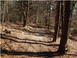 16
16 17
17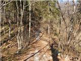 18
18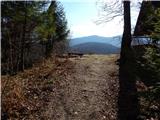 19
19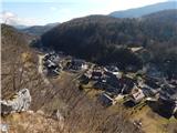 20
20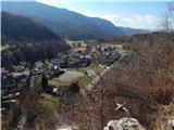 21
21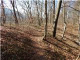 22
22 23
23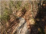 24
24 25
25 26
26 27
27 28
28 29
29 30
30 31
31 32
32 33
33 34
34 35
35 36
36 37
37 38
38 39
39 40
40 41
41 42
42 43
43 44
44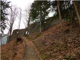 45
45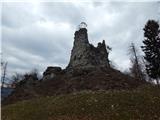 46
46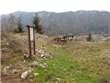 47
47 48
48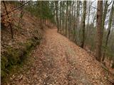 49
49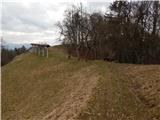 50
50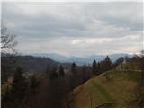 51
51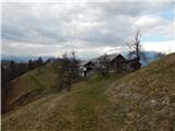 52
52 53
53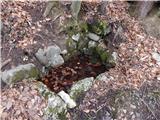 54
54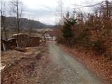 55
55 56
56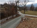 57
57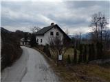 58
58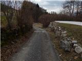 59
59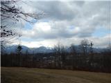 60
60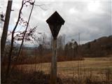 61
61 62
62 63
63 64
64 65
65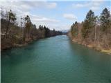 66
66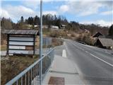 67
67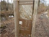 68
68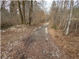 69
69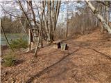 70
70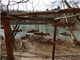 71
71 72
72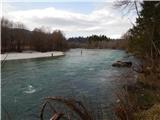 73
73 74
74 75
75 76
76 77
77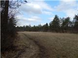 78
78 79
79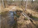 80
80 81
81 82
82 83
83 84
84 85
85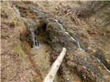 86
86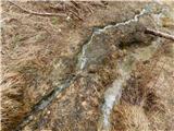 87
87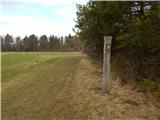 88
88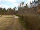 89
89 90
90 91
91 92
92 93
93 94
94 95
95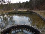 96
96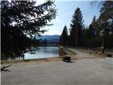 97
97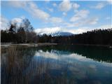 98
98