Alba di Canazei - Colac (path 646)
Starting point: Alba di Canazei (1486 m)
Starting point Lat/Lon: 46.45751°N 11.78814°E 
Path name: path 646
Time of walking: 4 h
Difficulty: very difficult marked way
Difficulty of skiing: no data
Altitude difference: 1229 m
Altitude difference (by path): 1240 m
Map:
Access to starting point:
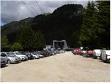
A) From Kranjska Gora over Korensko sedlo to Austria, where at the first larger crossroad, we continue left towards Podklošter / Arnoldstein and Trbiž / Tarvisio. By the end of the settlement Podklošter signs for Šmohor / Hermagor point us to the right on a regional road, on which past the mentioned settlement we drive to the end of the valley Gailtal, or more precisely to the settlement Kötschach-Mauthen, where we turn right towards the settlement Oberdrauburg. The path ahead leads us over an Alpine mountain pass Gailbergsattel (982 meters), after which we descend into the mentioned settlement. After we cross the bridge through river Drau, we continue left towards the settlement Lienz. In the main roundabout in Lienz we continue "left" in the direction of the settlement Sillian and Italy. Further, we cross the border between Austria and Italy, and we follow the main road to the settlement Dobbiaco / Toblach, where we turn left towards Cortina d'Ampezzo. When we get into Cortina d'Ampezzo, we follow the signs for Alpine mountain pass Passo Falzarego. On the mountain pass Falzarego (2105 meters) is a crossroad, where we continue straight downwards in the direction of Marmolada and mountain pass Passo Fedaia. At the next crossroads, we follow the road in the direction of Marmolada and mentioned mountain pass. After the mountain pass Fedaia (2057 meters), which is located by the artificial lake Lagho di Fedaia, the road again starts descending, and we follow it to the beginning of the settlement Alba, where we will on the left side notice a cableway Ciampac. We park on a large parking lot by the bottom station of the mentioned cableway. From Kranjska Gora to a starting point is approximately 280 km.
B) From Kranjska gora over a border crossing Rateče to Trbiž / Tarvisio and further on a highway towards Videm / Udine. We leave the highway at settlement Tolmezzo, from where we continue driving towards the settlement Ampezzo and forward towards Alpine mountain pass Passo della Mauria (1298 meters). The road then starts descending and brings us into a valley Cadore, where we continue right towards the settlement Auronzo di Cadore. At the next crossroads, we follow the signs for Cortina d'Ampezzo. When we get into Cortina d'Ampezzo, we follow the signs for Alpine mountain pass Passo Falzarego. On the mountain pass Falzarego (2105 meters) is a crossroad, where we continue straight downwards in the direction of Marmolada and mountain pass Passo Fedaia. At the next crossroads, we follow the road in the direction of Marmolada and mentioned mountain pass. After the mountain pass Fedaia (2057 meters), which is located by the artificial lake Lagho di Fedaia, the road again starts descending, and we follow it to the beginning of the settlement Alba, where we will on the left side notice a cableway Ciampac. We park on a large parking lot by the bottom station of the mentioned cableway. From Kranjska Gora to a starting point is approximately 270 km.
C) From Nova Gorica, we drive to Italy and drive forward on a highway to the settlement Portogruaro, where at the highway junction we turn in the direction of Belluno. We follow the highway to the exit for Belluno, and after the settlement Belluno we follow the road in the direction of the settlement Agordo and then Marmolada and Alpine mountain pass Passo Fedaia. After the mountain pass Fedaia (2057 meters), which is located by the artificial lake Lagho di Fedaia, the road starts descending, and we follow it to the beginning settlement Alba, where we will notice on the left side a cableway Ciampac. We park on a large parking lot by the bottom station of the mentioned cableway. From a border with Slovenia to a starting point is approximately 245 km.
Path description:
At the end of the parking lot, we continue slightly left following the signs »Locia de Contrin« on the forest road which is closed for public traffic. The road mostly runs through the forest and only occasionally a view opens up on the nearby peaks. The road then soon crosses a bridge and it brings us to a marked crossing where from the left joins the footpath from the settlement Penia. Further, the road is ascending mostly in zig-zags and higher from the road also few cart tracks branch off. We all the time continue straight on a well-settled road. Later road turns to the left and soon a footpath towards the ski slope Ciampac branches off to the right. We still continue on the road and after a short ascent, we come to the mountain hut Locia de Contrin.
From the mountain hut, we continue on a gently sloping macadam road which then soon crosses a gate. The road still leads through the valley by the stream Ruf de Contrin and by pastures brings us to a marked crossing.
Here we leave the road and go right on the path number 646 following the signs Colac. The path again starts ascending and brings us into the forest. Further, we are for quite some time ascending through the forest below the slopes of the peak Colac. From the path few times a view opens up towards Marmolada. Higher, the path crosses the fence and then through thinner larch forest brings us on grassy slopes. Further, we are ascending on a grassy slope and the path brings us near the stream Ruf de Gian de Mez. The path here starts ascending a little steeper towards the saddle Forcia Neigra. Higher, when we come on steep grassy slopes we continue right on a little poorly beaten path and we start ascending steeply towards the walls of the peak Colac. Or we can also continue on a little less steep path through saddle Forcia Neigra. If we continue right, we are at first quite steeply ascending by the torrent, after that follows an ascent on steep scree. Such a path then again joins the path from the saddle Forcia Neigra.
At the crossing, we continue right and start ascending diagonally below the walls of Colac. Slope, which we cross further becomes steeper and the path soon turns left and starts ascending on a gravel slope upwards. After that, the path becomes even a little steeper and we soon come to first steel cables. The path here is ascending by the steel cable on the left side of wide gully. Higher, the path turns a little to the right and continues to ascend on a crumbly slope by the steel cable. Gully on which we are ascending then becomes narrower and a little steeper. On this part of the path besides the steel cable we also get help from few stemples. From the gully, the path brings us on a ridge from which a view opens up towards the north. A little less steep path then short time runs on northwestern side of the mountain and then with the help of steel cables again ascends on the south side. Here the path ascends on a little less steep but quite crumbly gully upwards. When we come from the gully we continue left and only a short ascent on a ridge follows to a panoramic summit.
Pictures:
 1
1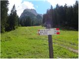 2
2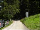 3
3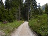 4
4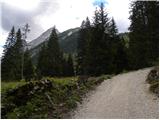 5
5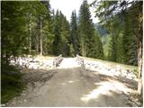 6
6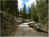 7
7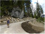 8
8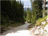 9
9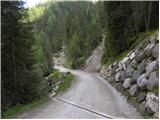 10
10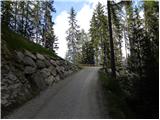 11
11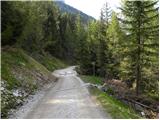 12
12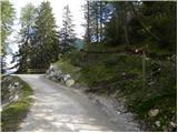 13
13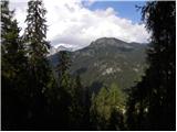 14
14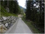 15
15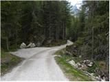 16
16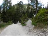 17
17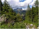 18
18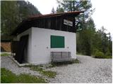 19
19 20
20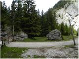 21
21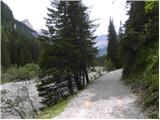 22
22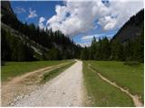 23
23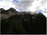 24
24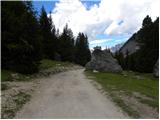 25
25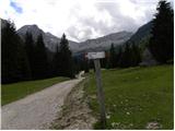 26
26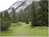 27
27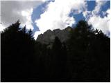 28
28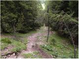 29
29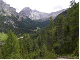 30
30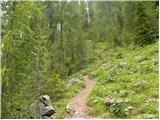 31
31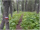 32
32 33
33 34
34 35
35 36
36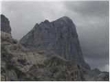 37
37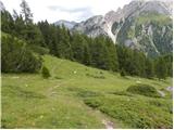 38
38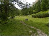 39
39 40
40 41
41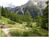 42
42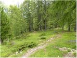 43
43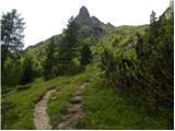 44
44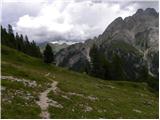 45
45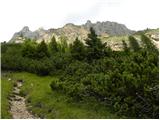 46
46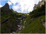 47
47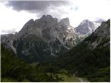 48
48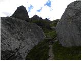 49
49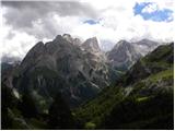 50
50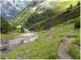 51
51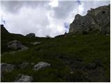 52
52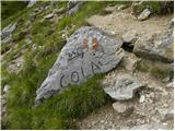 53
53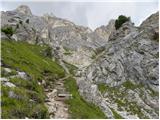 54
54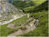 55
55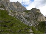 56
56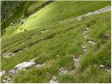 57
57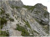 58
58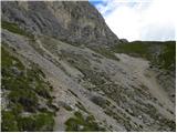 59
59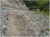 60
60 61
61 62
62 63
63 64
64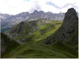 65
65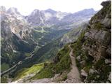 66
66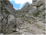 67
67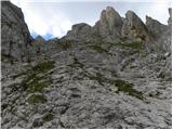 68
68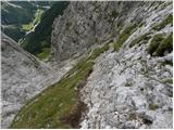 69
69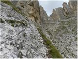 70
70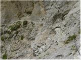 71
71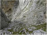 72
72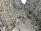 73
73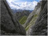 74
74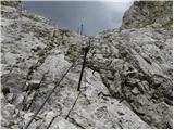 75
75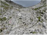 76
76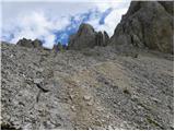 77
77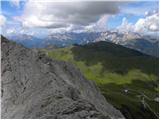 78
78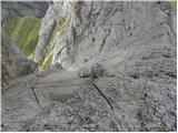 79
79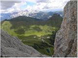 80
80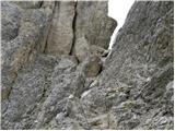 81
81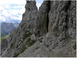 82
82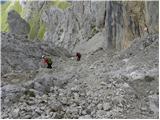 83
83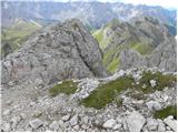 84
84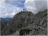 85
85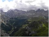 86
86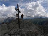 87
87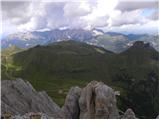 88
88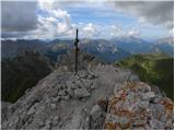 89
89