|
|
|
|
Commented tours
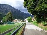
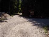 Robanov kot - Strelovec Robanov kot - StrelovecPeak with a beautiful view is located between two Alpine valleys those are Logarska dolina and Robanov kot. The view from the peak is the most beautiful on mountains above the mentioned valleys. On th... 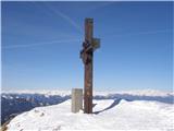 Rosstratte - Dobratsch / Dobrač (by road) Rosstratte - Dobratsch / Dobrač (by road)Dobrač is a massive mountain range, which is located west from Beljak. Its highest peak is 2166m high Kuhriegel, which is better known by name Dobrač or German Dobratsch. On the summit stands a cross,... 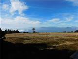 Ribniška koča - Grmovškov dom pod Veliko Kopo Ribniška koča - Grmovškov dom pod Veliko KopoGrmovškov dom pod Veliko Kopo is situated below the saddle Pungart, between Velika Kopa (1542 meters) and less distinct peak Otiše (1416 meters). Grmovškov dom pod Veliko Kopo is also a point of SPP, ...  Veliko Trebeljevo - Janče Veliko Trebeljevo - JančeJanče is 792 meters high peak, which is situated between the river Sava and the valley of the stream Besnica. From the top, on which there is a mountain hut and few meters below it also a church of St... 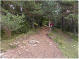 Cerknica - Slivnica Cerknica - SlivnicaSlivnica is 1114 meters high peak, which is situated north from Cerknica Polje. From the top, on which there is an inscription box, because of the nearby forest and transmitters is the view quite limi...
|
|
|
New webcams
New panoramas
|
|
|
Ferratas
 Hrušica - Dobršnik waterfalls (Ferata Dobršnik) Hrušica - Dobršnik waterfalls (Ferata Dobršnik)In a lonely wild gully, which is ascending above Hrušica towards Karawanks, runs the stream Dobršnik, which is here hiding seven waterfalls, numerous gorges and pools, by which we find petrified treas...  Rifugio Pederü - Furcia Rossa III Rifugio Pederü - Furcia Rossa IIIFurcia Rossa III is 2791 meters high peak in a little more lonely ridge over which leads Walk of Peace (Fridensweg / Via della pace). On the top besides a cairn with a small cross stands also a very i... Sant'Uberto - Furcia Rossa IIIFurcia Rossa III is 2791 meters high peak in a little more lonely ridge over which leads Walk of Peace (Fridensweg / Via della pace). On the top besides a cairn with a small cross stands also a very i...
|
|
|
Easy hikes
 Podvelka - Klančnik (Glančnik) (via Sveti Ignacij) Podvelka - Klančnik (Glančnik) (via Sveti Ignacij)Klančnik, on some maps also Glančnik, is 877 meters high peak, which is situated above the right bank of river Drava, only few minutes away from Hunting cottage Klančnik. From the top, a nice view ope...
|
|
|
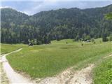 Planina Rčitno Planina RčitnoRčitno is scenic low mountains mountain pasture above Lake Bled on Pokljuka. In the past it was intended mainly for cutting grass, and the path there also for loading logs from Pokljuka forests. Today... 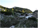 Draški rob Draški robDraški rob is the name for a part of the ridge between Mali Draški vrh and Solnice, which is precipitously descending towards the valley Krma. From the survey point 1979 meters, which is also the high... 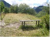 Grančišče GrančiščeGrančišče (also Grančiše) is a smaller precipitous hill, which is rising west to southwest from Mojstrana. From the top, on which there are a bench and table, a nice view opens up on Dovje, Mojstrana,... 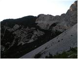 Požgana Mlinarica Požgana MlinaricaPožgana Mlinarica is 1868 meters high peak, which is situated in the ridge of mountains, which separates valleys Vrata and Kot. From the top, on which there is an inscription box in the shape of minia... 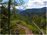 Lengarjeva glava Lengarjeva glavaLengarjeva glava is 1498 meters high peak, which is situated between the valleys Vrata and Kot. From a partly vegetated peak, a nice view opens up on Debela peč and Macesnovec, and on other peaks the ...
|
|
|