Veliko Trebeljevo - Janče
Starting point: Veliko Trebeljevo (555 m)
| Latitude/Longitude: | 46,01240°N 14,73840°E |
| |
Walking time: 2 h 15 min
Difficulty: easy marked way
Elevation gain: 237 m
Elevation difference along the route: 415 m
Map: Ljubljana - okolica 1:50.000
Recommended equipment (summer):
Recommended equipment (winter):
Views: 13.333
 | 2 people like this post |
Access to starting point:
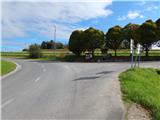
A) From the Ljubljana east bypass, we take the Bizovik exit, then continue driving towards Sostro and Besnica. After the saddle, where the road branches off to the right towards the settlement Javor, the road starts descending, and after a short macadam section it brings us into the valley of the stream Besnica, from there we continue driving on the main road towards the settlement Veliko Trebeljevo. Just before the beginning of the mentioned settlement, we will come to a somewhat larger intersection, where the main road continues towards Prežganje and Litija, and to the right the road branches off towards Mali Vrh and Veliko Trebeljevo. At the intersection where the described path begins, there are no designated parking spots, so it is better to park somewhat earlier at a suitable place along the road.
B) First, we drive to Zalog (part of Ljubljana), then across the Ljubljanica river we continue driving towards Podgrad, where we turn right towards Besnica. The road ahead first leads through a narrower underpass under the railway line, then it gradually starts to ascend. In Besnica, we join the road from Sostro, and we continue straight towards Veliko Trebeljevo. Just before the beginning of the mentioned settlement, we will come to a somewhat larger intersection, where the main road continues towards Prežganje and Litija, and to the right the road branches off towards Mali Vrh and Veliko Trebeljevo. At the intersection where the described path begins, there are no designated parking spots, so it is better to park somewhat earlier at a suitable place along the road.
C) First, we drive to Litija, from there we continue driving towards Zavrstnik, Štangarske Poljane and Malo and Veliko Trebeljevo. At Malo Trebeljevo the road flattens, then we follow it to the intersection at the beginning of the settlement Veliko Trebeljevo, where there is also a somewhat larger intersection. At the intersection where the described path begins, there are no designated parking spots.
Route description:
From the intersection right next to Veliko Trebeljevo we continue on the main road towards Litija. After a few minutes of easy walking on the asphalt road, which runs along the hay meadow, we arrive at the chapel, where a marked road branches off to the left to Malo Trebeljevo, a few steps ahead, behind the transformer a marked path branches off to the left, which continues on a somewhat narrower asphalt road. Immediately when we leave the main road we enter the village Malo Trebeljevo, through which the road starts ascending. After a smaller saddle we descend in a few minutes to another, somewhat wider road, which we follow to the left, on it gradually ascending towards Prežganje. Soon a road branches off to the right, which leads to St. Marjeta and the Minorite spiritual retreat house (car access), and from there we continue a short time on the main road. At the larger built chapel we continue right and quickly ascend on a quite steep road to the church of St. Marjeta.
From the church we return to the main road, from there from the chapel we continue ahead towards the nearby Gostilnica in Picerija Marjeta inn and pizzeria. The path ahead also leads past the fire station, then we arrive at the sign that marks the end of the settlement Prežganje. Here a path branches off to the right to the nearby memorial, which was erected on the fifth anniversary of independent Slovenia and in the year of Pope John Paul II's visit, located on a panoramic rise, and we continue straight on the asphalt road, which quickly takes us to the village Volavlje. On the section where the road flattens, a path branches off to the right to the waterfalls. A few steps ahead, at the smaller intersection by the wooden sign, we likewise continue on the asphalt road (also possible right, as the paths join higher up), then at the start of the left bend we turn sharply right onto the macadam road, along which we walk to the first branch of the cart track, which branches sharply left (we can also reach this branch via the aforementioned macadam road).
On the cart track we ascend in a few minutes to another asphalt road, which we follow to the right. A little behind the left bend, a marked cart track branches off to the right from the road, along which we continue the ascent through the forest. From the cart track we soon step onto a macadam road, past a few houses along it we quite quickly reach the next asphalt road, along which we then easily descend to a somewhat larger intersection by the transformer.
From the mentioned intersection we continue straight (left Gabrje, right Dolgo Brdo), then beyond the high-voltage power line we continue slightly left onto the marked footpath towards Janče. On the cart track we ascend across a panoramic hay meadow, then the path enters the forest, through which it ascends transversely to the right. When the transverse ascent ends we step out of the forest and past the nearby house ascend to the asphalt road, which we reach near the church of St. Miklavž. We cross the mentioned road somewhat to the left, then along the narrower road continue to the nearby Planinski dom na Jančah, which we reach after one more minute of walking.
Description and pictures refer to the condition in 2014 (September).

Photos:
 1
1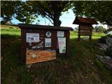 2
2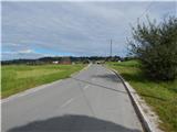 3
3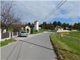 4
4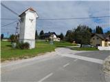 5
5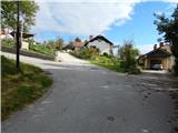 6
6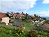 7
7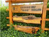 8
8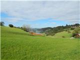 9
9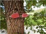 10
10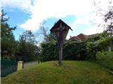 11
11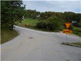 12
12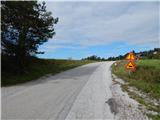 13
13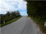 14
14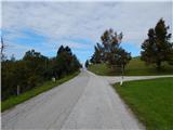 15
15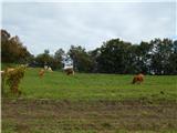 16
16 17
17 18
18 19
19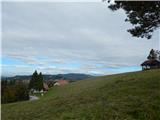 20
20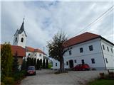 21
21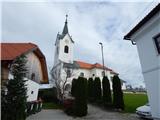 22
22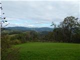 23
23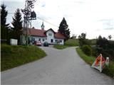 24
24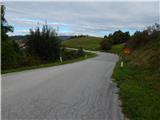 25
25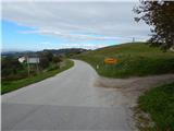 26
26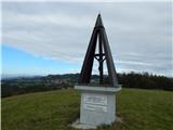 27
27 28
28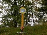 29
29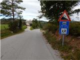 30
30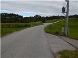 31
31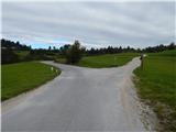 32
32 33
33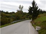 34
34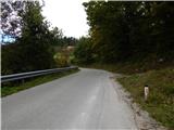 35
35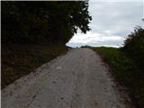 36
36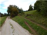 37
37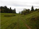 38
38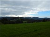 39
39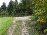 40
40 41
41 42
42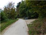 43
43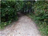 44
44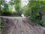 45
45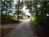 46
46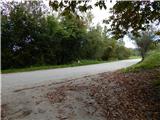 47
47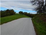 48
48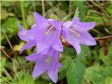 49
49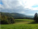 50
50 51
51 52
52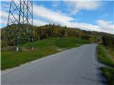 53
53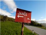 54
54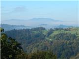 55
55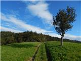 56
56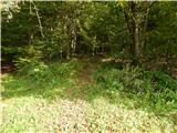 57
57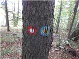 58
58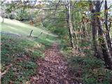 59
59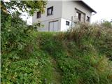 60
60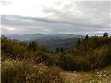 61
61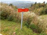 62
62 63
63 64
64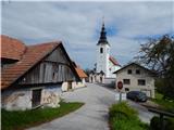 65
65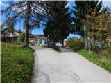 66
66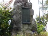 67
67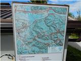 68
68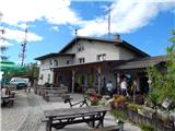 69
69 70
70
Discussion about the trip Veliko Trebeljevo - Janče
|
| prenovljeni20. 03. 2023 07:10:34 |
hello,
is there a marked path from Janče to Dragovšek?
thanks, lp
|
|
|
|
| Janez Seliškar20. 03. 2023 13:30:55 |
In large part it goes along the road, unfortunately.
|
|
|
To post a comment you must log in:
If you do not yet have a username, you must first
register.