Aljažev dom v Vratih - Cmir (Tominšek route)
Starting point: Aljažev dom v Vratih (987 m)
| Latitude/Longitude: | 46,41280°N 13,84660°E |
| |
Route name: Tominšek route
Walking time: 6 h 25 min
Difficulty: very difficult marked way
Elevation gain: 1406 m
Elevation difference along the route: 1610 m
Map: Triglav 1:25.000
Recommended equipment (summer): helmet, self belay set
Recommended equipment (winter): helmet, self belay set, ice axe, crampons
Views: 21.478
 | 3 people like this post |
Access to starting point:
We drive to Mojstrana, then follow the signs for Vrata Valley. We continue on the toll road, which is closed to public traffic in winter, following it to the large parking lot located a few minutes before Aljažev dom v Vratih.
Route description:
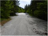
From the large parking lot, we continue along the road closed to public traffic, arriving at Šlajmerjev dom in a few minutes and shortly afterwards at Aljažev dom v Vratih.
In front of Aljažev dom, the path to Škrlatica branches right, but we continue straight towards Triglav, Luknje, Pogačnikov dom na Kriških podih and numerous other destinations along a wide path that leads us into the forest after the chapel, remaining fairly gentle further on.
We continue past the winter bivouac; upon leaving the forest, we reach the famous wedge in Vrata Valley dedicated to the fallen partisan mountaineers.
Here we leave the wide gentle path continuing towards the valley head and proceed left towards Tominškova route. We go through scree into the forest, where the ascent begins on a well-made path that is quite steep with wooden steps in places. After a little over an hour and a half of steep path, the forest thins and we reach the start of the climbing section, aided by the first safety devices.
Further, the path becomes steeper and more exposed to falling rocks, gradually shifting from the slopes of Rjavčeve glave to those of Begunjski vrh. The climbing section of Tominškova route mainly leads in a traversing ascent to the right, with a few steep upward climbs aided by safety devices.
Above 2000 m a.s.l., the path eases and joins the Prag path, soon reaching Begunjski studenec.
We continue steeply ascending; technically not demanding here, after about 15 minutes we reach the next junction near Kotel.
Continue left to Staničev dom pod Triglavom (slightly right to Triglav and Triglavski dom na Kredarici), bypassing Kotel valley on the left through high karst terrain along fissures and abysses—extra caution needed in fog or snow, otherwise not technically demanding. Higher, traverse a short scree, then reach plateau terrain and ascend to Dom Valentina Staniča with fine views of Triglav and surrounding peaks.
From the hut, left towards Begunjski vrh, Visoke Vrbanove špice and Cmir (straight Kot valley, right Krma and Rjavina valleys, sharply right Triglavski dom na Kredarici and Triglav). The gentle path soon reaches Begunjski preval, where the path to Vrbanove špice branches right; we go straight, soon splitting into two.
Straight (left to Begunjski vrh) traversing NE slopes of Begunjski vrh (possible snow early summer), leading to a small saddle behind it. Fine view into Vrata Valley and surrounding mountains.
Path turns right across well-protected smooth rock slab. Steep ascent to panoramic ridge followed NE. Pleasant path halted by steep rock step, descend vertically (10 m) on excellent protection. Easier path descends a bit, then ascends to Rjavčeve glave. Short ascent to the peak, then descend steep grassy slope (slip risk). Moderate ascent to narrow exposed ridge, descend to notch below Cmir summit. Path turns left, steep ascent up summit slope. After ~15 min, summit of Cmir with excellent views.
Starting point - Aljažev dom 0:05, Aljažev dom - Kozja dolina 1:50, Kozja dolina - Begunjski studenec 1:45, Begunjski studenec - Kotel 0:15, Kotel - Dom Valentina Staniča 0:30, Dom Valentina Staniča - Cmir 2:00.

Along the route: Aljažev dom v Vratih (1001m), Spomenik padlim partizanom gornikom (1020m), Kozja dolina (1749m), Begunjski studenec (2091m), Kotel (2166m),
Dom Valentina Staniča (2332m), Begunjska vratca (2342m), Rjavčeve glave (2360m)
Photos:
 1
1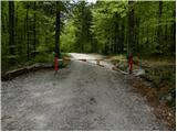 2
2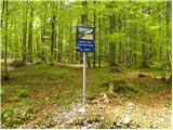 3
3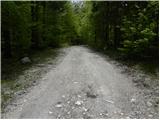 4
4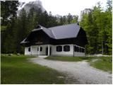 5
5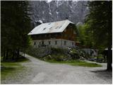 6
6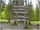 7
7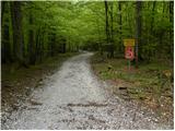 8
8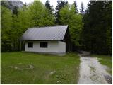 9
9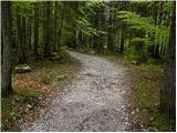 10
10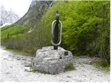 11
11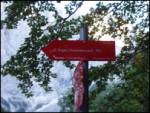 12
12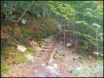 13
13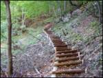 14
14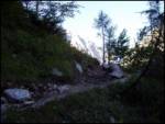 15
15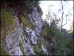 16
16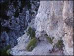 17
17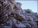 18
18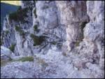 19
19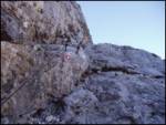 20
20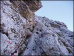 21
21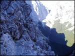 22
22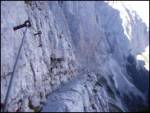 23
23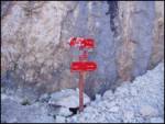 24
24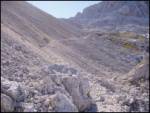 25
25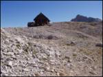 26
26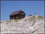 27
27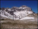 28
28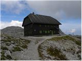 29
29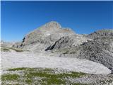 30
30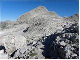 31
31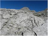 32
32 33
33 34
34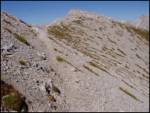 35
35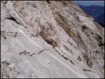 36
36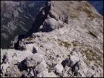 37
37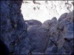 38
38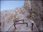 39
39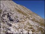 40
40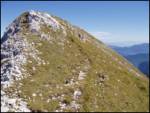 41
41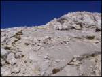 42
42 43
43
Discussion about the trip Aljažev dom v Vratih - Cmir (Tominšek route)
|
| Daaam10. 09. 2012 |
Walked the path on Saturday. After Tominškova up, from former spring to the junction for Stanič's hut it was a hospital  (read columns of people struggling up through Prag, some already looked quite exhausted (read columns of people struggling up through Prag, some already looked quite exhausted ) Short break at the hut, then onwards blissful peace!! We met only three more people on the way back towards the foot of Begunjski vrh. We descended pathless behind Cmir directly to the car in Turkov rovt. (a bit lucky since it was our first descent behind Cmir ) Short break at the hut, then onwards blissful peace!! We met only three more people on the way back towards the foot of Begunjski vrh. We descended pathless behind Cmir directly to the car in Turkov rovt. (a bit lucky since it was our first descent behind Cmir ) But I'd just add a comment on the difficulty of the path to Cmir, since the path from Stanič's hut to the summit is rated difficult, I'd still warn that the jump, though excellently secured, isn't so innocent and probably due to those 20 meters? drop the rating could easily be very difficult. It didn't cause us trouble, but for someone unaccustomed to cables it could be a bit delicate. ) But I'd just add a comment on the difficulty of the path to Cmir, since the path from Stanič's hut to the summit is rated difficult, I'd still warn that the jump, though excellently secured, isn't so innocent and probably due to those 20 meters? drop the rating could easily be very difficult. It didn't cause us trouble, but for someone unaccustomed to cables it could be a bit delicate.
|
|
|
|
| Ornitolog27. 07. 2013 |
Is there still any snow on this trail? Can it be done with summer gear?
|
|
|
|
| lipko27. 07. 2013 |
No snow on the trail (trail hiked 27.7.2013 right to Cmir)
|
|
|
|
| spet_jaz31. 08. 2017 |
Beautiful path, especially from below Begunjski vrh to Cmir - really views for gods! Descent via the valley Za Cmirom - cairn-marked pathless terrain.
More photos at link
|
|
|
|
| Planinka7427. 07. 2018 |
Is there still any snow on the path from Stanicev dom to Cmir? And on the pathless terrain behind Cmir to Turk's Rovt? Thanks for the info.
|
|
|
To post a comment you must log in:
If you do not yet have a username, you must first
register.