Aljažev dom v Vratih - Lake Zgornje Kriško jezero (via Pogačnikov dom)
Starting point: Aljažev dom v Vratih (987 m)
Starting point Lat/Lon: 46.4128°N 13.8466°E 
Path name: via Pogačnikov dom
Time of walking: 5 h 15 min
Difficulty: partly demanding marked way, easy unmarked way
Difficulty of skiing: demanding
Altitude difference: 1171 m
Altitude difference (by path): 1350 m
Map: Triglav 1:25.000
Access to starting point:
We drive to Mojstrana, then follow the signs for Vrata valley. We continue on the toll road, which is closed to public traffic in winter time, following it to the large parking lot located a few minutes before Aljažev dom v Vratih.
Path description:
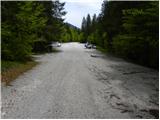
From the large parking lot in Vrata valley we continue along the gravel road, reaching Aljažev dom v Vratih in a few minutes of walking.
From the hut we continue straight towards Triglav, Stenar and Kriške pode (right Škrlatica) and proceed along the wide tourist path. The path ahead ascends barely noticeably through the forest belt, where we bypass the winter bivouac on the right side, then the forest thins and after a few more minutes of walking we arrive at a large wedge (monument dedicated to fallen partisan mountaineers). From the monument we continue straight (left Tominškova pot) along the path that gradually re-enters the forest and leads us a bit higher to a marked junction, where we turn right towards Pogačnikov dom (straight to Triglav and Luknja). From the junction the path begins to ascend more steeply through the beech forest (the area is called Bukovlje), bringing us just above 1300 m a.s.l. to a pleasant spring that dries up in dry periods. A few more minutes of walking through forest or higher shrubbery follow, and the path leads us out of the forest to the foot of Sovatna, where a quite overgrown path from Bivak pod Luknjo joins.
From here the path becomes steeper and more scenic. From the path we enjoy beautiful views of the Triglav north face, and higher up it leads to a short slightly exposed passage where extra caution is needed especially when wet. The path ahead flattens slightly but continues to ascend relatively steeply. An ascent through scree follows, then the valley narrows and the path leads to a short rocky step over which we climb with the aid of fixed protection.
Above the step the slope flattens, and the path leads across a series of small valleys where we often spot a herd of chamois. Higher up the path switches to the left side of the valley, then ascends transversely across a wide and on a short section slightly exposed ledge. From there a few dozen more steps follow, and the path leads to a marked junction at Dovška vrata.
We continue straight towards Pogačnikov dom (left Bovški Gamsovec, right Stenar and Križ). The path ahead begins to descend gradually through ever more beautiful high-alpine terrain. In a slight right bend we notice cairns on the left side of the path. Here an unmarked path branches left, crossing scree slopes under Bovški Gamsovec before rejoining the marked path at Pihavec. We continue on the marked path which gently descends further and leads to a marked junction.
Here a marked path to Pihavec branches left, while we take the lower path towards Pogačnikov dom na Kriških podih. The path then crosses slopes above Spodnje Kriško jezero, visible to our left below. The path descends a little more and leads to the next junction where it meets the path from the Zadnjica valley starting point.
We continue right uphill (left downhill to Zadnjica and Spodnje Kriško jezero) and reach Pogačnikov dom in less than five minutes of further walking; it is located on a scenic knoll.
From the hut we continue past the upper station of the cargo cable car, along the marked path which in two minutes of gentle descent leads to a marked junction, where we continue slightly right towards Križ and Škrlatica (left to Razor and Planja). We then ascend moderately across the vast Kriške pode along a path passing a spring and numerous sinks, leading to a less noticeable junction where the path to Zgornje Kriško jezero branches right from the marked path (small cairn at junction).
We continue on the unmarked path which with a few short ascents and descents brings us in about 10 minutes of further walking to Slovenia's highest lake.
Starting point - Aljažev dom 0:05, Aljažev dom - spring in Bukovlje 1:25, spring in Bukovlje - Dovška vrata 2:30, Dovška vrata - Pogačnikov dom 0:30, Pogačnikov dom na Kriških podih - Zgornje Kriško jezero 0:45.
Pictures:
 1
1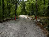 2
2 3
3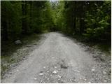 4
4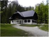 5
5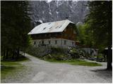 6
6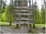 7
7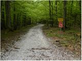 8
8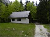 9
9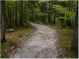 10
10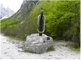 11
11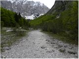 12
12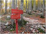 13
13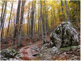 14
14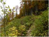 15
15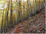 16
16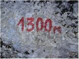 17
17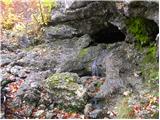 18
18 19
19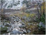 20
20 21
21 22
22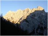 23
23 24
24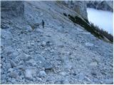 25
25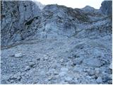 26
26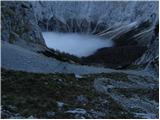 27
27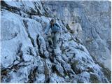 28
28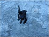 29
29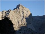 30
30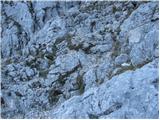 31
31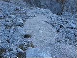 32
32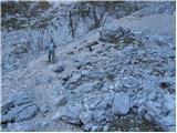 33
33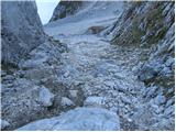 34
34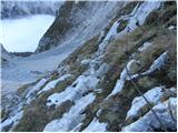 35
35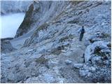 36
36 37
37 38
38 39
39 40
40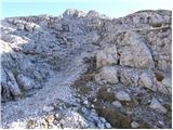 41
41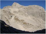 42
42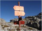 43
43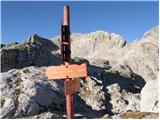 44
44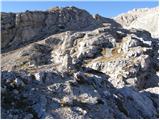 45
45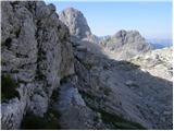 46
46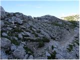 47
47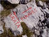 48
48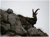 49
49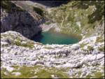 50
50 51
51 52
52 53
53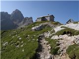 54
54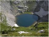 55
55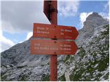 56
56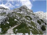 57
57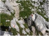 58
58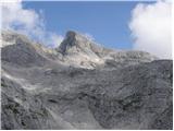 59
59 60
60 61
61 62
62 63
63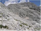 64
64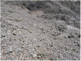 65
65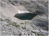 66
66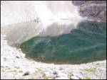 67
67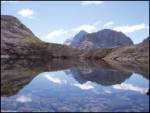 68
68