Atelsko sedlo - Ledenica na Golteh
Starting point: Atelsko sedlo (1317 m)
Starting point Lat/Lon: 46.40329°N 14.89713°E 
Time of walking: 1 h 20 min
Difficulty: easy marked way
Difficulty of skiing: no data
Altitude difference: 88 m
Altitude difference (by path): 175 m
Map: Kamniške in Savinjske Alpe 1:50.000
Access to starting point:
From Mozirje, Gornji Grad or Luče we drive to Ljubno ob Savinji, from there we follow the signs for Smrekovec. Through Ljubno ob Savinji, we initially drive on an occasionally narrower road in Rastke, and at the crossroads among the houses, we follow the signs for Smrekovec. After the settlement the road widens, and then to Ljubenske Rastke is mostly gently moderately ascending, and from here on it gradually becomes narrower and steeper. We follow the mentioned road to the parking lot at Atelsko sedlo, where hiking signposts are also located.
Path description:
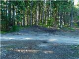
From Atelsko sedlo we head along the path that continues south, marked with signs for Mozirska koča na Golteh. At first, we begin ascending through the forest, where there are several footpaths, but we follow the marked trail, which after a few minutes of ascent leads us to Kalski greben, where the path levels out. Next follows a few minutes of gentle ascent along a forested ridge, then we steeply descend to the saddle Kal, where we cross a macadam road.
We continue to follow the signs for Mozirska koča, resuming our ascent along the mountain trail, which crosses several grazing fences. Higher up, we reach the pasture Zagradiški hlev, where the trail briefly levels out, and looking back, a beautiful view of Uršlja gora opens up. The path ahead returns to the forest, and we follow the blazes at several junctions; when we leave the forest again, we ascend with increasingly beautiful views to the saddle Isteje, where a marked junction is located.
We continue straight (left Boskovec and cottage Mozirska koča over Boskovec) and a few tens of meters continue on the macadam road, from which we soon go slightly left onto a marked footpath that further crosses grazing slopes.
A little further in a gentle descent, we reach the next crossing, where we go slightly left (right Stari stani), and then in the area of Hleviška planina descend into a strip of forest, where we reach the turn-off towards cave Ledenica na Golteh, which we reach after a minute of further walking.
Description and pictures refer to the condition in June 2024.
On the way: Kal (1319m), Isteje (1525m), Hleviška planina (1468m)
Pictures:
 1
1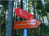 2
2 3
3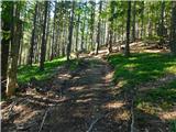 4
4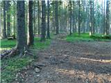 5
5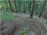 6
6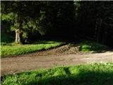 7
7 8
8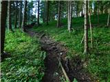 9
9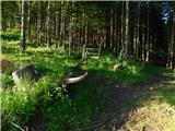 10
10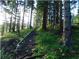 11
11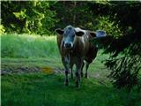 12
12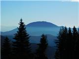 13
13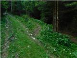 14
14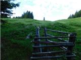 15
15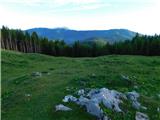 16
16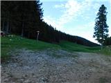 17
17 18
18 19
19 20
20 21
21 22
22 23
23 24
24 25
25 26
26