Aussichtswarte Vulkanland - Rosenberg
Starting point: Aussichtswarte Vulkanland (479 m)
Starting point Lat/Lon: 46.8253°N 15.92296°E 
Time of walking: 18 min
Difficulty: easy marked way
Difficulty of skiing: no data
Altitude difference: -21 m
Altitude difference (by path): 20 m
Map:
Access to starting point:
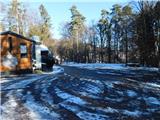
From Gornja Radgona, we drive into Austria, following the signs for Sveta Ana pri Igu / Sankt Anna am Aigen. In the village of Deutsch Haseldorf, we turn left towards Tieschen, and after a short descent, we turn left again. We then drive through the village of Pichla bei Radkersburg, where we turn sharply right towards the settlements of Bad Gleichenberg and Frutten-Gießelsdorf. In Frutten-Gießelsdorf, we turn right and drive to the northern part of the village, where at the bus stop on a small pass, we turn left towards Aussichtswarte. This is followed by an approximately 2 km ascent to the parking lot near the inn and the lookout tower.
Path description:
From the parking lot, head left from the inn and lookout tower following the signs for Rosenberg, Himmelsberg Straden and Kirche Tieschen, starting the walk on a gentle cart track. The path, leading through the forest or a short section along the edge of the field, initially gently descends.
After about ten minutes, reach a small pass with a junction; continue straight (right path towards Stainz bei Straden) and begin a gentle ascent, first passing a cross and benches. Leaving the forest and reaching the upper edge of the vineyards, arrive at the panoramic summit of Rosenberg, where benches and a wine barrel-shaped object are noticeable on the left.
Description and photos refer to the status in December 2025.
Pictures:
 1
1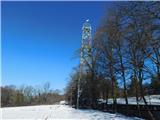 2
2 3
3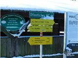 4
4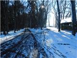 5
5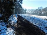 6
6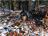 7
7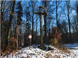 8
8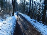 9
9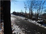 10
10 11
11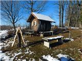 12
12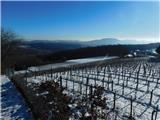 13
13