Bad Gleichenberg (Sägewerk Weiss) - Stradner Kogel
Starting point: Bad Gleichenberg (Sägewerk Weiss) (271 m)
Starting point Lat/Lon: 46.86307°N 15.91269°E 
Time of walking: 1 h 15 min
Difficulty: easy marked way
Difficulty of skiing: no data
Altitude difference: 338 m
Altitude difference (by path): 345 m
Map:
Access to starting point:
We drive into Gornja Radgona, from where we drive into Austria. Through Radgona / Bad Radkersburg we follow the signs for highway, and after the settlement Halbenrain we turn right in the direction of the town Vrbna / Feldbach. When we reach the settlement Bad Gleichenberg from the roundabout at the store Spar, we take the first exit towards St. Anna am Aigen, driving past the road sign marking the end of the settlement Bad Gleichenberg to a nearby chapel, behind which we turn right. Only a few meters from the crossroad, we notice yellow hiking signposts, where the described path begins.
Path description:
From the starting point, we continue on the asphalt road that heads south and soon splits. From the crossroad, we continue straight on Grünwaldweg street, passing a few houses, and slightly higher, the road turns left, descending briefly to the hunting observatory, behind which we continue right on a footpath that initially runs along the forest edge before entering the forest and turning right. After a short level section, the path begins to gently ascend, and at several crossings, we follow the blazes. Higher up, the path branches off to the right toward Buschenschank, but we continue straight, gradually ascending more noticeably.
Higher up, the path from the settlement Haag joins from the right, and we continue straight. As we approach the quarry, located southwest of the peak Stradner Kogel, the marked path turns left, and shortly ahead, back to the right. Next, we cross a meadow, where we turn left into the forest. In the forest, we quickly reach a cart track, on which we ascend to the peak, a few minutes away, where a large antenna tower stands.
Description and pictures refer to conditions in April 2023.
On the way: Grünwald (300m)
Pictures:
 1
1 2
2 3
3 4
4 5
5 6
6 7
7 8
8 9
9 10
10 11
11 12
12 13
13 14
14 15
15 16
16 17
17 18
18 19
19 20
20 21
21 22
22 23
23 24
24 25
25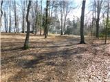 26
26 27
27 28
28