Bele vode / Rio Bianco - Rifugio Brunner
Starting point: Bele vode / Rio Bianco (989 m)
Starting point Lat/Lon: 46.4096°N 13.5357°E 
Time of walking: 1 h 15 min
Difficulty: easy marked way
Difficulty of skiing: no data
Altitude difference: 443 m
Altitude difference (by path): 443 m
Map: Julijske Alpe - zahodni del 1:50.000
Access to starting point:
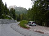
A) Via the Rateče border crossing, we drive into Italy, then follow the main road to Trbiž / Tarvisio, where at the beginning of the town we turn left towards Bovec. The road quickly brings us, past the settlement of Rabelj / Cave del Predil, to the intersection before Rabelj Lake / Lago di Predil, where we turn right. There follows some more driving through Jezerska Valley / Val Rio del Bianco, then we arrive at the spot where the road crosses Beli potok / Rio Bianco, where we park on the left side in a smaller parking lot. About 100 m further along, by the next stream, there is a larger parking lot, which is the starting point of the path to Jerebica.
B) Via the Predel border crossing, we drive into Italy and descend to Rabelj Lake / Lago di Predil, where after the lake we continue left towards Nevejski Pass (in Žlebeh) / Sella Nevea. There follows some more driving through Jezerska Valley / Val Rio del Bianco, then we arrive at the spot where the road crosses Beli potok / Rio Bianco, where we park on the left side in a smaller parking lot. About 100 m further along, by the next stream, there is a larger parking lot, which is the starting point of the path to Jerebica.
Path description:
From the starting point, we first carefully cross the road, then continue on the marked path towards the huts Brunner and Corsi and bivouac Gorizia. Initially we walk along an undulating path running along the left bank of Beli potok, soon the path becomes steeper; from the path, which mostly runs through the forest, beautiful views open up to the cascades, rapids and pools of Beli potok. Higher up, the forest thins out several times, opening a fine view ranging from nearby peaks to the border mountains between Slovenia and Italy. Higher up we cross a few more torrents, then past a spring we ascend to the renovated hut Brunner.
Description and pictures refer to the conditions in 2019 (June).
Pictures:
 1
1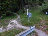 2
2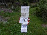 3
3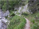 4
4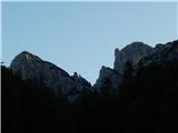 5
5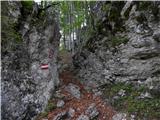 6
6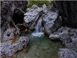 7
7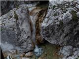 8
8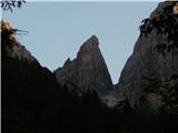 9
9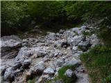 10
10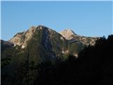 11
11 12
12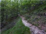 13
13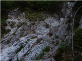 14
14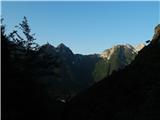 15
15 16
16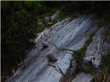 17
17 18
18 19
19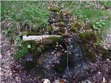 20
20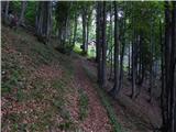 21
21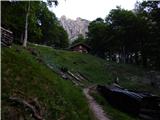 22
22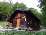 23
23