Beli Potok at Frankolovo - Waterfall Lindek
Starting point: Beli Potok at Frankolovo (435 m)
Starting point Lat/Lon: 46.3484°N 15.323°E 
Time of walking: 15 min
Difficulty: easy marked way
Difficulty of skiing: no data
Altitude difference: 120 m
Altitude difference (by path): 120 m
Map:
Access to starting point:
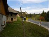
From the Ljubljana - Maribor highway, we head to the Celje - center exit, then continue driving towards Vojnik, Frankolovo and Zreče. At the end of Frankolovo, we will notice signs for Lindek Castle, which direct us left onto a narrower and ascending asphalt road. Beside the mentioned road, we then park at an appropriate place.
Path description:
We walk for a few minutes along the asphalt road, then we arrive at a smaller junction, where we do not continue left or right, but straight onto a marked cart track in the direction of Lindek Castle, Kislice and Stenice. The path ahead ascends along the cart track, which runs beside the riverbed of the Belski potok stream. Higher up, we cross the mentioned stream, and the path brings us to the 9 m high Lindeški slap waterfall.
Pictures:
 1
1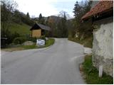 2
2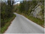 3
3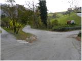 4
4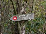 5
5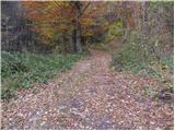 6
6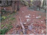 7
7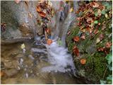 8
8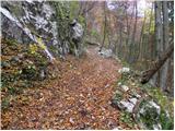 9
9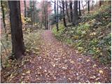 10
10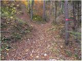 11
11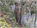 12
12