Belopeška jezera - Mangart (Via Italiana)
Starting point: Belopeška jezera (929 m)
Starting point Lat/Lon: 46.4733°N 13.6713°E 
Path name: Via Italiana
Time of walking: 5 h 30 min
Difficulty: extremely difficult marked way
Ferrata: C
Difficulty of skiing: no data
Altitude difference: 1750 m
Altitude difference (by path): 1800 m
Map: Julijske Alpe - zahodni del 1: 50.000
Access to starting point:
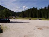
From Kranjska Gora over the border crossing Rateče we drive towards Trbiž / Tarvisio. Soon after the border crossing, the road in the direction of lakes Belopeška jezera / Laghi di Fusine branches off to the left, which in a moderate ascent we then follow to a large parking lot at the lake Zgornje Mangartsko (Belopeško) jezero.
Path description:
From the parking lot, we continue on the left side of the inn following the signs Bivacco Nogara. The path runs on the road and in few minutes brings us to a crossroad, where the path towards the mountain hut Zacchi branches off to the left. We continue right on the road on which we walk for some time, and then we go slightly right on a cart track. When the cart track ends, we continue on the path through a meadow, which brings us to a crossing. Left leads the path 513 towards the mountain hut Zacchi, and we continue right on the path 517/A towards the bivouac Nogara. The path then brings us into the forest through which we are for quite some time quite steeply ascending. Out of the forest we come on grassy slopes and we are soon at a crossing again. We go right towards the bivouac Nogara, left runs the path slightly downwards towards the mountain hut Zacchi. We continue on grassy slopes slightly to the right and we soon come to a little more demanding part of the path. Here the path steeply ascends and we get help from quite a few fixed safety gear. Next follows a crossing of steep grassy slopes, and then the path becomes again less steep and soon brings us to bivouac Nogara.
At the bivouac, where there is also a crossing we continue to the left following caption on rock »Via Italiana«. Blazes are on this part of the path quite faded and we get help from numerous cairns. After that, the path crosses a slope to the left and it brings us to the entry of a climbing part of the path. At the beginning path steeply ascends left upwards by the steel cable and it brings us to a smaller cave. From the cave we then through the window ascend on precipitous ledge and then we continue upwards on a wall. The path turns to the left and crosses precipitous slope, and then again ascends almost vertically upwards and brings us on a little less steep grassy slope. We cross the slope by the steel cable to the left and we are soon in front of probably most difficult part of the path. First, we vertically ascend by the steel cable, after that on a very exposed wall with the help of stemples we climb above rocky overhang. Here we are standing on a wide stemple, and below us is a deep precipice. We continue on stemples vertically upwards. The path then goes slightly to the right and few times steeply ascends with the help of stemples. Next follows exposed crossing on a narrow ledge to the left and then we again ascend with the help of stemples and iron spikes on a vertical wall. Again we walk above a deep precipice on a wide stemples from which we then ascend almost vertically upwards. Next follows traversing to the left on narrow exposed ledge and then steep ascent with the help of stemples. After that, the path becomes a little less steep and we soon come on the ridge from which a view opens up towards Slovenia. A short descent follows by the steel cable and we join the path from the saddle Mangartsko sedlo.
We continue to the left on a well-marked path and at first, we walk on smooth rocky plates. After that, the path turns a little left on the scree below Mangart, which is in the early summer still covered with snow. The path ahead is slowly turning to the right and we are soon at the crossing, where we go right (left on the ridge Kotovo sedlo, Loška Koritnica). The path is still turning to the right so that we almost circle Mangart. Follows ascent on a panoramic grassy slope. Then we cross the gully and to the top we have only the last steepness which we overcome in zig-zags.
The path Via Italiana is extremely demanding and it is appropriate only for most skilled mountaineers with mandatory self belaying. The path is otherwise very well secured but from technical perspective it is among more difficult in Julian Alps and maybe even the most exposed in the entire Julian Alps.
On the territory of Slovenia we won't find so demanding high mountain paths.
We can descend to Mangartsko sedlo and then on an easier path (path 517) back to lakes Belopeška jezera.
Pictures:
 1
1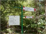 2
2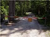 3
3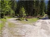 4
4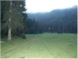 5
5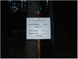 6
6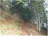 7
7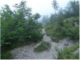 8
8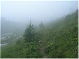 9
9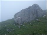 10
10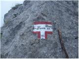 11
11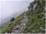 12
12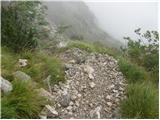 13
13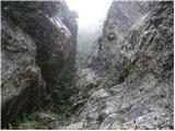 14
14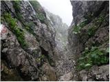 15
15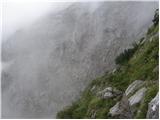 16
16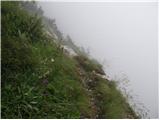 17
17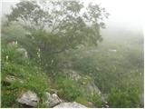 18
18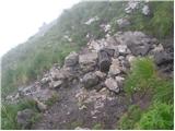 19
19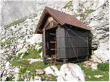 20
20 21
21 22
22 23
23 24
24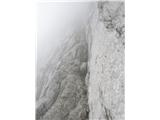 25
25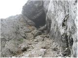 26
26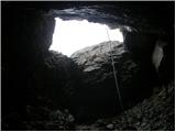 27
27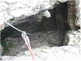 28
28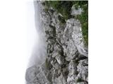 29
29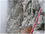 30
30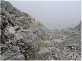 31
31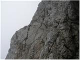 32
32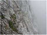 33
33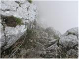 34
34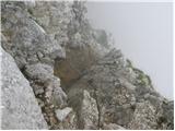 35
35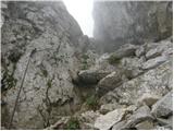 36
36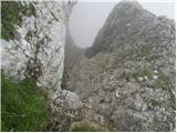 37
37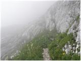 38
38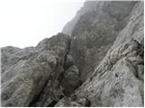 39
39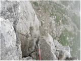 40
40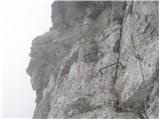 41
41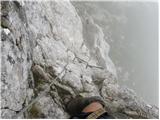 42
42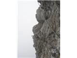 43
43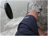 44
44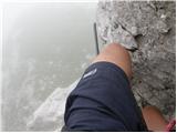 45
45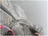 46
46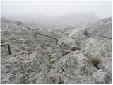 47
47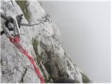 48
48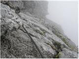 49
49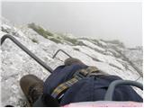 50
50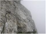 51
51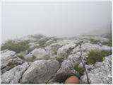 52
52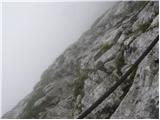 53
53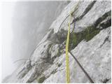 54
54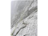 55
55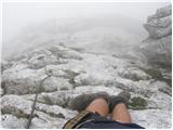 56
56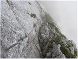 57
57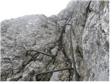 58
58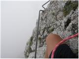 59
59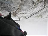 60
60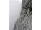 61
61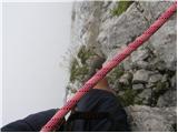 62
62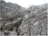 63
63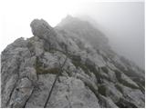 64
64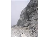 65
65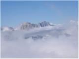 66
66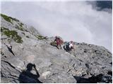 67
67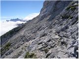 68
68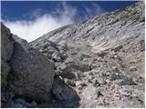 69
69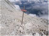 70
70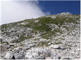 71
71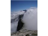 72
72 73
73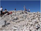 74
74