Belska Kočna - Mrzla gora
Starting point: Belska Kočna (968 m)
Starting point Lat/Lon: 46.4023°N 14.5664°E 
Time of walking: 5 h 40 min
Difficulty: very difficult marked way
Difficulty of skiing: no data
Altitude difference: 1235 m
Altitude difference (by path): 1550 m
Map: Kamniške in Savinjske Alpe 1:50.000
Access to starting point:
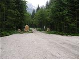
First, we drive to Jezersko, and then we continue driving in the direction of Austria. The road from Jezersko in few hairpin turns ascends to the border crossing Jezerski vrh, and from there in numerous zig-zags starts descending steeper. Lower at settlement Bela / Bad Velach, we come at the marked crossroad, where we continue right in the direction of Belska Kočna / Velacher Kotschna. The road ahead crosses the stream Bela and only few meters ahead brings us to the next crossroad. Here we continue straight on the right road and we continue driving by the already mentioned stream. We follow this road to the settled parking lot by the gate, which is preventing further driving.
Possible is also access over saddle Pavličevo sedlo. In this case, at settlement Bela we continue left. Further, we follow the description above.
Path description:
From the parking lot, we continue on the road, and after 3 minutes of walking, it brings us to a crossing. We continue straight, further on the road in the direction of the valley Logarska dolina (right Goli vrh). We follow a gently sloping road a little less than 20 minutes to the spot, where the marked path branches off to the left upwards. Further, we are ascending on at first a wide path, which through the forest in a moderate ascent brings us to a torrent stream, where the path turns right, crosses the stream and then brings us to a secured part of the path. With the help of steel cables we ascend on a slightly exposed ridge, which is short and snowless undemanding. The path ahead is ascending among the bushes with beautiful views on the surrounding peaks. We notice the most sharp Storžek, to which we are getting closer. Ahead path runs past a pleasant well after which we soon get to an old hunting cottage, which is surrounded by a lush vegetation. The path is then ascending for some time among a bushes and a thin forest, after which we step into the arms of larches. Terrain ahead is becoming more and more rocky and larches are getting replaced by scree, which is because of a shady side quite long under the snow. Over the scree leads us pretty steep and a more panoramic path, which eventually brings us to the saddle Savinjsko sedlo, where there is a marked crossing.
From the saddle Savinjsko sedlo we descend towards Okrešelj. After few minutes of descent, we come to a smaller emergency bivouac, where write in inscription book (bivouac Bivak pod Mrzlim vrhom). And we are still descending and we soon come to a crossing, where right on the scree upwards climbing path on Koroška Rinka branches off, and we still continue downwards. And soon left at the altitude 1700m path branches off on Mrzla gora. The path at first ascends through rare dwarf pines and then brings us to a traverse over a rocky plate. Here we put on a helmet, because the path ahead is very crumbly and exposed to falling stones. From the traverse path brings us into a gully which we only cross. Now we come into a climbing part of the path. The path is at the beginning well-secured, but the fixed safety gear soon vanishes. Next follows unsecured ascent on a slope in a shape of a pyramid. Because this part of the path is very steep, watch out for falling stones. Before we step on the top of the pyramid we have a feeling, that there is the summit. But when we step on the "top" we see, that this isn't the case. Next follows a very exposed crossing of a narrow ledge without fixed safety gear. At the end of this ledge path turns left on a moderately steep wall straight upwards (without fixed safety gear). Then we walk on the ridge, which is in parts quite exposed. After that, the path turns a little to the right and in 30 minutes on a quite steep terrain brings us to the summit.
The starting point - Savinjsko sedlo 3:10, Savinjsko sedlo - Mrzla gora 2:30.
On the way: Lovska koča Presteralše (1469m), Savinjsko sedlo (2001m)
Pictures:
 1
1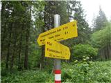 2
2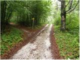 3
3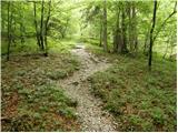 4
4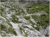 5
5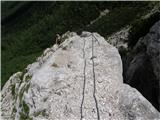 6
6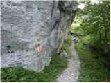 7
7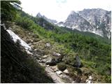 8
8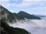 9
9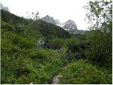 10
10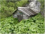 11
11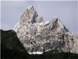 12
12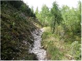 13
13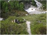 14
14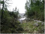 15
15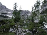 16
16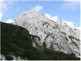 17
17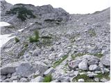 18
18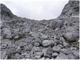 19
19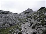 20
20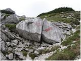 21
21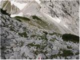 22
22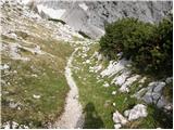 23
23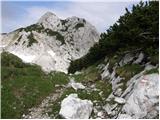 24
24 25
25 26
26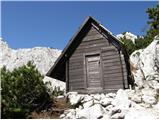 27
27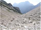 28
28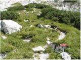 29
29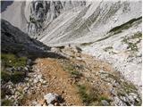 30
30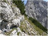 31
31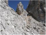 32
32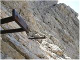 33
33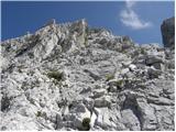 34
34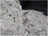 35
35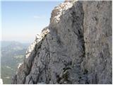 36
36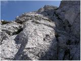 37
37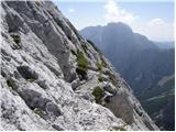 38
38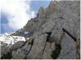 39
39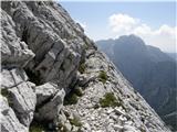 40
40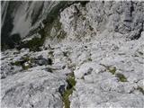 41
41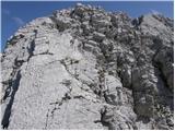 42
42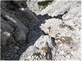 43
43 44
44 45
45