Bistriški jarek (Verdinek) - Sveti Jernej above Muta
Starting point: Bistriški jarek (Verdinek) (452 m)
Starting point Lat/Lon: 46.6509°N 15.1234°E 
Time of walking: 1 h 40 min
Difficulty: easy marked way
Difficulty of skiing: no data
Altitude difference: 586 m
Altitude difference (by path): 586 m
Map: Koroška 1:50.000
Access to starting point:
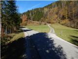
A) We drive to Dravograd, and then we continue driving towards Maribor. After the road sign 8.0 km, we need to pay attention, because a little behind the bus stop and the pedestrian crossing, we turn left into the settlement Gortina (the turn-off from the main road is not marked). Immediately when we leave the main road, we arrive in the settlement Gortina, and then we drive in the direction of Muta; we turn left at the marked intersection, where we notice signs for Bistriški jarek. The road then quickly brings us to Bistriški jarek, through which we ascend gently. After the homestead Verdinek and still before the road sign 6.0 km, a macadam road branches off slightly to the right, which leads towards the homestead Štrigel. At the intersection, where a little to the right there are also red mountain signposts, the described path begins.
B) First, we drive to Maribor, and then we follow the signs for Dravograd. When we are already crossing Mučka Bistrica, a little after the Tuš store we turn right in the direction of the settlement Muta 1. The route ahead brings us to Muta, where at intersections we follow the priority road; from a somewhat larger intersection we go left, so that further on we drive towards Gortina. A little after the settlement Muta ends, from the marked intersection we turn right in the direction of Bistriški jarek. The road then quickly brings us to Bistriški jarek, through which we ascend gently. After the homestead Verdinek and still before the road sign 6.0 km, a macadam road branches off slightly to the right, which leads towards the homestead Štrigel. At the intersection, where a little to the right there are also red mountain signposts, the described path begins.
Path description:
From the starting point, we continue even a little more to the right than where the side road branches off, on the footpath in the direction of Sveti Jernej and Bricnik. At first the path ascends diagonally across the pasture, then it passes into the forest, where at the symbol it levels out completely. For a short time we still cross the slopes to the right, then we continue along the stream. Higher along the stream, the state border also runs for some time, and the path brings us higher to a cart track, along which we ascend for a few minutes. From the cart track, the mountain signposts then direct us sharply left, and we ascend through the forest for some time; before the homestead Lubej we temporarily step onto the road.
Before the homestead we continue slightly to the right on a worse path, and above the homestead we reach the cart track, which we follow to the right. A well-marked path brings us a few minutes higher to a junction, beside which there is an information board with the description of the Knafelc marking with a green ring.
We continue straight towards Sveti Jernej (left Austria, Sveti Lovrenc), and the path a little higher brings us out of the forest, where we go right, temporarily once again into the forest. We quickly leave the forest, and then past the cemetery we reach the church of Sveti Jernej.
The stamp and logbook box are located a little further on at the homestead Primož.
The description and pictures refer to the condition in 2018 (October).
Pictures:
 1
1 2
2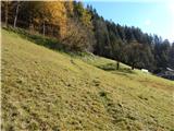 3
3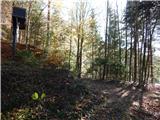 4
4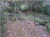 5
5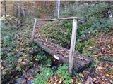 6
6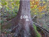 7
7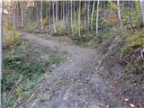 8
8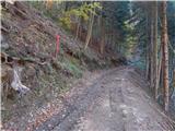 9
9 10
10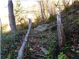 11
11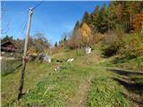 12
12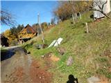 13
13 14
14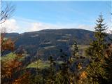 15
15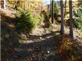 16
16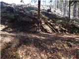 17
17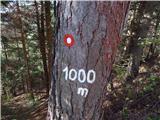 18
18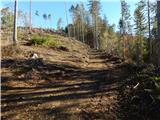 19
19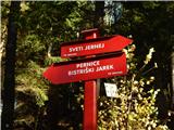 20
20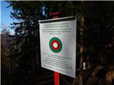 21
21 22
22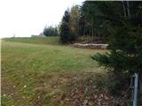 23
23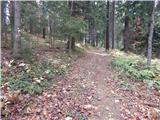 24
24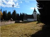 25
25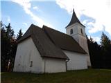 26
26