Bodenbauer - Hochstuhl/Stol (on scree)
Starting point: Bodenbauer (1052 m)
Starting point Lat/Lon: 46.4678°N 14.2152°E 
Path name: on scree
Time of walking: 4 h
Difficulty: easy pathless terrain, easy marked way
Difficulty of skiing: no data
Altitude difference: 1184 m
Altitude difference (by path): 1250 m
Map: Karavanke - osrednji del 1:50.000
Access to starting point:
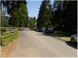
From highway Ljubljana - Jesenice we go to the exit Ljubelj (Tržič), and then we continue driving in the direction of Celovec / Klagenfurt. After the Ljubelj tunnel the road starts descending, and we follow it to a crossroad, where the road into a valley Poden / Bodental branches off to the left. We go on the mentioned road which further leads through Slovenji Plajberk / Windisch Bleiberg and higher Žabnica / Bodental. The mentioned road, we follow to the end of the asphalt by inn Podnar / Bodenbauer, where on an appropriate place by the road we also park.
Path description:
From Podnar near of which we park on extended road we go on a macadam and for public traffic closed forest road in the direction of Mlaka / Märchenwiese and Celovška koča / Klagenfurter Hütte. The road which starts gently ascending soon brings us to the first crossing, where the path towards the farm Vgriz / Ogrisbauer branches off to the right, and we continue straight in the direction of the mountain hut Celovška koča. The road goes a little further in the forest and splits into two parts. We choose the left marked road, and which after approximately 30 minutes of walking from the starting point brings us to Mlaka (flat, ample and panoramic meadow).
Here the road turns slightly to the right, and we continue straight on parallel, but a little poorly visible marked path which continues over the meadow. On the other side of the meadow, the path returns into the forest and it gradually starts moderately ascending. After a short ascent, we get to a smaller crossing, where ski touring path branches off to the left, and we continue straight on a smaller torrent ditch. Some 10 strides higher marked path turns to the right, and we continue by a torrent, where we follow a rough footpath, and which a little ahead turns to the left and through a lane of dwarf pines ascends to an ample scree below Vrtača. Here, the footpath vanishes, and we continue by the lower part of the scree, where here and there we notice a cairn. Further, we are for some time ascending by the lower part of the scree below Vrtača, and then on the right side a nice passage opens to slopes below Svačica. After a shorter diagonal ascent towards the right, we will get to a rough, but well visible footpath which is then ascending between scree and a lane of dwarf pines. We continue the ascent on the mentioned footpath, from which increasingly beautiful views are opening up on surrounding peaks. Higher, the footpath starts vanishing on the scree below Svačica, and if we will pay attention, we will be able to find on the right side barely visible footpath which starts ascending diagonally towards the right. Further, we are ascending over steeper, partly already with grass overgrown scree, which ends, or starts below the cliffs of Svačica. When we reach the bottom edge of the cliffs we join the unmarked path which leads from the saddle Vrata / Matschatcher Sattel towards the saddle Belščica (path, which on left eastern side bypasses Svačica). We follow the mentioned path to the left, and we are ascending on it over occasionally quite steep slopes. Higher, the path flattens and from scree passes on less steep grassy slopes, through which we ascend to the border with Slovenia.
Here we continue straight (right Svačica, left Vrtača) on at first gently sloping path, from which few 10 meters further also a marked path on Svačica branches off to the right. Here we continue slightly left and over a little steeper slope in few 10 strides we descend to a saddle Belščica, where there is a marked crossing.
From the saddle Belščica we continue left in the direction of Vrtača, mountain hut Prešernov koča and Zelenica (right downwards mountain hut Celovška koča). For few minutes we cross grassy slopes, and then we get to the spot, where the path on Vrtača branches off to the left, and we continue straight downwards. The path ahead at first steeply descends through the gully, and then turns to the right, where passes on ample scree, through which is ascending diagonally. Higher, we leave the scree and slightly descend to a nearby crossing, where upper and bottom path and the path from Završnica join.
Here we continue straight, and the path from a small valley between Srednja peč 1920 meters (Srednja peč is a less known peak on the left) and the ridge of Orlice (Orlice are harder accessible ridge between saddle Belščica and Stol) gradually passes on larger scree, on which we diagonally ascend towards the right, and then the path gradually passes into steeper valley between Mali Stol on the left and Stol on the right. Here the path steeply ascends, and then it gradually flattens and it brings us to a marked crossing, where the path towards the nearby mountain Prešernova koča branches off to the left to which is 5 minutes, and we continue right and in 10 minutes of additional walking, we ascend on the highest peak of Karawanks.
On the way: Sedlo Belščica (1840m)
Pictures:
 1
1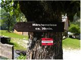 2
2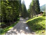 3
3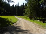 4
4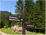 5
5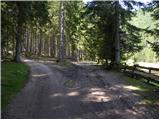 6
6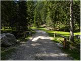 7
7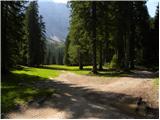 8
8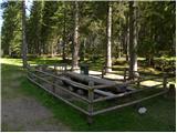 9
9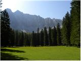 10
10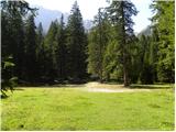 11
11 12
12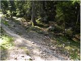 13
13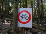 14
14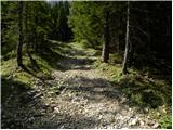 15
15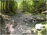 16
16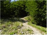 17
17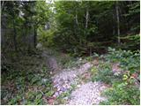 18
18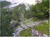 19
19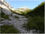 20
20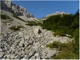 21
21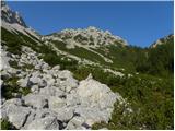 22
22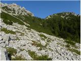 23
23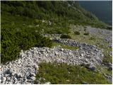 24
24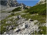 25
25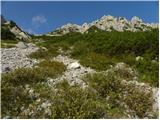 26
26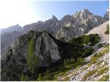 27
27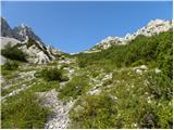 28
28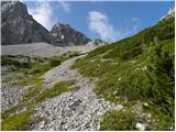 29
29 30
30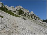 31
31 32
32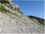 33
33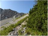 34
34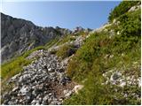 35
35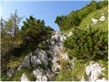 36
36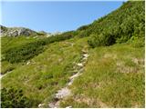 37
37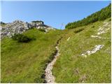 38
38 39
39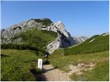 40
40 41
41 42
42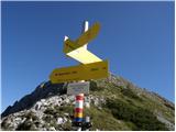 43
43 44
44 45
45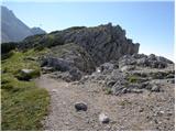 46
46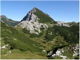 47
47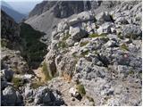 48
48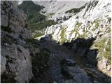 49
49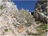 50
50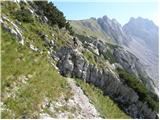 51
51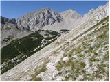 52
52 53
53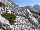 54
54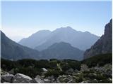 55
55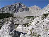 56
56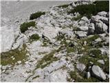 57
57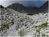 58
58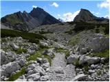 59
59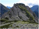 60
60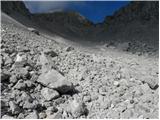 61
61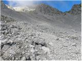 62
62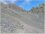 63
63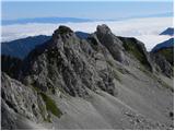 64
64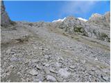 65
65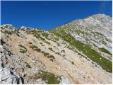 66
66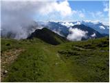 67
67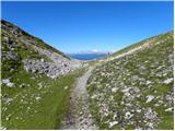 68
68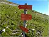 69
69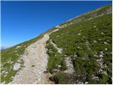 70
70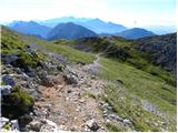 71
71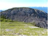 72
72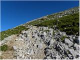 73
73 74
74 75
75