Bohinjsko sedlo - Slatnik (southeastern peak) (via Lajnar)
Starting point: Bohinjsko sedlo (1277 m)
Starting point Lat/Lon: 46.2409°N 14.0101°E 
Path name: via Lajnar
Time of walking: 1 h 5 min
Difficulty: easy marked way
Difficulty of skiing: no data
Altitude difference: 320 m
Altitude difference (by path): 320 m
Map: Škofjeloško in Cerkljansko hribovje 1:50.000
Access to starting point:
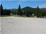
A) From the highway Ljubljana - Jesenice we take the exit Lesce and follow the road towards Bled and further towards Bohinjska Bistrica. From Bohinjska Bistrica we continue left in the direction of Tolmina and Soriška planina. We follow this road to a large parking lot near the ski center Soriška planina.
B) From Železniki we drive towards Podbrdo or vice versa, but only to the spot where the signs for Soriška planina direct us onto an ascending road. We follow this road to a large parking lot at the foot of the ski area Soriška planina.
Path description:
From the parking lot, we continue on a macadam road in the direction of the mountain hut Koča na Soriški planini, to which we arrive in a few minutes.
A little above the mountain hut, on the nearby spruce, we notice signposts for Lajnar, Možic and Šavnik, which direct us onto a gentle path that continues alongside the ski lift. Soon the path towards Šavnik, Možic and the old Italian barracks branches off to the right, and we continue straight ahead, still alongside the ski lift. Higher up the ski lift ends, and the path becomes steeper and temporarily passes through a belt of forest. When the forest ends, the path flattens, and we arrive at the saddle between Lajnar on the left and the southeastern peak of Slatnik on the right.
Here, before we cross the grazing fence, we continue right along the ridge and proceed the path with nice views on Porezen and Baška grapa. Higher, the path moves away from the ridge a little to the right, where we cross grassy slopes from which a nice view opens towards Soriška planina. A little further, we return to the ridge, where we continue sharply left on easier pathless terrain, on which in a minute or two of further walking we reach the peak, on which there is a stamp attached to a metal pole.
Description and pictures refer to the condition in the year 2015 (August).
Pictures:
 1
1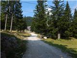 2
2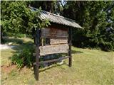 3
3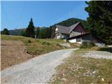 4
4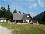 5
5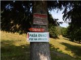 6
6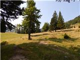 7
7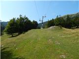 8
8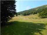 9
9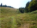 10
10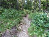 11
11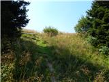 12
12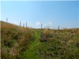 13
13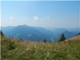 14
14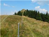 15
15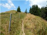 16
16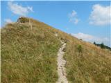 17
17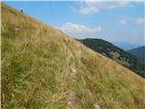 18
18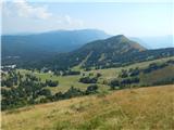 19
19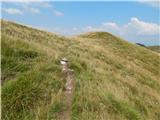 20
20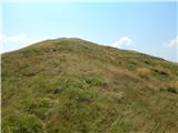 21
21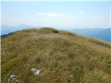 22
22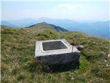 23
23 24
24