Branik - Trstelj (on forest path)
Starting point: Branik (87 m)
Starting point Lat/Lon: 45.8608°N 13.7861°E 
Path name: on forest path
Time of walking: 3 h
Difficulty: easy marked way
Difficulty of skiing: no data
Altitude difference: 556 m
Altitude difference (by path): 660 m
Map: Goriška - izletniška karta 1:50.000
Access to starting point:
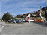
A) From highway Ljubljana - Koper we go to the exit Senožeče, and then we continue driving in the direction of village Štorje. In Štorje we continue right in the direction of Branik (straight Sežana and Trst) and further we drive through the village Kazlje, Dobravlje and Ponikve. At the crossroad few kilometers after Ponikve we continue right towards the village Kobdilj (left Kopriva and Dutovlje), from there we follow the signs for Štanjel and Branik. After few kilometers of descent we get to Branik, where from the left also the road from Komen joins. Only a little further from the mentioned crossroad, on the right we will notice a larger parking lot, where we park (parking lot is located near the post office and Mercator store).
B) First, we drive to Ajdovščina, and then we continue driving on the old road towards Nova Gorica. When we get to the settlement Potoče we leave the main road and we continue left in the direction of the settlement Branik. The road quickly brings us to the bridge over the river Vipava, and after which it becomes more winding. After a short ascent follows a shorter descent and we get to Branik. When we reach the main road we continue left and then after few 10 meters of additional driving, we turn left on a larger parking lot (parking lot is located near the post office and Mercator store).
C) From Nova Gorica or its surroundings we drive to Dornberk, and from there we continue driving in the direction of Branik. We park in the center of Branik on a larger settled parking lot (parking lot is located near the post office and Mercator store).
Path description:
From the parking lot, we continue by the main road towards Dornberk, and then we continue left in the direction of the settlement Cvetrož. And soon after we leave the main road we will on transformer notice signs for Pedrovo. A little further, the road leads us through a bridge over the river Branik, and right behind the bridge we continue left in the direction of hamlet Lojevi (right Cvetrož). Only few steps ahead the road again splits, and this time we continue right (straight farm Furlan and agrotourism Pri mlinu). On the asphalt road, we walk only few 10 meters more, and then at the nearby residential house we continue straight towards the bridge of railway track. When we reach the foot of the bridge of railway we continue on a marked path which continues below the stone arch. For a short time, we are ascending on the bottom of a small valley, we then cross a torrent and on the other side, we start ascending steeper. Higher, we reach a forested ridge and the path immediately passes on its right side (looking in the direction of ascent). Next follows few minutes of a diagonal ascent, and then we again step on a forested ridge.
When we step on the ridge, we join the cart track (path from Branik past the railway station Branik), which we follow to the right, and we walk there to the first crossing.
We continue on the left marked cart track (right one immediately once again splits into two parts), and it further starts lightly descending. After a short descent, we reach riverbed of a torrent stream Petnik and we get to a metal hunting observatory. Right at the observatory we go slightly left and we cross a riverbed of the mentioned intermittent stream. On the other side of the stream, we start steeply ascending on a steeper slope, and the path higher brings us below the village Pedrovo. A short ascent follows and among houses we reach the road which leads through the village.
When we step on the road, we continue right (left church of the Holy Spirit 1 minute) and we walk through the village.
At the end of the village from the right joins also the path "on cart track" (Po kolovozu), and we go straight and we continue the ascent on a little wider cart track which is gently to moderately ascending through the forest. Further, the cart track few times splits, and we continue on the "main" or the one, which is marked (blazes are otherwise occasionally quite rare). Higher, we reach a worse road (firebreak gap - intervention road number 14P), on which we start moderately descending. A little further from a slope we pass into a smaller valley, where we continue right upwards on at first less distinct cart track. The path ahead for a short time continues through a panoramic meadow, and then it quickly brings us to abandoned cottage Slavčeva bajta. Mentioned cottage we bypass on the left side and we continue on a poorly marked cart track which few times ascends and descends. At the crossings, we continue on a marked cart track, and eventually it brings us on grassy slopes, from which a beautiful view opens up, which reaches all the way to the highest peaks of Julian Alps. Next follows a little steeper descent and the path brings us to Železna vrata, where we cross the asphalt road.
We continue on the macadam road in the direction of Trstelj, and we walk there to the power line. Immediately after the power line we leave the road and we continue the ascent left on a marked path which starts ascending steeper. After few minutes, the path flattens and passes on panoramic and relatively gentle shady slopes. The path quickly returns into the forest and from the right the path from Renče joins.
We continue left in the direction of the mountain hut, on the path which soon splits into two parts. We continue slightly right on a marked shortcut, and then we join a worse forest road which we follow to the nearby mountain hut Stjenkova koča on Trstelj.
From the mountain hut, we continue right in the direction of the peak and we continue on a pleasant footpath which ascends through a lane of thin forest. Only a little higher we join a wide cart track, on which in few 10 strides of additional walking, we get to the top of Trstelj.
Pictures:
 1
1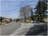 2
2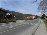 3
3 4
4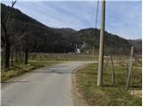 5
5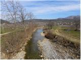 6
6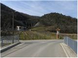 7
7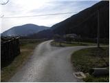 8
8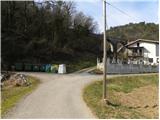 9
9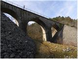 10
10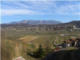 11
11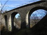 12
12 13
13 14
14 15
15 16
16 17
17 18
18 19
19 20
20 21
21 22
22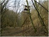 23
23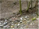 24
24 25
25 26
26 27
27 28
28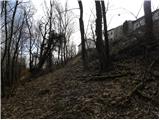 29
29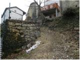 30
30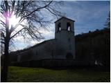 31
31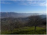 32
32 33
33 34
34 35
35 36
36 37
37 38
38 39
39 40
40 41
41 42
42 43
43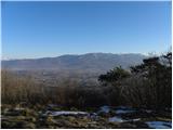 44
44 45
45 46
46 47
47 48
48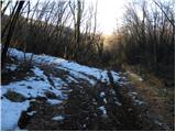 49
49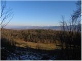 50
50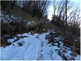 51
51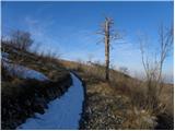 52
52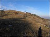 53
53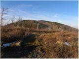 54
54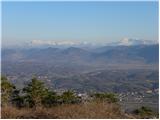 55
55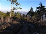 56
56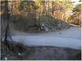 57
57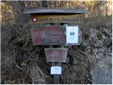 58
58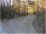 59
59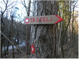 60
60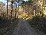 61
61 62
62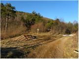 63
63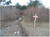 64
64 65
65 66
66 67
67 68
68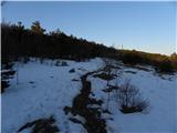 69
69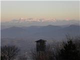 70
70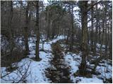 71
71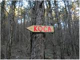 72
72 73
73 74
74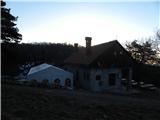 75
75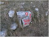 76
76 77
77 78
78 79
79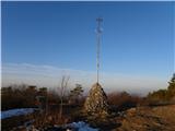 80
80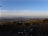 81
81 82
82