Starting point: Brda (551 m)
Time of walking: 3 h
Difficulty: easy unmarked way
Difficulty of skiing: no data
Altitude difference: 991 m
Altitude difference (by path): 991 m
Map: Pohorje 1:50.000
Access to starting point:
A) From the highway Ljubljana - Maribor, we take the exit Žalec, and then we continue driving in the direction of Velenje. In the main roundabout in Velenje, we continue right and then continue driving towards Slovenj Gradec and Dravograd. A little before Slovenj Gradec, more precisely at Turiška vas, we turn right and on a local road drive into the center of Turiška vas. Here we continue on the main road, which turns right, and then it takes us across the bridge over the river Mislinja into Brda. After the bridge, we continue right, and then the road enters the forest, where it starts to ascend gradually. In the part of the trail where the road runs through the forest, we park in a suitable place by the road (higher up there are no suitable parking spots).
B) From Koroška, we first drive to Slovenj Gradec, and then we continue driving towards Velenje. A little after Slovenj Gradec, more precisely at Turiška vas, we turn left and on a local road drive into the center of Turiška vas. Here we continue on the main road, which turns right, and then it takes us across the bridge over the river Mislinja into Brda. After the bridge, we continue right, and then the road enters the forest, where it starts to ascend gradually. In the part of the trail where the road runs through the forest, we park in a suitable place by the road (higher up there are no suitable parking spots).
Path description:
From the starting point, we continue on the road by which we have parked, and it brings us after a few minutes to a smaller intersection, where we continue left in the direction of homesteads Merkač, Orter and Pegan. When a little further we get to a smaller hamlet with a few houses, we continue on the upper right road, by which a little higher we notice the first blazes (signs of the European footpath E6 Baltic - Adriatic). Here we continue right on a cart track, which first ascends along the edge of the forest and then passes onto fields and meadows. Across the meadow we walk on a poorer cart track, and the path higher brings us to a forest road, which we only cross, since we continue the ascent on the marked footpath. Orientation ahead is much easier, since quite frequent and well-visible blazes accompany us. A little higher we once again cross a macadam road, and the path passes into dense forest, which ends at the hunting observatory. Next follows an ascent through a panoramic grassy hayfield, and the path quickly brings us to a lonely farm, where we step onto the road. We continue on the road, and it brings us after a few minutes to a marked intersection at the chapel.
Here we continue straight (right Sv. Magdalena 5 minutes) and continue on the road for a short time, then continue left on the marked footpath. The path quickly passes from the forest onto a meadow, across which we ascend in a few minutes to a smaller hamlet. Above the hamlet we again leave the road and continue the ascent on a cart track, which moderately ascends through the forest. Higher, on the right side we bypass the chapel of Sv. Štefan, the path brings us to the next hamlet at the homestead Pridgar.
We continue on the footpath, which returns into the forest and a little higher crosses the asphalt road that leads from Slovenj Gradec towards Kope. The path continues for a short time through the forest, then brings us to the next homestead.
From the homestead near which there are a smaller chapel and NOB monument, we return into the forest, and we continue the ascent for quite some time on a relatively well-marked cart track. Much higher we step onto a wider macadam road, which leads towards the Partisan home (the marked footpath E6 also continues in the same direction), but we continue straight upwards on a wider but unmarked cart track. Further we ascend on a relatively wide cart track, which has some side branches, and we always stick to the one that is somehow the "main" one and mostly keeps the same direction. Higher the cart track, which for the most part runs among blueberry bushes, narrows somewhat and gradually turns somewhat to the right. A little further the forest also thins, and the path finally brings us a little higher out of the forest onto the increasingly panoramic grassy slopes of Velika Kopa.
Ahead we walk to the lower station of the ski lift, and from it we continue on the marked path, which brings us in 10 minutes of further walking to the panoramic summit.
Pictures:
 1
1 2
2 3
3 4
4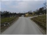 5
5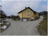 6
6 7
7 8
8 9
9 10
10 11
11 12
12 13
13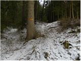 14
14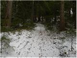 15
15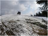 16
16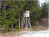 17
17 18
18 19
19 20
20 21
21 22
22 23
23 24
24 25
25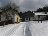 26
26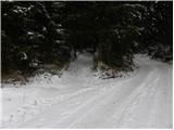 27
27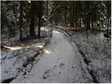 28
28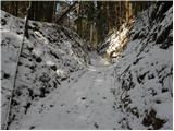 29
29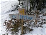 30
30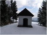 31
31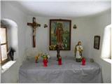 32
32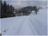 33
33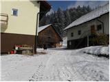 34
34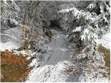 35
35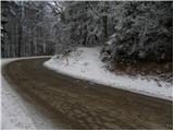 36
36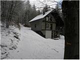 37
37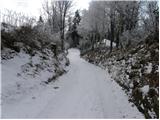 38
38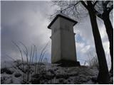 39
39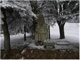 40
40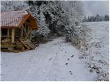 41
41 42
42 43
43 44
44 45
45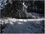 46
46 47
47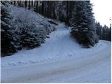 48
48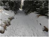 49
49 50
50 51
51 52
52 53
53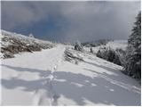 54
54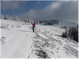 55
55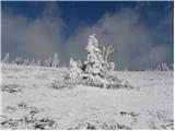 56
56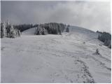 57
57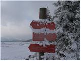 58
58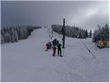 59
59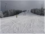 60
60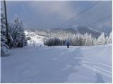 61
61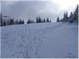 62
62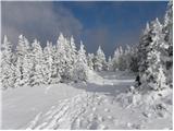 63
63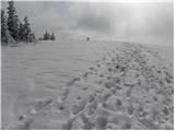 64
64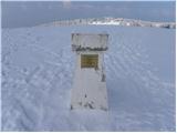 65
65 66
66